Map size in jpg-format: 1.53712MiB
Click to open in high resolution (open in new tab).
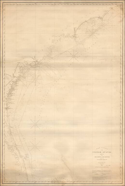
Fine large format sea chart of the coastline from the Outer Banks of North Carolina to central Florida, published by Blunt in New York City, the most famous of American Chart makers of the period.
Includes an early pencil annotation near Savannah, Georgia, showing annotations into the Savannah River, utilizing "Black Boy" (Buoy), "Breaker Boy" and Bar Lights as visual navigational aids.
The map shows light houses, light ships and channel buoys colored in red and yellow.
Working sea charts are inherently rare due to the nature of their use aboard ships. Although likely common when first made, the vast majority of them were either destroyed by use or destroyed intentionally when new updated versions were obtained.
Edmund Blunt started in business in 1796, before growing to become America's foremost producer of charts, pilot guides in the19th century. Blunt's charts were the standard for American Navigations charts from 1810 to the 1860s and a number of the engravers who worked for them would later find work as competitors.
If you are a student, write to us in telegram: @antiquemaps and indicate what material you need and for what work you need a map in high detail. We are ready to provide material on special terms. For students only!

![[Wall Map] West-Indische Paskaert waer in de graden der breedde over weder zyden vande middelyn wassende so vergrooten dat die geproportioneert syn tegen hunne nevenstaende graden de lengde.](/map/small/60169.jpg)
