Map size in jpg-format: 6779290B
Click to open in high resolution (open in new tab).
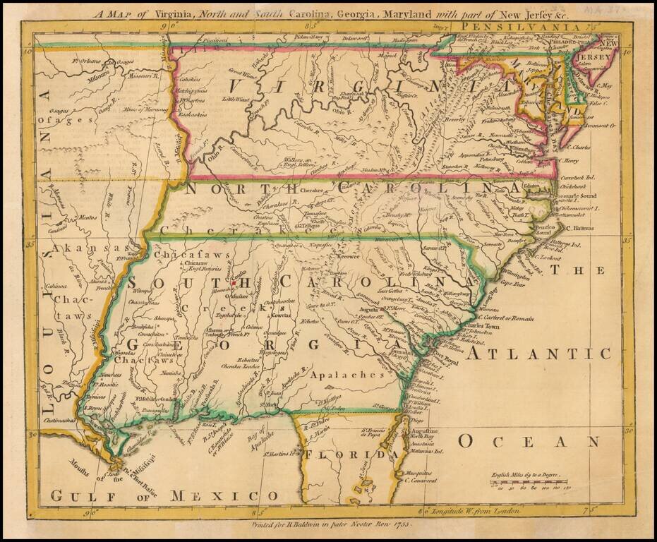
Scarce map of the Southeastern portion of the British Colonies, extending tothe Mississippi River and lower Missouri River, based upon John Mitchell's Map of the British Colonies, also issued in 1755.
The map extends to West of the Mississippi River in Arkansas, Chactaws and Osage Country. Virginia, the Carolinas and Georgia extend to the Mississippi and there is only one Florida noted. The lands just east of the Mississippi are still dominated by the French and Indians, including the Chactaws, Chicaswas, Cherakees [sic] and Illinois.
Many early forts are noted, including Ft. Mobile, Ft. Rosalie, at least 5 French Forts, Ft. Francis, Ft. Orleans on the Missouri, Ft. Chartres, etc. In the Ohio Valley, there are notes regarding the actions of the English and French during the French & Indian War in 1754.
An excellent early regional map.
If you are a student, write to us in telegram: @antiquemaps and indicate what material you need and for what work you need a map in high detail. We are ready to provide material on special terms. For students only!