Map size in jpg-format: 66.6656MiB
Click to open in high resolution (open in new tab).
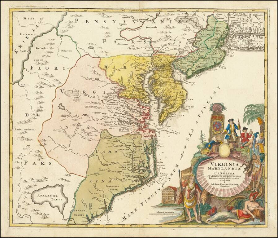
A nice example of JB Homann's map of Virginia, Maryland, New Jersey, North Carolina and South Carolina. Cartouche shows the splendor of the new world and the riches it provides.
One of the most decorative maps of the area, intended to promote German immigration to America. Germantown Teutsche Statt is placed at the headwaters of the Rappahannock. A number of early counties shown in the Carolinas. Nice detail in the interior of Virginia and Maryland for the period. New Jersey is divided into East and West New Jersey. The region in the west is Florida, extending to Lake Erie. Long Island is oversized and moved to the south relative to New Jersey. Shows Indian tribes and place names, rivers, bays, coastal soundings, early settlements and other details.
Embellished by one of the most decorative cartouches to appear on a map of the region, showing figures from regional history and local trade with the English. The Atlantic is labeled the "Mare Virginianum anglice the Sea of Virginy".
If you are a student, write to us in telegram: @antiquemaps and indicate what material you need and for what work you need a map in high detail. We are ready to provide material on special terms. For students only!