
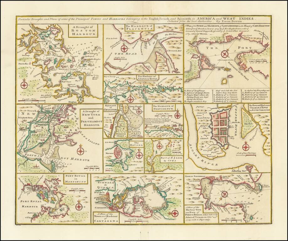
Nice set of harbor and town plans, showing the major trading cities and ports in North America and the Caribbean. The maps include: Boston New York Charleston Martinico Placentia Anapolis St. Augustine Havana St. Jago (San Juan) Providence...
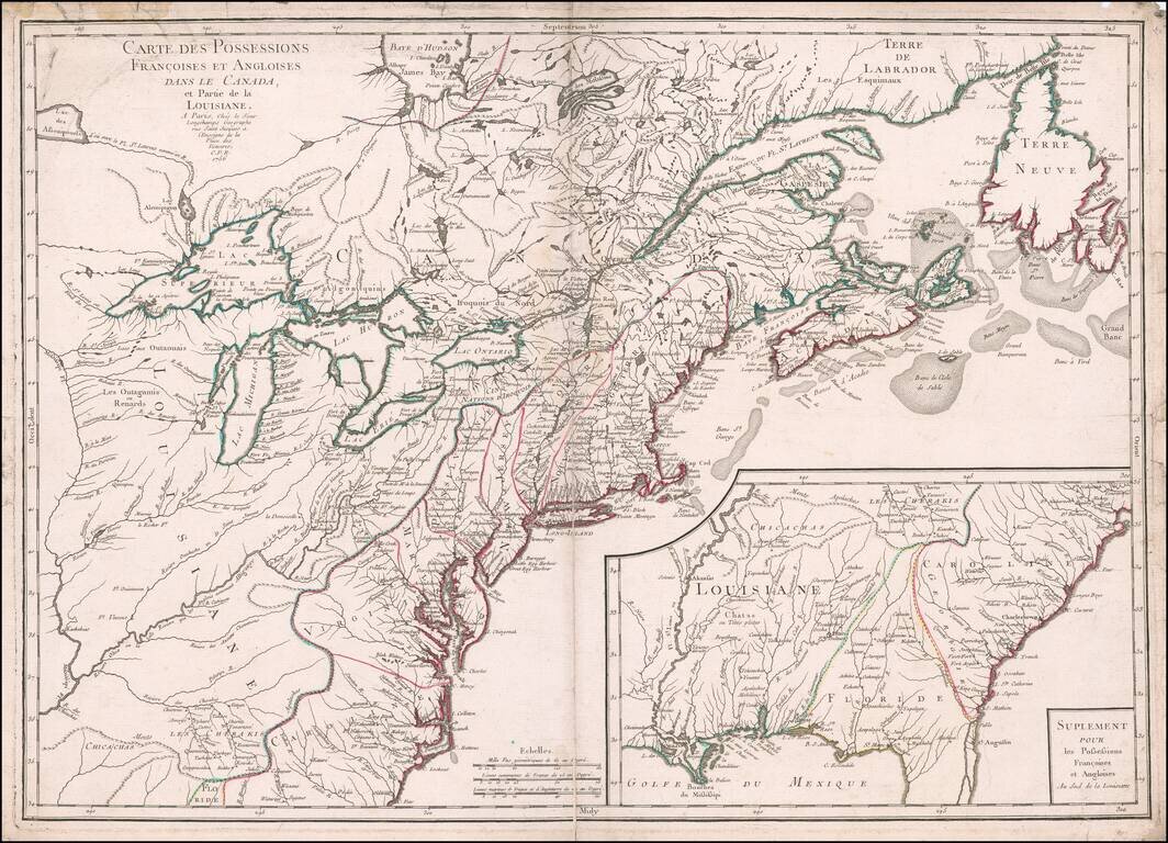
Rare, Detailed First Edition of Longchamps’ Map of the North American Colonies—Proof State! Fine example of the first edition of Longchamps’ map of the colonies—Spanish, French, and British—in North America east of the Mississippi River,...
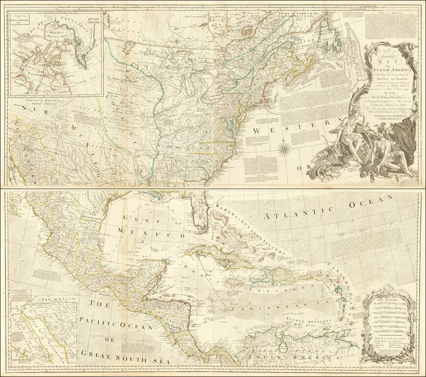
Striking 4-sheet map of North America on the eve of the American Revolution. The map is one of the best large format representations of the British Colonies, from a British perspective, on the eve of the Revolution. The claims of the Carolinas,...
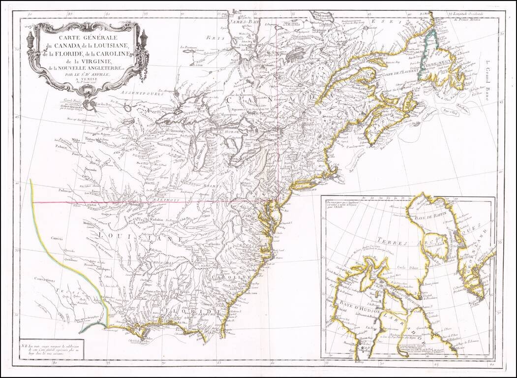
Second edition of Santini's map of the British & French Colonies in North America, based upon D'Anville's seminal map of 1746. The map provides a highy detailed treatment of Great Lakes and Mississippi Valley, on the eve of the American...
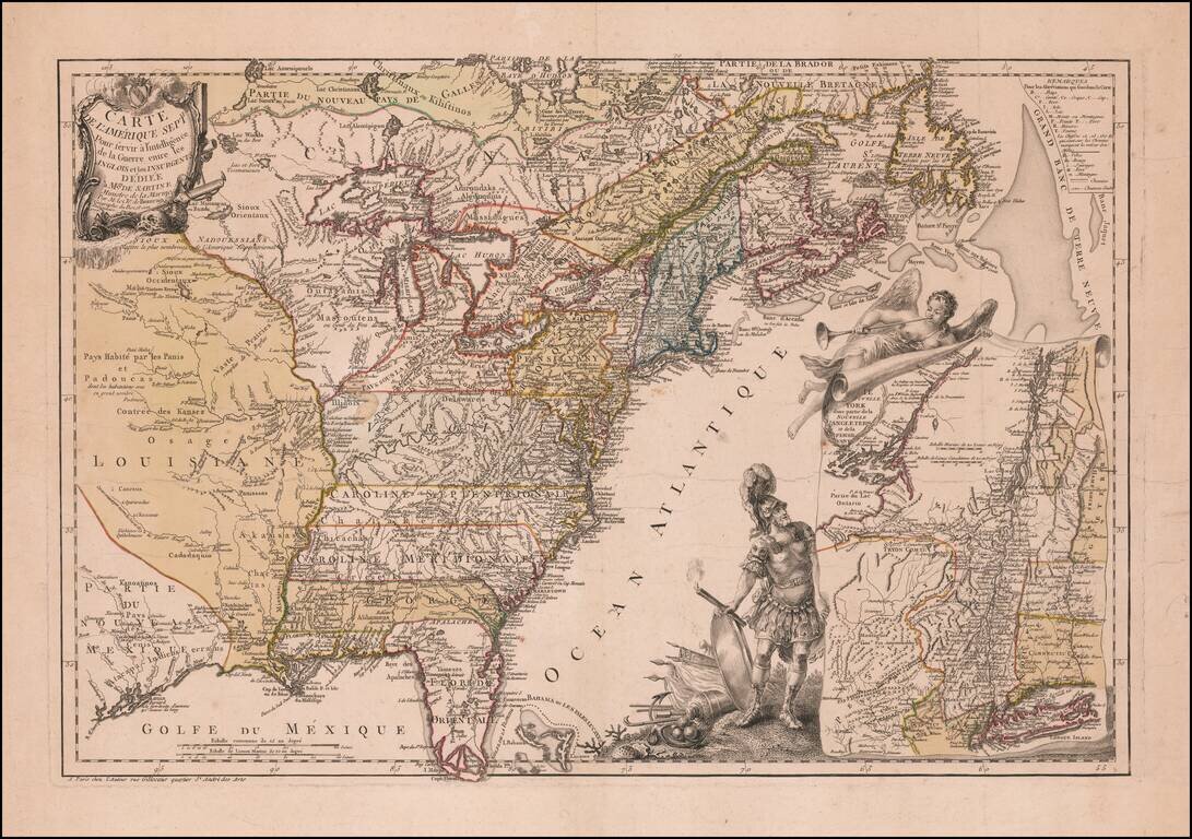
Mars, the God of War, Witnessing Fame's Proclamation of the Birth of the United States Fine example of Beaurain's important map of The 13 Colonies and the contiguous part of French Louisiana and Florida, one of the earliest maps published in Europe to...
![[Franklinia] A Map of the States of Virginia, North Carolina, South Carolina and Georgia; Comprehending the Spanish Provinces of East and West Florida: Exhibiting the Boundaries as fixed by the late Treaty of Peace . . .](/map/small/67980.jpg)
One of the Earliest Appearances of the State of Franklin (Franklinia) Nice example of Purcell's map of the Southern States (and Midwest), which includes an early reference to the New State of Franklin in the center part of North Carolina. This map...
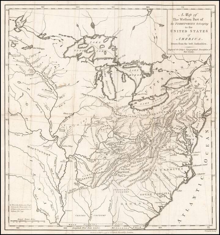
Nice example of this scarce regional map of the United States, which appeared in A Topographical Description of the Western Territory of North America ... by Gilbert Imlay. The map covers the region from the Great Lakes through Georgia and from the...
![The United States of North America with the British Territories And Those of Spain, according to the Treaty of 1784 . . . 1793 [shows Franklinia!]](/map/small/64978.jpg)
Rare First State of Franklin's United States Showing The State of Franklin! Scarce map of the United States, which includes the State of Franklinia in Western North Carolina. One of the first and finest English maps to display the boundaries of the...
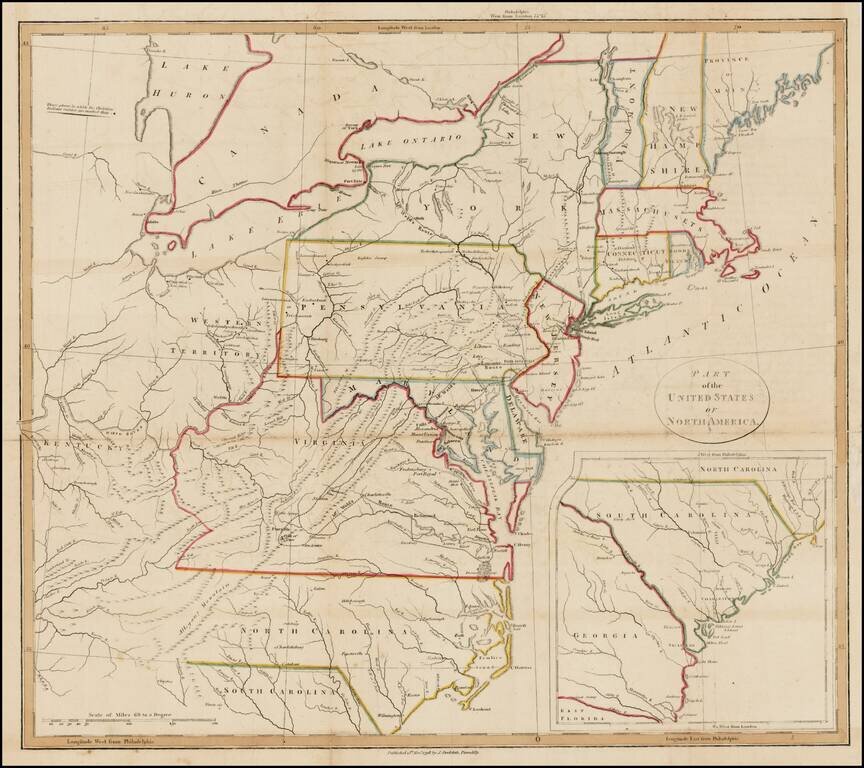
Interesting map of the United States with large inset of South Carolina and Georgia. The map extends east to include the confluence of the Kentucky and Ohio Rivers and names Kentucky, but not Ohio or Tennessee. Includes nice detail in the...
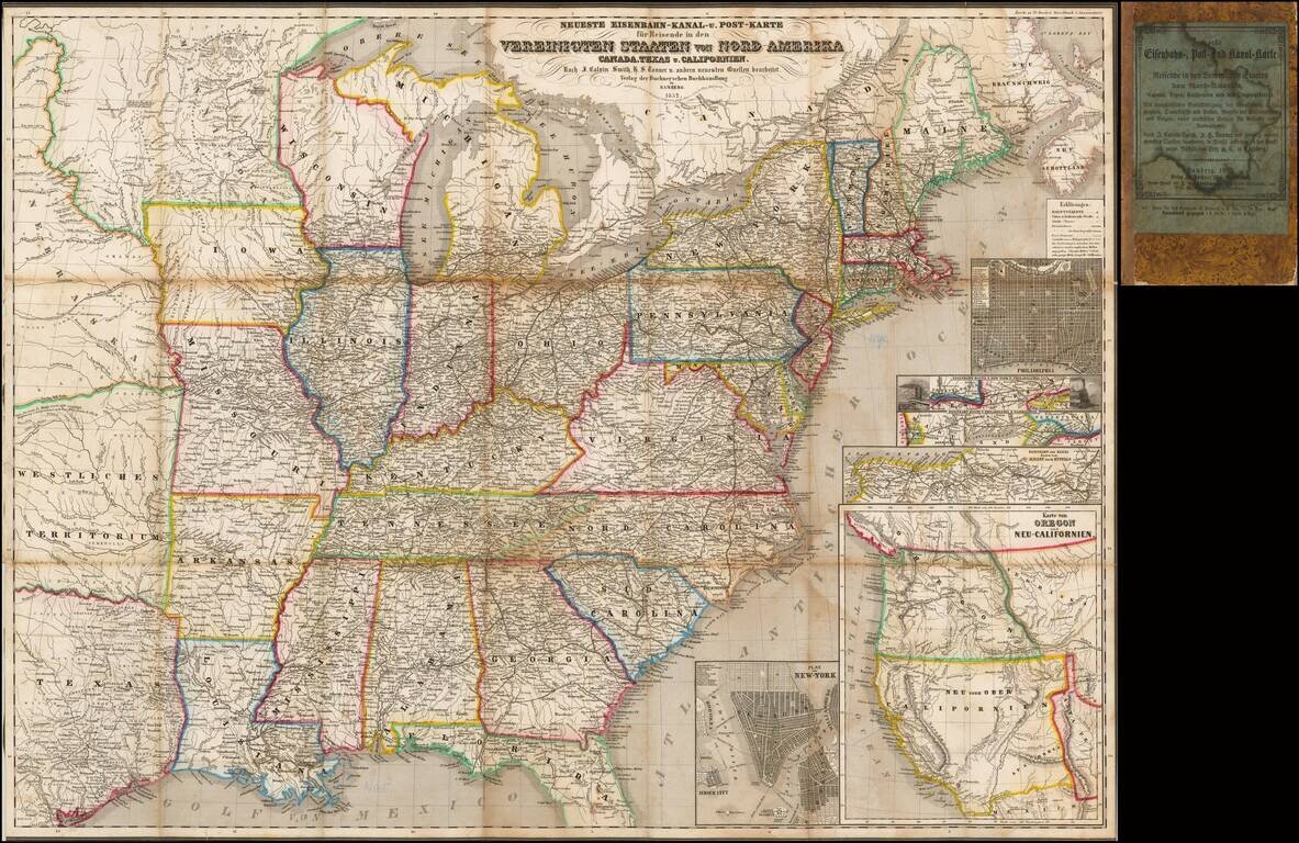
Rare Early of the Bamberg Emigrant Maps Rare Bamberg published Railroad, Canal and Post Route map of the United States, published in 1852. While later versions of the map are recorded, this 1852 edition is extremely rare, especially with the...
![[East Coast & Canada ] Tierra Nueva](/map/small/64984.jpg)
One of the Earliest Printed Maps of the Northeastern Part of America Final state of Ruscelli's map of the East Coast of North America, extending from the Mid-Atlantic to the Canadian Coastline. The map shows the discoveries of Cartier and Verrazzano....
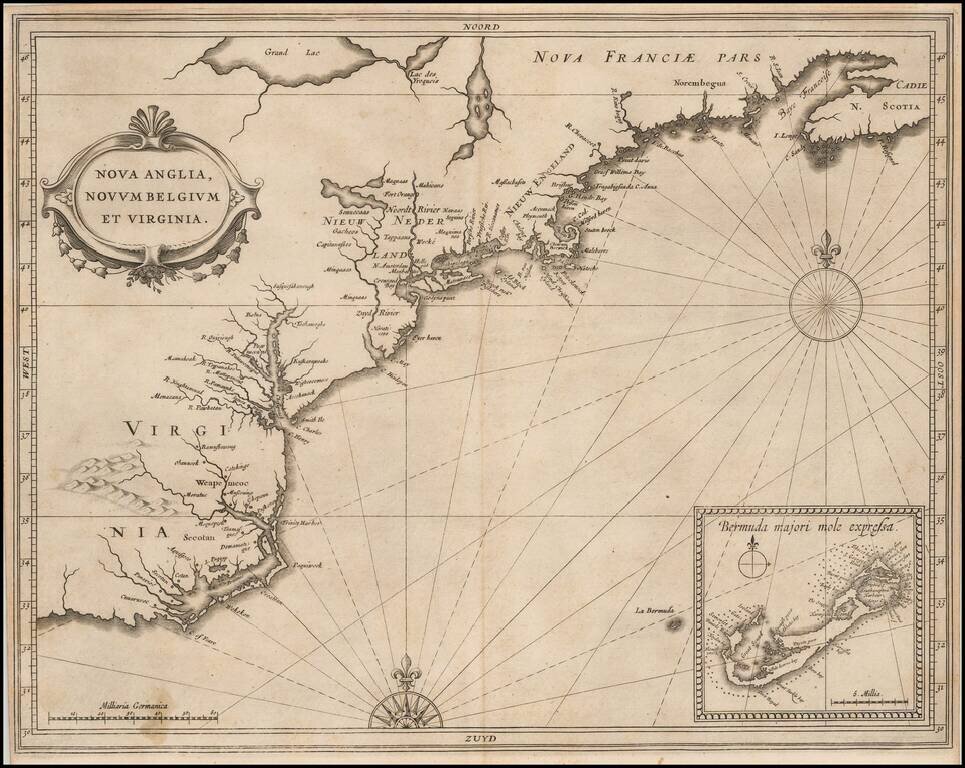
Quite Possibly The Most Important Map of the Northeast & Mid-Atlantic Published in the First Half of the 17th Century. Johannes De Laet's highly influential map of the East Coast of North America is a cartographic landmark, depicting the region...
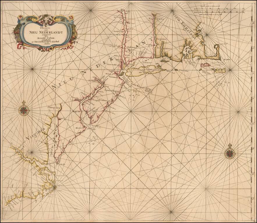
The First Sea Chart of the New Netherlands Fine example of Arnold Colom's sea chart of New Netherlands, the Chesapeake, Virginia, etc., first published by Arnold Colom in about 1656. Colom's sea chart is a landmark in the mapping of the region,...
Fine wide margined example of one of the finest and most beautiful regional 17th-century charts of America, from De Zee Atlas ofter Water-Weereld, first published by Goos in 1666. The map illustrates the Atlantic coast of America from Cape Cod to Cape...
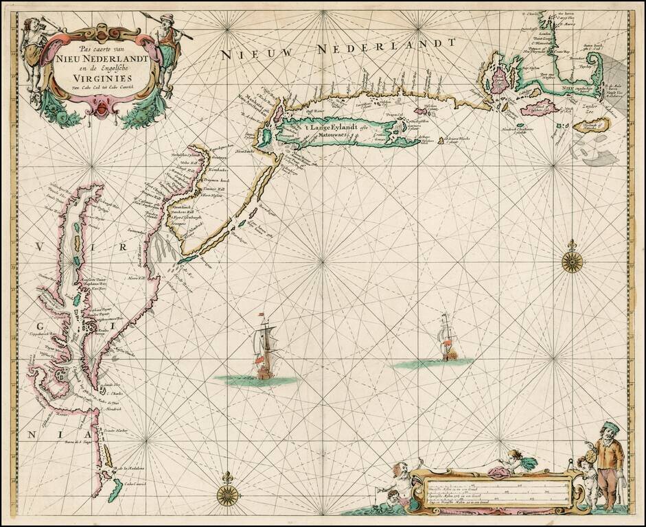
An English Rarity First state of Thornton's sea chart of the Canadian, Northeast and Mid-Atlantic coast, the most up-to-date sea chart of the period. Prior to 1685, John Thornton's former partner William Fisher had entered into a partnership with...
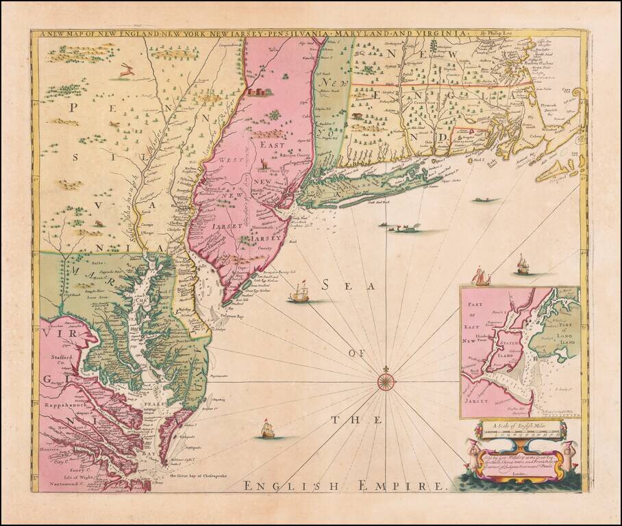
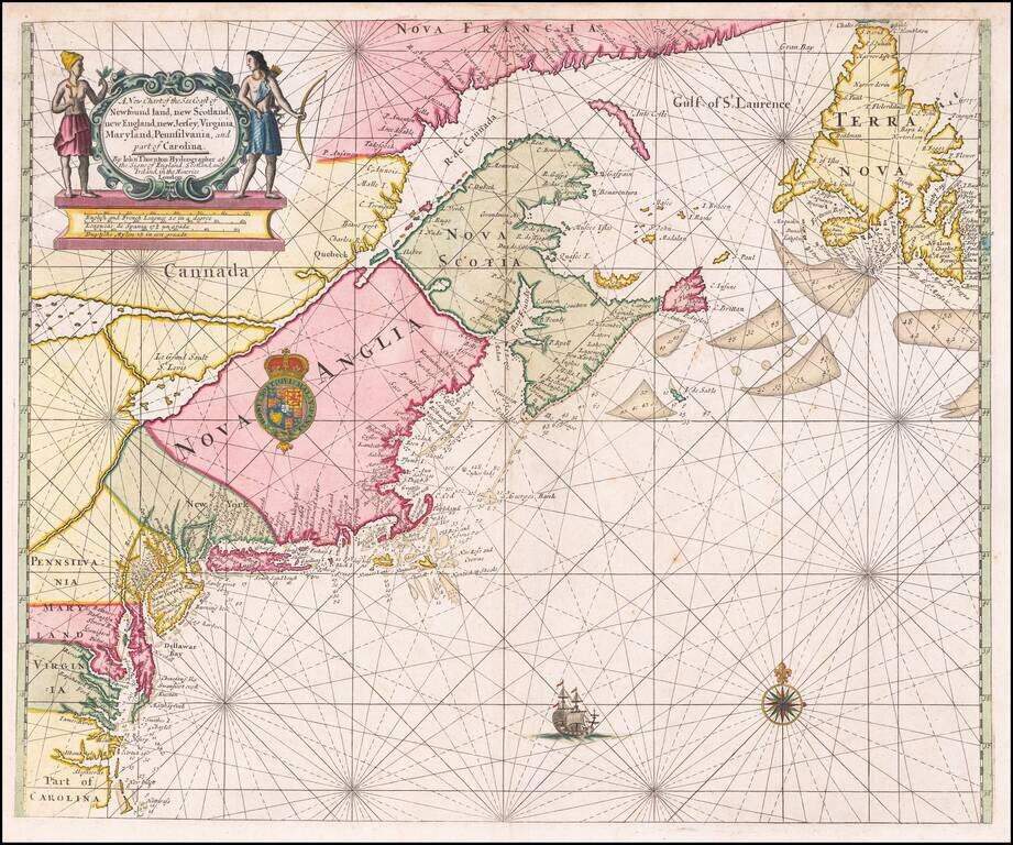
Spectacular Contemporary Color Example of An Important Map of the British Colonies with the First Printed Plan of New York Harbor Remarkable old color example of the final edition of Thornton, Morden & Lea's important map of the English Colonies...