logo

1671. Nova Virginiae Tabula

  • Nova Virginiae Tabula

Map size in jpg-format: 14.3711MiB

Download "Nova Virginiae Tabula", in high resolution.

Nova Virginiae Tabula information:

Year of creation: 
Resolution size (pixels): 
 10061x8546 px
Disk Size: 
 14.3711MiB
Number of pages: 
 1
Place: 
 London
Author: 

Print information. Print size (Width x height in inches):
Printing at 72 dpi 
  139.74 х 118.69
Printing at 150 dpi 
 67.07 х 56.97
Printing at 300 dpi 
 33.54 х 28.49

An example of detailing the file of this map of in a printable high-resolution:

Click to open in high resolution (open in new tab).
Attention! this is just the central piece (central area 960x960 px) of the map file!
This is an example, so that you can see and study the level of detail of a given map. The entire Map will be fully available after payment!

Nova Virginiae Tabula

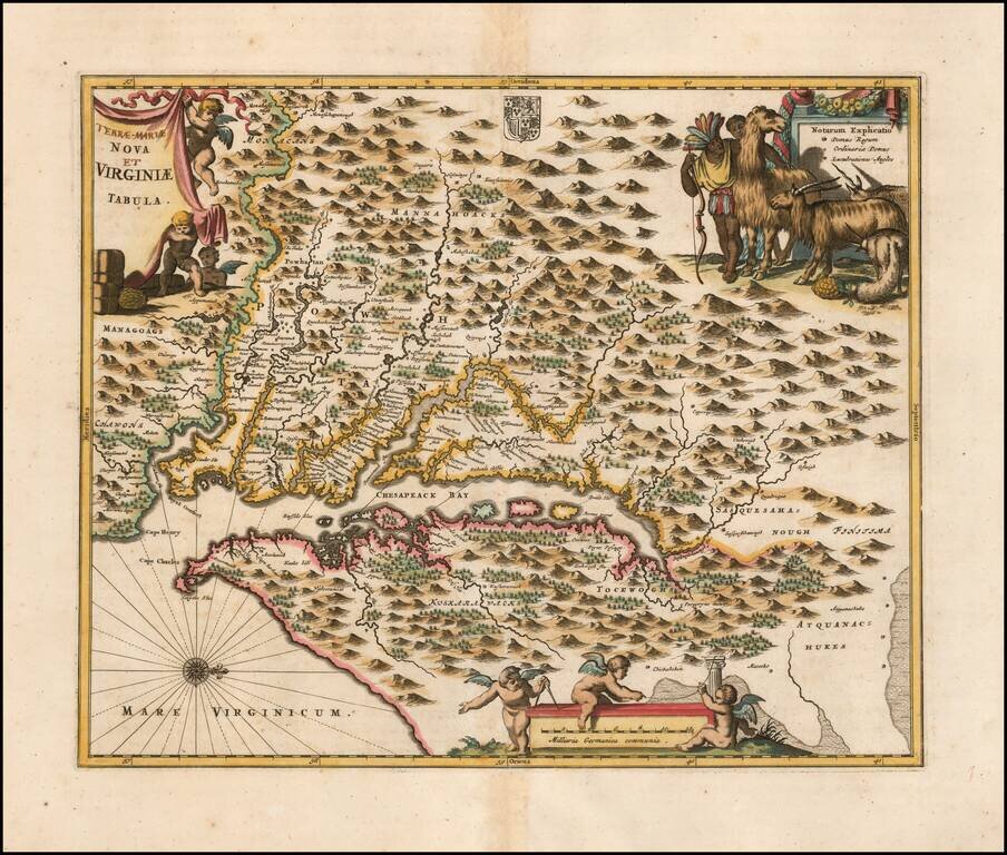
Nice example of Ogilby's edition of Smith's map of the Virginia & Chesapeake region.

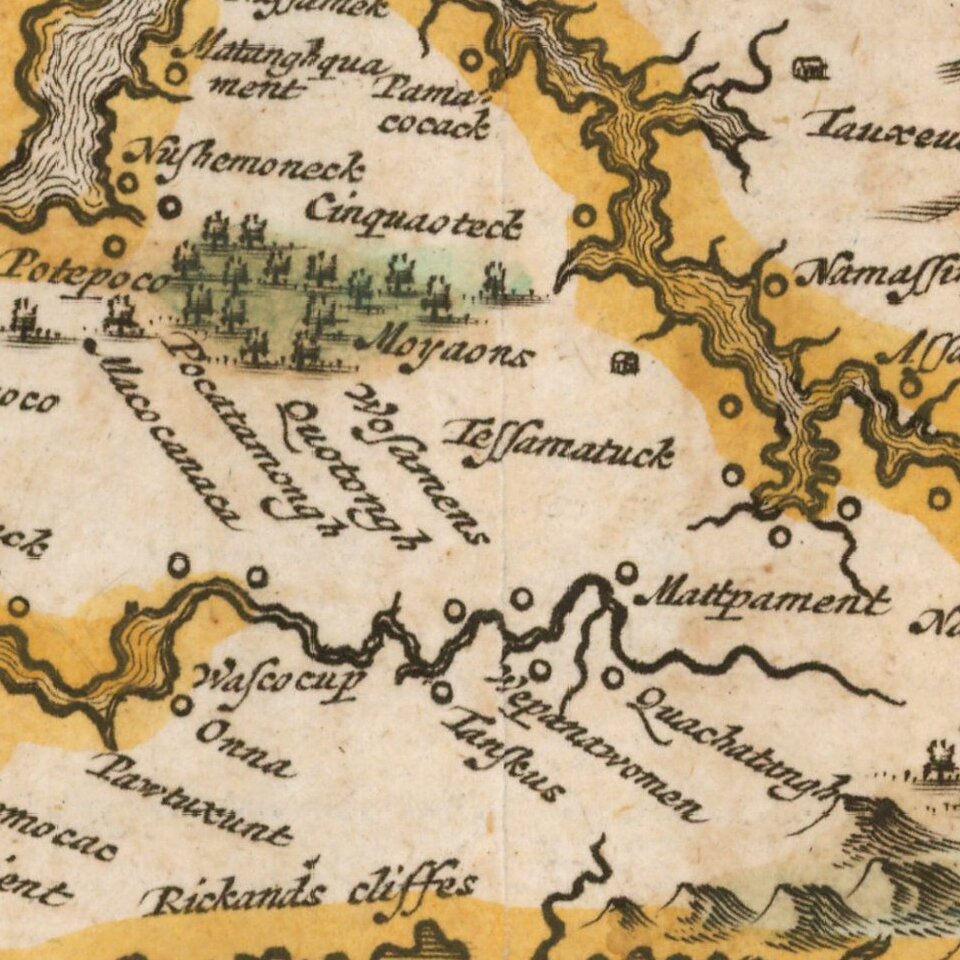
The map is based upon the earlier maps by Hondius and Blaeu, a bit smaller, but with 3 large cartouches, one of which includes fascinating indigenous animals, including a llama and horned long haired sheep. Smith's map of the Chesapeake region was the basic prototype of all regional maps until Augustine Herman's exceedingly rare 4 sheet map published in London in 1673. Tooley notes that the map derives from the first state of the Smith map, and therefore lacks the longitude lines added in later states.

An attractive full color example of this increasingly scarce map.

Burden, P.D. #412; Tooley, R.V. (Amer) pp.168-169, pl.76; Goss, J. (N. Amer) #38.

Special conditions for students!

If you are a student, write to us in telegram: @antiquemaps and indicate what material you need and for what work you need a map in high detail. We are ready to provide material on special terms. For students only!

Item information:

Year of creation:
Size:
10061x8546 px
Disk:
14.3711MiB
Number of pages:
1
Place:
London
Author:
John Ogilby.
$14.99

Related item