Map size in jpg-format: 2.35236MiB
Click to open in high resolution (open in new tab).
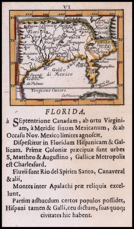
Rare Southeast regional American map, published by Johann Ulrich Muller.
Highly coveted miniature map of Florida, the Gulf Coast, Texas, the Mississippi Valley and the Mid-Atlantic, extending northward to Lac du Chat (Ontario?). Excellent detail throughout the map. The course of the Mississippi is considerably west of its true location and very primitive.
Many other interesting features. From one of the rarest and most coveted of all miniature atlases.
If you are a student, write to us in telegram: @antiquemaps and indicate what material you need and for what work you need a map in high detail. We are ready to provide material on special terms. For students only!

![[Wall Map] West-Indische Paskaert waer in de graden der breedde over weder zyden vande middelyn wassende so vergrooten dat die geproportioneert syn tegen hunne nevenstaende graden de lengde.](/map/small/60169.jpg)
