
Map size in jpg-format: 2.33167MiB
Click to open in high resolution (open in new tab).
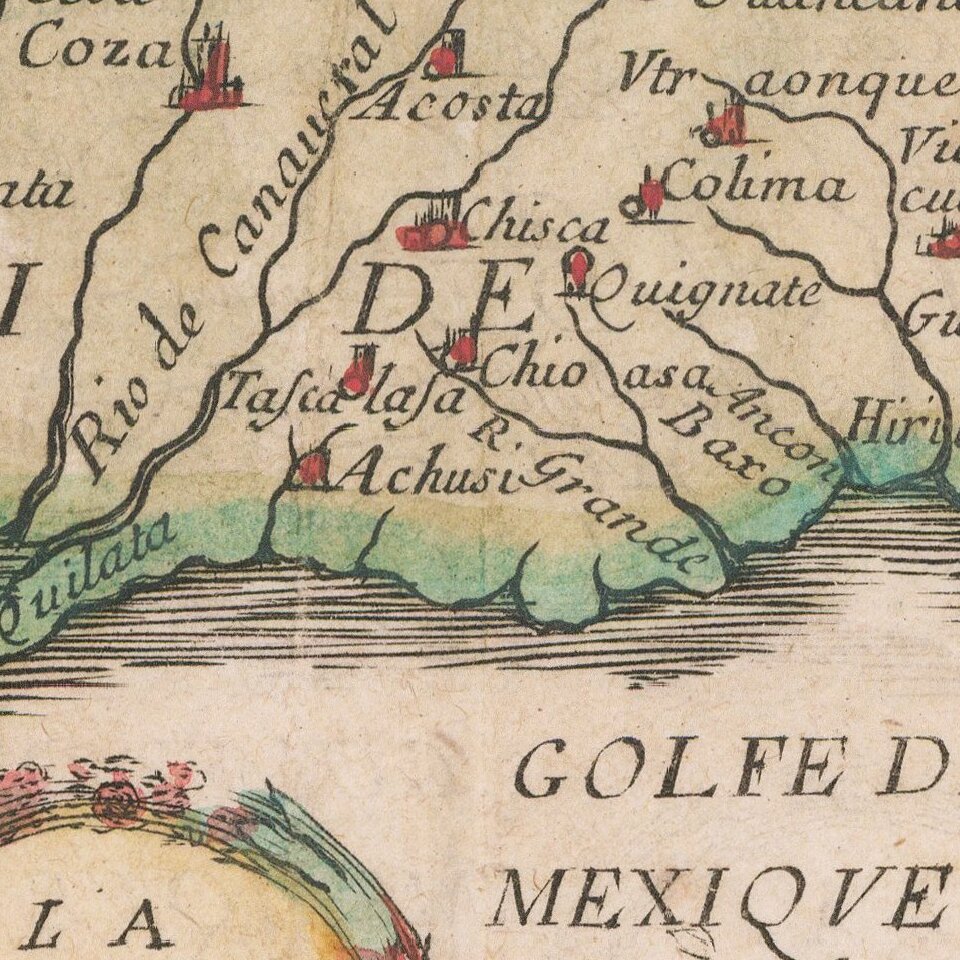
Rare regional map of Florida, the Gulf Coast and Southeastern United States, from Du Val's Le Monde Terrestre.
Du Val's map is based upon Sanson's 1657 map. The major difference is the prominence given the Rio del Spiritu Santu (Mississippi River), which pushed far west of its true location and course. Caroline is named at Port Royal, and the French claim to the Region is identified.
This is the third state, with the G.O.D.R. (Geographer to the King) status conferred upon Du Val and Nouvelle Espagne added at the bottom left corner.
While Du Val had previously used information by Lescarbot, this map uses the more up to date information contained in Sanson's map. A seminal map for collectors of the Gulf Coast, Florida and the Southeast.
If you are a student, write to us in telegram: @antiquemaps and indicate what material you need and for what work you need a map in high detail. We are ready to provide material on special terms. For students only!

![[Wall Map] West-Indische Paskaert waer in de graden der breedde over weder zyden vande middelyn wassende so vergrooten dat die geproportioneert syn tegen hunne nevenstaende graden de lengde.](/map/small/60169.jpg)
