Map size in jpg-format: 83.2505MiB
Click to open in high resolution (open in new tab).
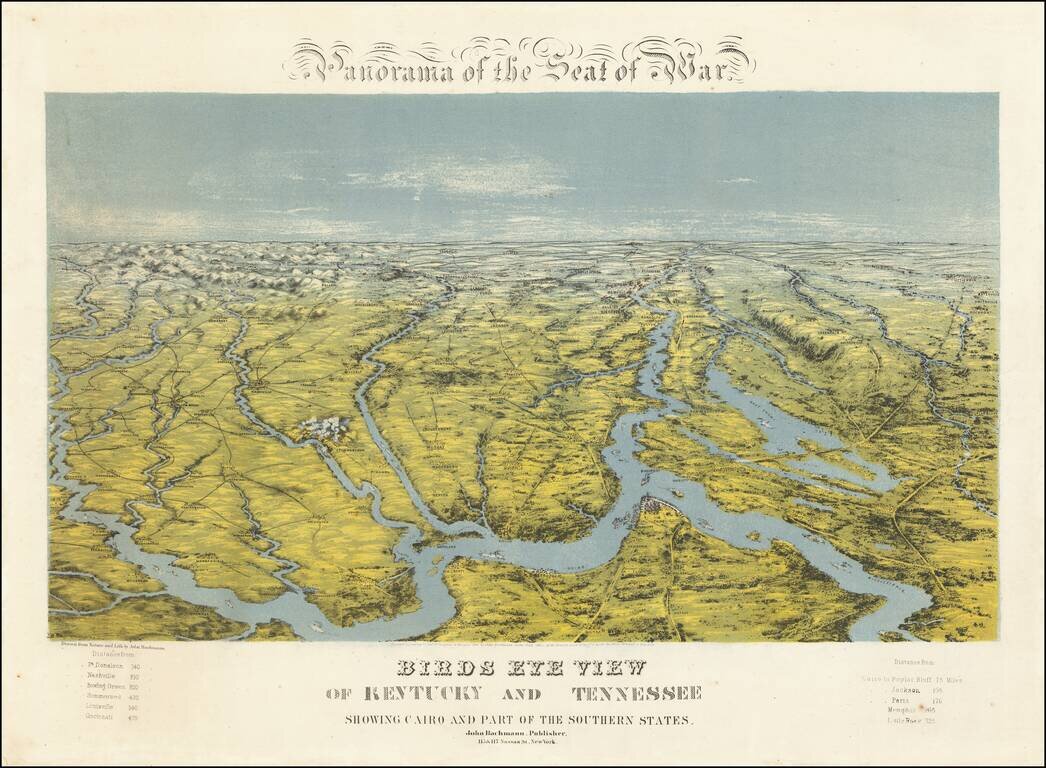
A Southern Rarity
Rare regional birds eye view of Kentucky, Tennessee and parts of contiguous states, published by John Bachmann.
The area shown is bounded by Cape Girardeau and the Mississippi River in the Southwest, Evansville and the Ohio River in the Northwest, Cincinnati in the Northeast and centered on Memphis, Cairo, New Liberty, and Nashville.
The map is oriented with east at the top, with the Mississippi River appearing in the foreground, and its major regional tributary Rivers flow toward the horizon.
Bachmann's birds eye view is one of the most unique map productions of the era, unlike virtually anything else produced in the United States at the time. It followed similar work by Bacon in England, combining a birds eye topographical view with the features of a map.
Rarity
This is one of a set of 5 regional views published by Bahman. While the panorama of the Chesapeake region appears occasionally, the Texas, Florida and Carolinas maps, and this map, are extremely scarce on the market.
If you are a student, write to us in telegram: @antiquemaps and indicate what material you need and for what work you need a map in high detail. We are ready to provide material on special terms. For students only!