Map size in jpg-format: 15.9556MiB
Click to open in high resolution (open in new tab).
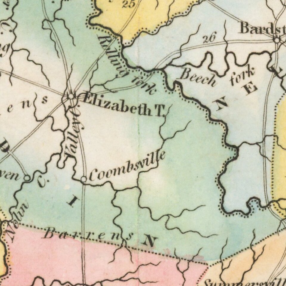
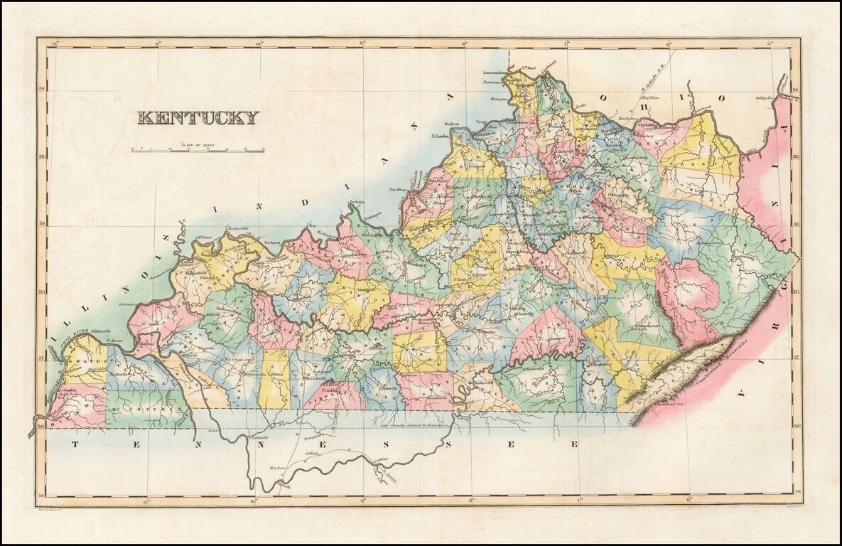
Striking map of Kentucky, colored by counties from Fielding Lucas' New Elegant General Atlas.
A number of counties are still not shown, especially in the east. Undoubtedly one of the most attractive and sought after early 19th Century atlas maps of the state.
The map shows counties, towns, roads, rivers, churches, meeting houses, mountains, etc. Fielding Lucas produced the best engraved and most attractive of all general atlases published in America (the 1823 Tanner and 1825 Finley being Atlases of America). Prior to this work, Lucas had engraved maps for Carey and later Carey & Lea and had produced his New Elegant General Atlas, a highly scarce early work.
Fielding Lucas, Jr. (1781-1854) was a prominent American cartographer, engraver, artist, and public figure during the first half of the 19th century.
Lucas was born in Fredericksburg, Virginia and moved to Philadelphia as a teenager, before settling in Baltimore. There he launched a successful cartographic career. Lucas's first atlas was announced in early- to mid-1812, with production taking place between September 1812 and December of 1813, by which point the engravings were complete. Bound copies of the atlas -- A new and elegant general atlas: Containing maps of each of the United States -- were available early in the next year, beating Carey to market by about two months. Lucas later published A General Atlas Containing Distinct Maps Of all the known Countries in the World in the early 1820s.
If you are a student, write to us in telegram: @antiquemaps and indicate what material you need and for what work you need a map in high detail. We are ready to provide material on special terms. For students only!