Map size in jpg-format: 85.251MiB
Click to open in high resolution (open in new tab).
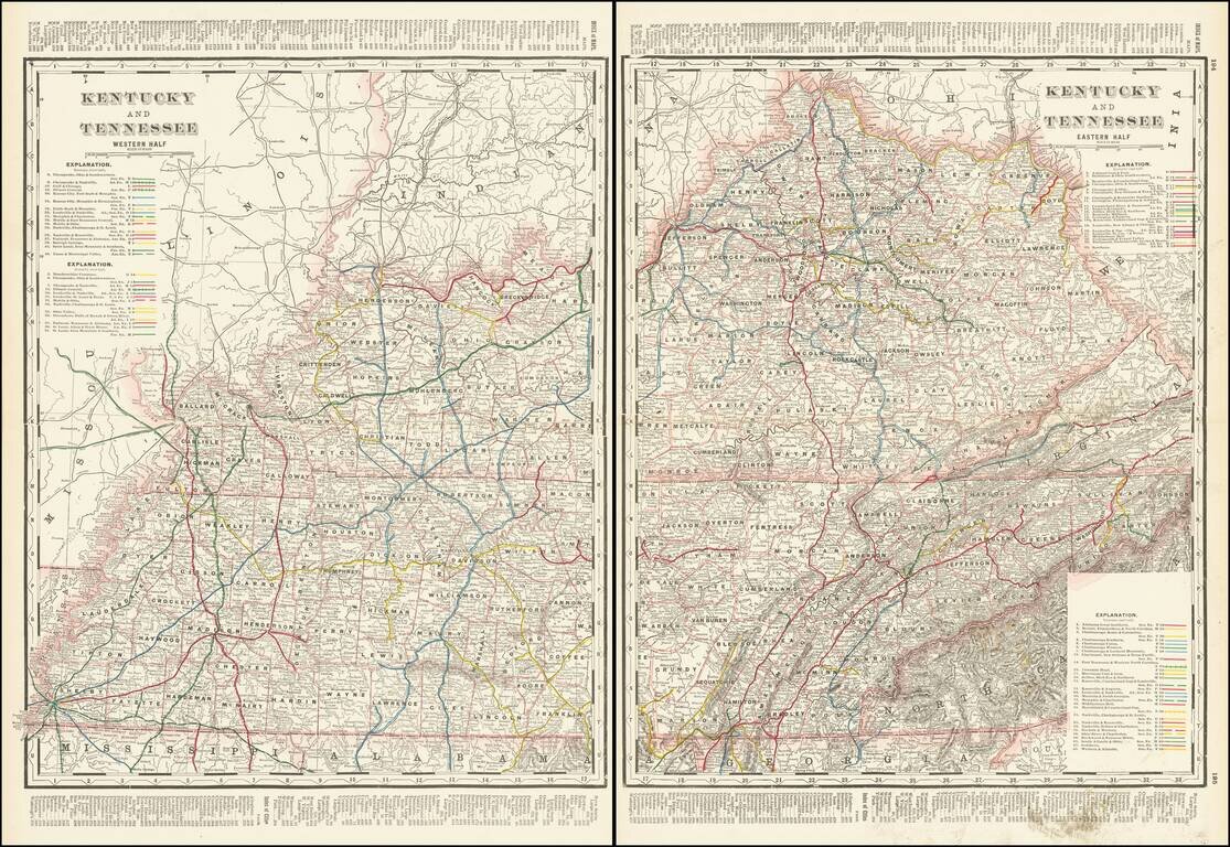
Highly detailed 2-sheet railroad map of Kentucky and Tennessee.
Shows counties, railroads, railway stations, township surveys, mountains, rivers, lakes, and a host of other early details.
George F. Cram (1842-1928), or George Franklin Cram, was an American mapmaker and businessman. During the Civil War, Cram served under General William Tecumseh Sherman and participated in his March to the Sea. His letters of that time are now important sources for historians of the Civil War. In 1867, Cram and his uncle, Rufus Blanchard, began the company known by their names in Evanston, Illinois.
Two years later, Cram became sole proprietor and the company was henceforth known as George F. Cram Co. Specializing in atlases, Cram was one of the first American companies to publish a world atlas. One of their most famous products was the Unrivaled Atlas of the World, in print from the 1880s to the 1950s.
Cram died in 1928, seven years after he had merged the business with that of a customer, E.A. Peterson. The new company still bore Cram’s name. Four years later, the Cram Company began to make globes, a branch of the business that would continue until 2012, when the company ceased to operate. For the final several decades of the company’s existence it was controlled by the Douthit family, who sold it just before the company was shuttered.
If you are a student, write to us in telegram: @antiquemaps and indicate what material you need and for what work you need a map in high detail. We are ready to provide material on special terms. For students only!