Map size in jpg-format: 16.3461MiB
Click to open in high resolution (open in new tab).
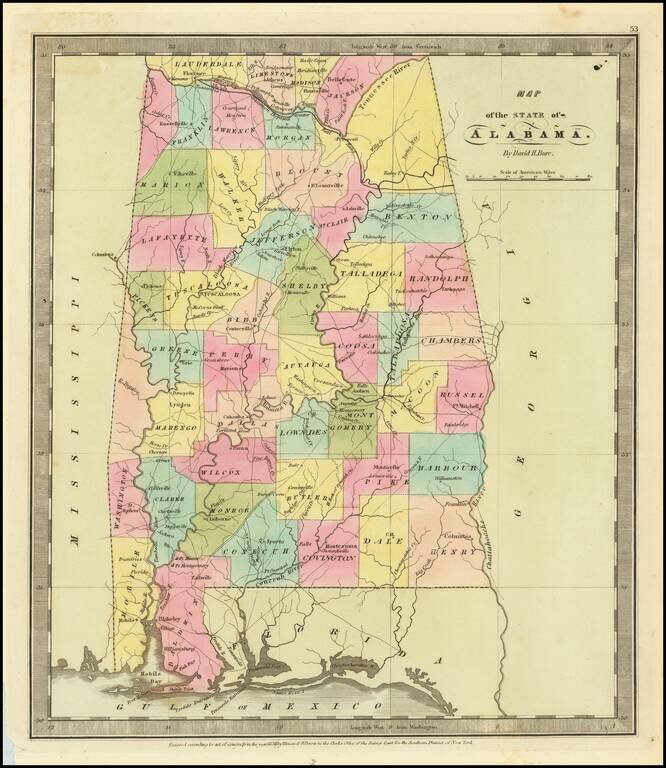
Fine example of David Burr's map Alabama, published just 15 years after Alabama became a state.
The map is hand colored by counties and showing roads, towns, rivers, forts, and other details.
A number of counties not yet shown and several shown as unnamed. Perhaps the most elegant American atlas of its time, utilizing wonderful wash colors and elegant engraving style.
An essential map for Alabama collectors.
If you are a student, write to us in telegram: @antiquemaps and indicate what material you need and for what work you need a map in high detail. We are ready to provide material on special terms. For students only!
![The Coast of West Florida and Louisiana . . . [with] The Peninsula and Gulf of Florida or Channel of Bahama with the Bahama Islands . . .](/map/small/38977.jpg)
![The Coast of West Florida and Louisiana . . . [with] The Peninsula and Gulf of Florida or Channel of Bahama with the Bahama Islands . . .](/map/small/66344.jpg)
