Map size in jpg-format: 5.0434MiB
Click to open in high resolution (open in new tab).
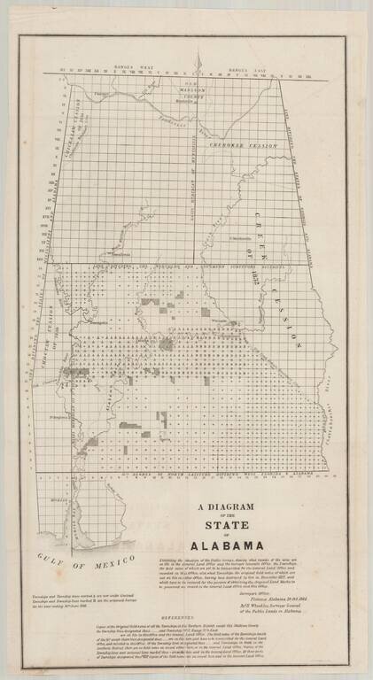
Detailed map of Alabama, illustrating the progress of the General Land Office Surveys as of October 10, 1844.
Based upon a report signed in Florence, Alabama, on October 10, 1844, this map details both the progress on the surveys to date and those planned in the comming months.
A note in the title references that fact that the earliest records for the Alabama Surveyor's Office had been lost in a fire in December 1827, and were retraced from official records (apparently held elsewhere).
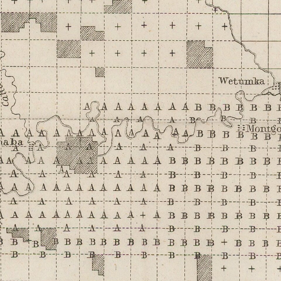
Perhaps most interesting is the location of the areas "under contract" (marked with an A) and those proposed to be surveyed in the following year, ending June 1846 (marked with a B).
A foundational map for the cartographic history of Alabama.
The General Land Office (GLO) refers to the independent agency in the United States that was in charge of public domain lands. Created in 1812, it assumed the responsibilities for public domain lands from the United States Department of the Treasury. The Treasury had overseen the survey of the Northwest Territory, but as more area was added to the United States, a new agency was necessary to survey the new lands.
Eventually, the GLO would be responsible for the surveying, platting, and sale of the majority of the land west of the Mississippi, with the exception of Texas. When the Secretary of the Interior was created in 1849, the GLO was placed under its authority. Until the creation of the Forest Service in 1905, the GLO also managed forest lands that had been removed from public domain. In additional to managing the fees and sales of land, the GLO produced maps and plans of the areas and plots they surveyed. In 1946, the GLO merged with the United States Grazing Service to become the Bureau of Land Management.
If you are a student, write to us in telegram: @antiquemaps and indicate what material you need and for what work you need a map in high detail. We are ready to provide material on special terms. For students only!
![The Coast of West Florida and Louisiana . . . [with] The Peninsula and Gulf of Florida or Channel of Bahama with the Bahama Islands . . .](/map/small/38977.jpg)
![The Coast of West Florida and Louisiana . . . [with] The Peninsula and Gulf of Florida or Channel of Bahama with the Bahama Islands . . .](/map/small/66344.jpg)
