Map size in jpg-format: 13.3827MiB
Click to open in high resolution (open in new tab).
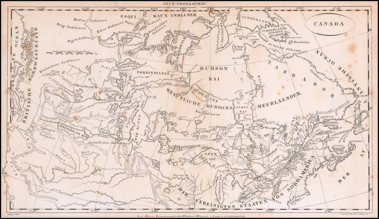
Rare early 19th Century map of Canada, from coast to coast, published in Germany.
The map focuses on the drainages of the various rivers and lakes, centered on the Win-ni-peg See. Includes excellent treatment of the Lakes and Rivers.
The map extends south to include the Missouri, Kansas and Arkansas Rivers, which meander to the Rocky Mountains. The tributaries of the Misury or Missury River, as it is spelled on the map, include Galatin, Madison and Jefferson.
The course of the Columbia flows due North, mimicking the Frasier River. Excellent detail in the NW parts of Canada, extending beyond Slave Lake.
If you are a student, write to us in telegram: @antiquemaps and indicate what material you need and for what work you need a map in high detail. We are ready to provide material on special terms. For students only!