Map size in jpg-format: 34.3597MiB
Click to open in high resolution (open in new tab).
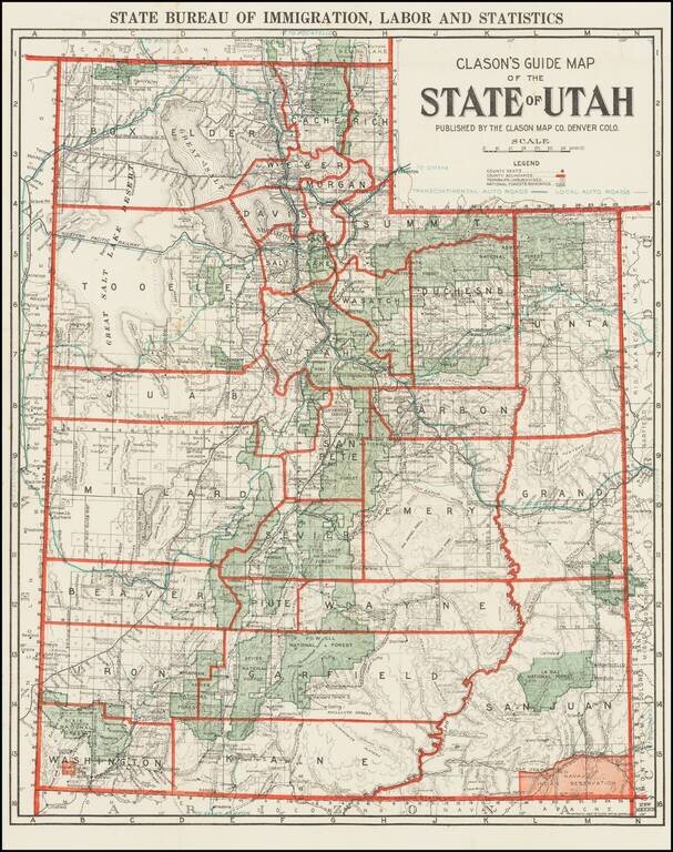
Rare Early Automobile Road Map of Utah
Scarce map of the state of Utah, published by Clason for the Utah Bureau of Immigration, Labor and Statistics.
The map shows County Seats, County Boundaries, Townships Unsubdivided and National Forest Boundaries.
The Transcontinental Auto Roads and Local Auto Roads are noted in Green.
Includes topographical details, Indian Reservations (in red), etc.
If you are a student, write to us in telegram: @antiquemaps and indicate what material you need and for what work you need a map in high detail. We are ready to provide material on special terms. For students only!

![[Mormon State of Desert] Die Vereinigten Staaten von Nord America nebst Canada . . . 1852](/map/small/69483.jpg)
![Mexique par Th. Duvotenay…1843 [Republic of Texas]](/map/small/67925.jpg)