Map size in jpg-format: 1.01654MiB
Click to open in high resolution (open in new tab).
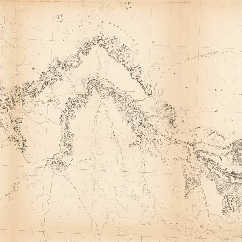
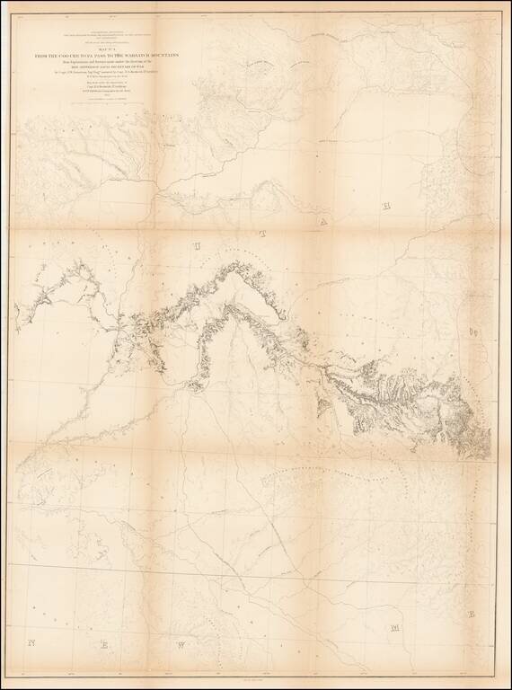
Detailed map extending from Bridger's Pass in the north to New Mexico, centered on the Sawatch and Wasatch Mountains.
Shows proposed railroad line through Bridger Pass in Northeast Utah Territory, including parts of present day Colorado and Wyoming and the Exploration of 1853 through the Central Rockies. Shows hydrology and Topography, forts, trails, mountain ranges including Sahwatch mountains, Elk mountains, Book Mountains, etc.
It also shows Indian locations, part of the Spanish Trail from Sante Fe to Los Angeles, camps, etc.
If you are a student, write to us in telegram: @antiquemaps and indicate what material you need and for what work you need a map in high detail. We are ready to provide material on special terms. For students only!
![Mexique par Th. Duvotenay…1843 [Republic of Texas]](/map/small/67925.jpg)
