Map size in jpg-format: 19.4381MiB
Click to open in high resolution (open in new tab).
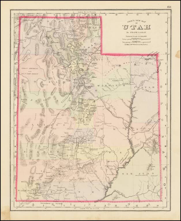
The First Atlas Map of Utah Territory in its Modern Configuration.
Historically important early map of Utah, published by OW Gray.
The map is colored by counties and showing early roads, rivers, mountains, railroads, mines, Indians, forts, etc.
This is the first commercial atlas map of Utah Territory in its final configutation, as it would appear when it gained statehood in 1896, and is preceded only by the 1857 Rogers & Johnson Utah Territory map, which shows Utah as including all of Nevada.
O. W. Gray was a publishing firm based in Philadelphia. Later, they published as O. W. Gray & Son. They published atlases in the late nineteenth century. Gray's National Atlas was one of the most successful commercial ventures of the 1870s and one of the last to employ hand coloring on maps.
If you are a student, write to us in telegram: @antiquemaps and indicate what material you need and for what work you need a map in high detail. We are ready to provide material on special terms. For students only!

![[Mormon State of Desert] Die Vereinigten Staaten von Nord America nebst Canada . . . 1852](/map/small/69483.jpg)
![Mexique par Th. Duvotenay…1843 [Republic of Texas]](/map/small/67925.jpg)