Map size in jpg-format: 30.2476MiB
Click to open in high resolution (open in new tab).
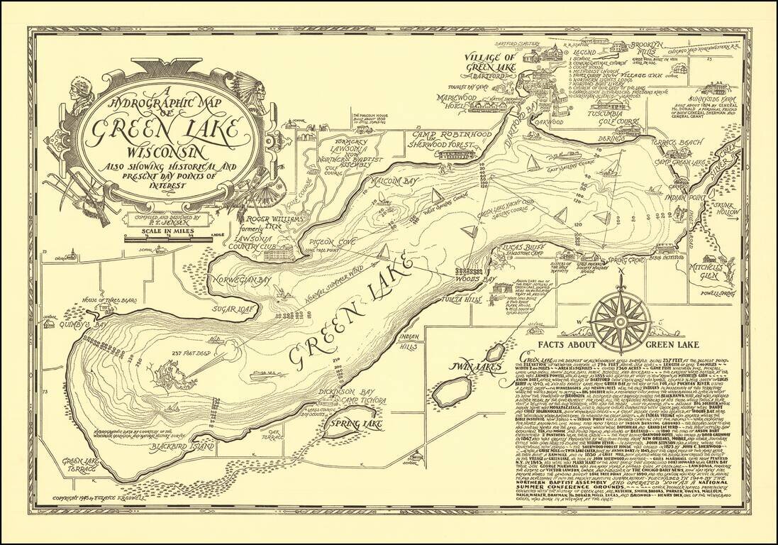
Scarce vintage pictorial map of Green Lake, Wisconsin, compiled and designed by P.T. Jensen and published by F. Clayce Kradwell in 1945.
Green Lake is a large lake between Oshkosh and Wisconsin Dells.
The Wisconsin Historical Society has a colored version of the map: https://www.wisconsinhistory.org/Records/Image/IM94573
Another edition of the map was published in 1970: https://www.wisconsinhistory.org/Records/Image/IM94574
If you are a student, write to us in telegram: @antiquemaps and indicate what material you need and for what work you need a map in high detail. We are ready to provide material on special terms. For students only!