Map size in jpg-format: 5.63559MiB
Click to open in high resolution (open in new tab).
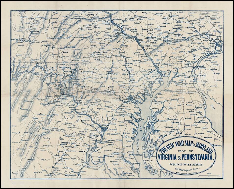
Rare separately issued map of the Mid-Atlantic theater of the American Civil War, published in Boston by Mayer & Co.
The map extends south to Fredericksburg and Fairfax and north to Harrisburg and Reading and East to Philadelphia and Delaware Bay, centered on Washington, Baltimore and Harper's Ferry. The map shows the towns, roads and railroads of the region in fine detail. A note below Gettysburg identifies the Battlefield of July 2 & 3.
This type of map was very popular during the War, with the public in America and Europe having a virtually endless appetite for new maps depicting the regions which were then seeing conflict.
OCLC locates 3 copies (Harvard, Penn State and Library of Congress). We note also the copy at the Boston Public Library.
If you are a student, write to us in telegram: @antiquemaps and indicate what material you need and for what work you need a map in high detail. We are ready to provide material on special terms. For students only!
![[Wall Map] West-Indische Paskaert waer in de graden der breedde over weder zyden vande middelyn wassende so vergrooten dat die geproportioneert syn tegen hunne nevenstaende graden de lengde.](/map/small/60169.jpg)

![[The First Maps in a la poupée Printed Color] Cartes en Couleur des Lieux Sujets aux tremblements de Terre Dans toutes les parties du Monde Selon le Sisteme de l’impulsion Solaire](/map/small/52293op.jpg)