Map size in jpg-format: 991159B
Click to open in high resolution (open in new tab).
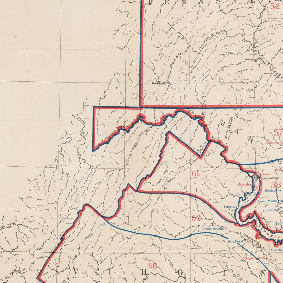
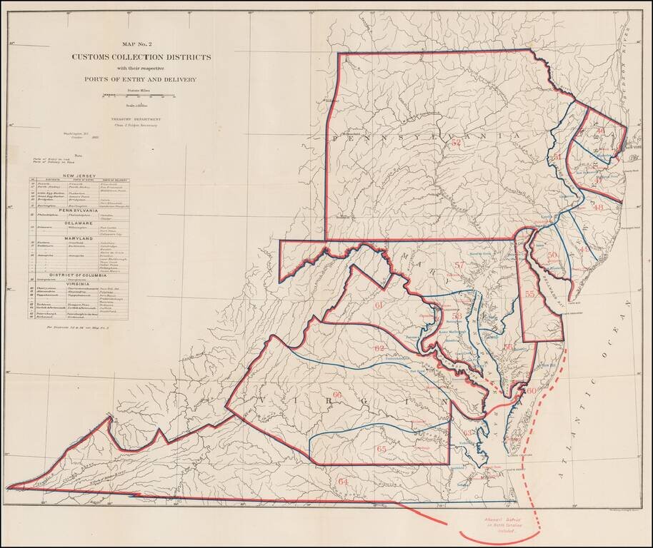
Rare Treasury Department Map of the Mid-Atlantic Region, identifying the customs port of entry.
The following are annotated:
The table identifies about 40 different ports districts.
A fascinating look at government administration in the late 19th Century.
If you are a student, write to us in telegram: @antiquemaps and indicate what material you need and for what work you need a map in high detail. We are ready to provide material on special terms. For students only!
![[Wall Map] West-Indische Paskaert waer in de graden der breedde over weder zyden vande middelyn wassende so vergrooten dat die geproportioneert syn tegen hunne nevenstaende graden de lengde.](/map/small/60169.jpg)

![[The First Maps in a la poupée Printed Color] Cartes en Couleur des Lieux Sujets aux tremblements de Terre Dans toutes les parties du Monde Selon le Sisteme de l’impulsion Solaire](/map/small/52293op.jpg)