Map size in jpg-format: 36.371MiB
Click to open in high resolution (open in new tab).
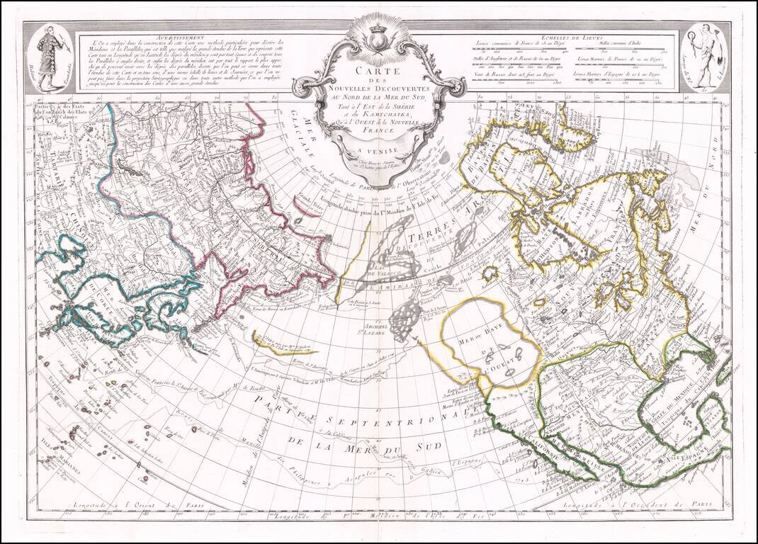
Santini's edition of Joseph De L'Isle's map of the Northern Pacific Ocean, North America and Asia.
De L'Isle's map was a cartographic landmark, representing the most important advances in the mapping of this region prior to Cook. The map reported the discoveries of numerous Russian explorers, including Tchirkow and Vitus Bering and several overland expeditions, as well as the routes of Frondat, Spanberg, and other Europeans. The Manilla Galleon route is also shown. While the treatment of the NW Coast of America is largely conjecture and myth, the information derived from the Russians dominated regional cartography for three decades, until Cook brought significant updates. Strong dark impression. Includes Remondini imprint.
If you are a student, write to us in telegram: @antiquemaps and indicate what material you need and for what work you need a map in high detail. We are ready to provide material on special terms. For students only!
![America [Manuscript Map Showing the Sea of the West!]](/map/small/41297dm.jpg)

![[Atlantis?] Ristretto Delle Carte presentate all' Academia delle Scienze di Parigi negli anni 1737 e 1752 dal Sig di Buache](/map/small/58667.jpg)