Map size in jpg-format: 1.11382MiB
Click to open in high resolution (open in new tab).
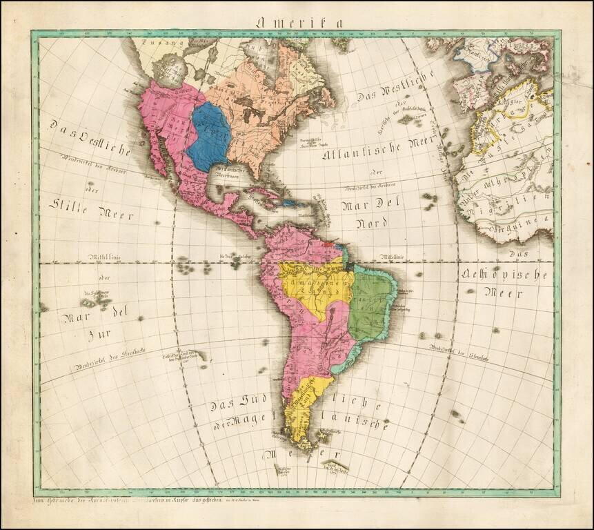
Extremely rare map of America, published in Mainz by W.C. Rucker.
The map boldly shows the Bay of the West (Das West Meer oder West Bay).
Louisiana is boldly depicted in blue, at a time when it was the only significant French territory the New World.
The printing and shading on the map is quite bold and unusual.
We have never seem a map by this mapmaker.
If you are a student, write to us in telegram: @antiquemaps and indicate what material you need and for what work you need a map in high detail. We are ready to provide material on special terms. For students only!
![America [Manuscript Map Showing the Sea of the West!]](/map/small/41297dm.jpg)

![[Atlantis?] Ristretto Delle Carte presentate all' Academia delle Scienze di Parigi negli anni 1737 e 1752 dal Sig di Buache](/map/small/58667.jpg)