logo

1786. Charte Von Den In Den Iahren 1778 und 1779 befahrenen nordwestlichen amerikanischen und nordostlichen asiatischen Kusten

  • Charte Von Den In Den Iahren 1778 und 1779 befahrenen nordwestlichen amerikanischen und nordostlichen asiatischen Kusten

Charte Von Den In Den Iahren 1778 und 1779 befahrenen nordwestlichen amerikanischen und nordostlichen asiatischen Kusten information:

Year of creation: 
Resolution size (pixels): 
 3434x2372 px
Disk Size: 
 1.22405MiB
Number of pages: 
 1
Place: 
 Germany ?
Author: 

Print information. Print size (Width x height in inches):
Printing at 72 dpi 
  47.69 х 32.94
Printing at 150 dpi 
 22.89 х 15.81
Printing at 300 dpi 
 11.45 х 7.91

An example of detailing the file of this map of in a printable high-resolution:

Click to open in high resolution (open in new tab).
Attention! this is just the central piece (central area 960x960 px) of the map file!
This is an example, so that you can see and study the level of detail of a given map. The entire Map will be fully available after payment!

Charte Von Den In Den Iahren 1778 und 1779 befahrenen nordwestlichen amerikanischen und nordostlichen asiatischen Kusten

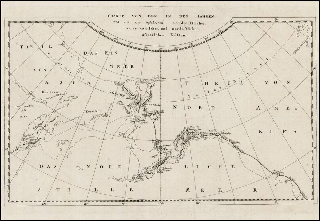
Rare map of the Northwest Coast of America and Northeast Coast of Asia, illustrating the tracks of Captain James Cook's Voyage in the region in 1778 and 1779.

This edition of the map is apparently very rare. This is the first example we have ever seen.


Special conditions for students!

If you are a student, write to us in telegram: @antiquemaps and indicate what material you need and for what work you need a map in high detail. We are ready to provide material on special terms. For students only!

Item information:

Year of creation:
Size:
3434x2372 px
Disk:
1.22405MiB
Number of pages:
1
Place:
Germany ?
Author:
James Cook.
$14.99

Related item