logo

1935. Fun Map of Southern California

  • Fun Map of Southern California

Fun Map of Southern California information:

Year of creation: 
Resolution size (pixels): 
 6231x6038 px
Disk Size: 
 17.4718MiB
Number of pages: 
 1
Place: 
 n.p.
Author: 

Print information. Print size (Width x height in inches):
Printing at 72 dpi 
  86.54 х 83.86
Printing at 150 dpi 
 41.54 х 40.25
Printing at 300 dpi 
 20.77 х 20.13

An example of detailing the file of this map of in a printable high-resolution:

Click to open in high resolution (open in new tab).
Attention! this is just the central piece (central area 960x960 px) of the map file!
This is an example, so that you can see and study the level of detail of a given map. The entire Map will be fully available after payment!

Fun Map of Southern California

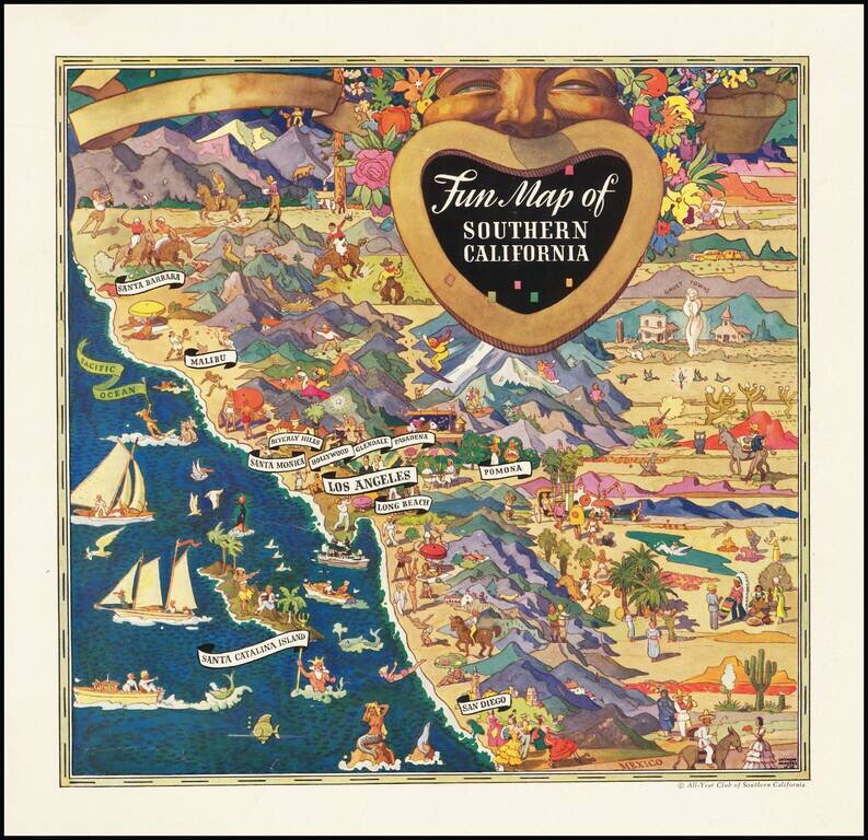
Striking pictorial advertising map, drawn by Raymond Winters in 1935.

The map was originally published for the All-Year Club of Southern California and was issued both as a separate map and an advertising insert.

Raymond Winters was a noted Western Illustrator who created a number of pictorial maps in the 1930s.


Special conditions for students!

If you are a student, write to us in telegram: @antiquemaps and indicate what material you need and for what work you need a map in high detail. We are ready to provide material on special terms. For students only!

Item information:

Year of creation:
Size:
6231x6038 px
Disk:
17.4718MiB
Number of pages:
1
Place:
n.p.
Author:
Raymond Winters.
$14.99

Related item