Map size in jpg-format: 81.1143MiB
Click to open in high resolution (open in new tab).
"While attractions for tourists are unlimited in California, it is necessary to advise persons seeking employment not to come here at this time. When opportunity arises California will gladly make it known."
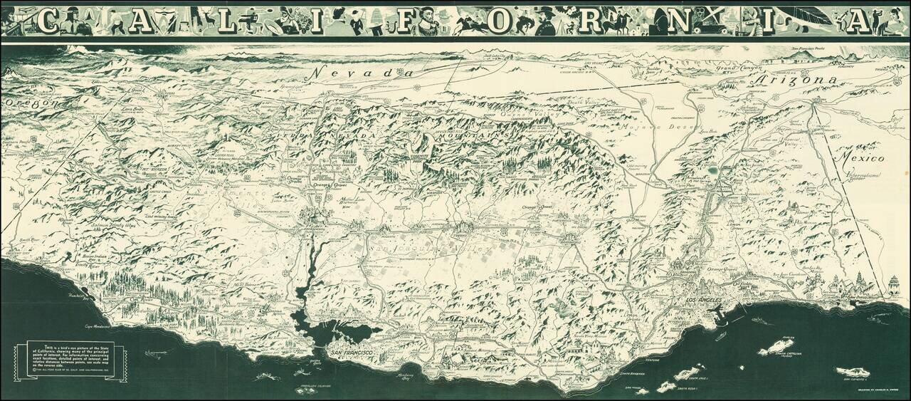
A striking Depression Era birds-eye view map of California, focusing on the major points of interest within the state, as well as major items of commerce, including oil fields near Long Beach, orange groves, old mining towns, and much more. The map shows the cities and attractions of California in great detail, showing all parts of the state although the coast, in the foreground, is given the most attention. Parts of Oregon, Nevada, and Arizona are all shown in the same style. The title names the state as well as showing cartoons of present and past life in California, from conquistadors to wine-makers to skiers.
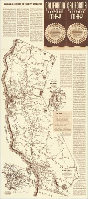
The text on verso describes "Principal Points of Tourist Interest" as well as showing a road map. This includes an inset road map of Los Angeles, showing the area from the San Fernando Valley to Long Beach. The text acts as an index for both maps, and it goes into great detail about the various points of interest from Wringley's million-dollar casino in Avalon to Mt. Whitney "highest point in the U.S."
A welcoming message on the front of the map is signed by Frank F. Merriam, Governor of California which dates this map to the period of 1934 - 1939. An interesting "warning" on the verso states that while tourist opportunities are unlimited in California, employment opportunities are not and that those seeking employment should not visit, perhaps suggesting an earlier part of Merriam's tenure.
If you are a student, write to us in telegram: @antiquemaps and indicate what material you need and for what work you need a map in high detail. We are ready to provide material on special terms. For students only!
![[Signed Political Satire Artwork] Vietnam ... Vietnam ... Vietnam ...](/map/small/68726.jpg)

