Map size in jpg-format: 40.4924MiB
Click to open in high resolution (open in new tab).
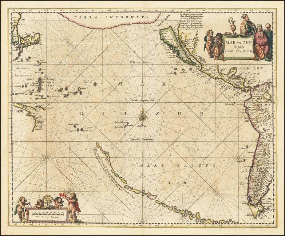
A fine example of Jansson's sea chart of the Pacific, the first chart of the Pacific to show California as an island and the earliest sea chart of the Pacific to appear in a Dutch Atlas.
A long chain of islands appears in the South Pacific, which are likely a vestige of Terra Australis. These were noted by Jansson to have been discovered by Hernando Gallego in 1576. The first mention of this explorer appears in a Hondius map of the Antarctic, and his existence is difficult to confirm. A journey by Juan Fernandez in search of Terra Australis in that year did claim to discover a mountainous island that some early scholars believed could be New Zealand. The earliest accepted date for European colonization of New Zealand is 1642.
California is shown as an island, based upon the Briggs model, but lacking the 2nd Punta de la Concepcion suggesting reliance upon Goos or his sources. Jansson includes a length note about the island and previous mapping. The large Terra Incognita in the Northwest nearly connects Asia with the Island of California, separated only by the Fretum [Strait] Anian.
Many places in California are named, from Cabo San Lucas to the Cabo Mendocino. Some islands of the West Pacific start to take shape, with a part of Papua outlined. Many other islands, real and imaginary, are shown.
If you are a student, write to us in telegram: @antiquemaps and indicate what material you need and for what work you need a map in high detail. We are ready to provide material on special terms. For students only!


