
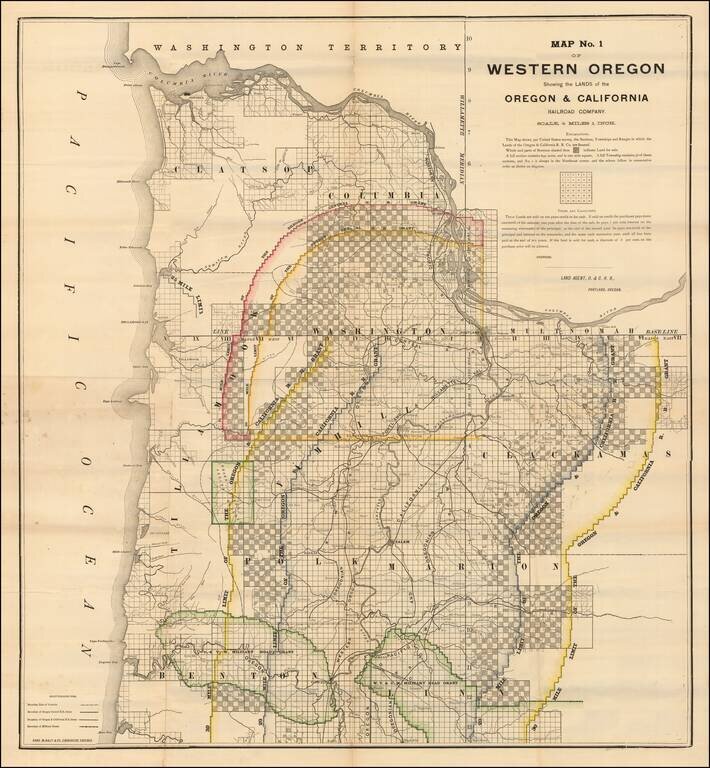
Lands Granted to the Oregon & California Railroad Rare separately published map of northwestern Oregon, printed by Rand McNally & Co. for the Oregon & California Railroad Company. The map extends from the Columbia River to Yaquina Bay and...
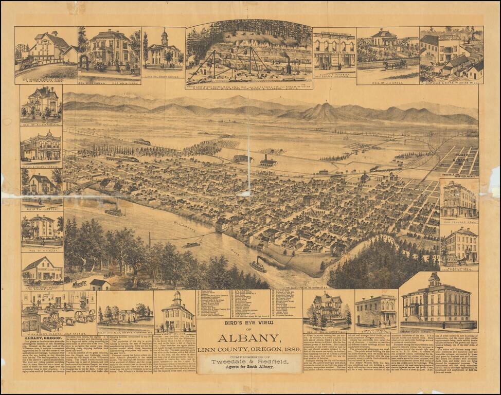
One of the Earliest Settlements in Oregon Rare separately published view of Albany, in Linn County, Oregon. Includes an interesting smaller view of the Albany Sand Stone Quarry and Allen & Goff's Electric Light Stations, along with the unusual...
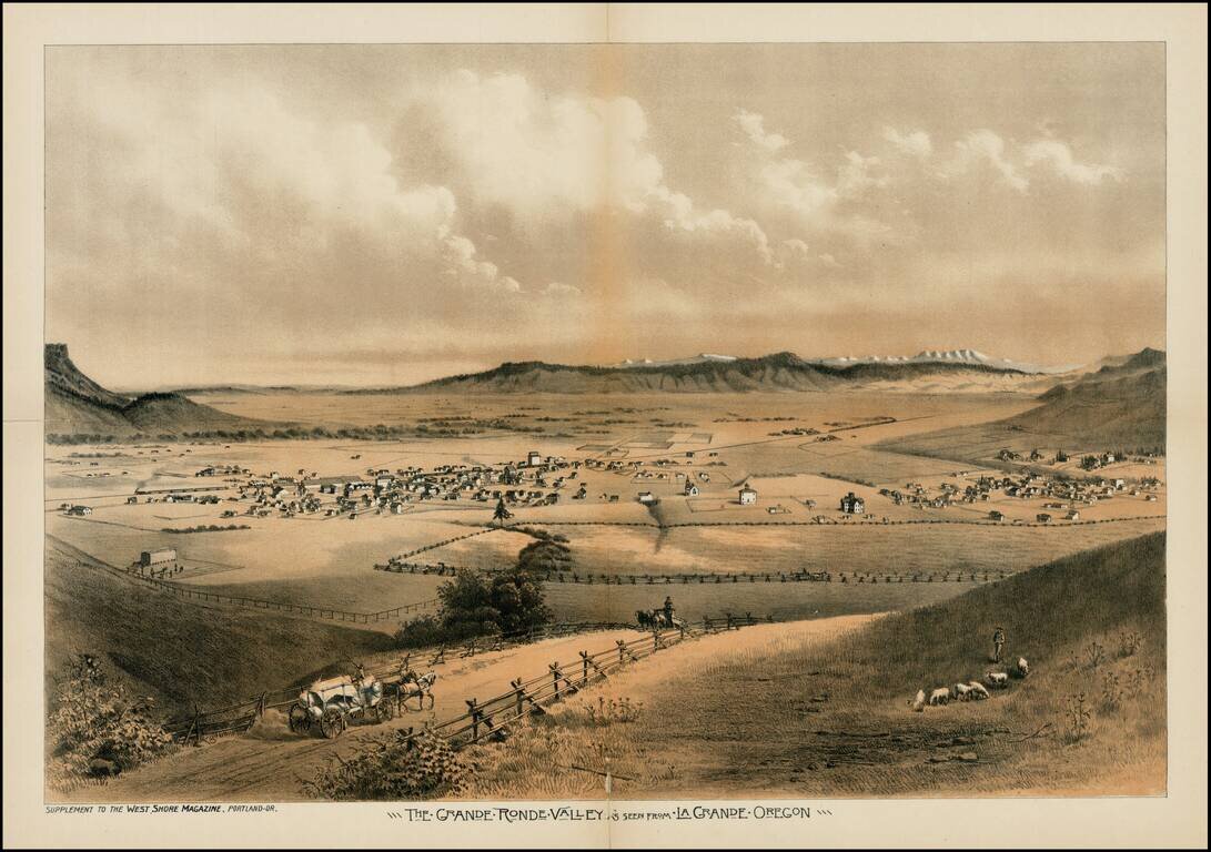
Fine early view of the Le Grande Ronde Valley, in Oregon, from West Shore Magazine. The Astor Expedition passed through the Le Grande Valley in 1811. Thereafter, it became a waypoint along the Oregon Trail. Since the 1840s, settlers headed toward the...
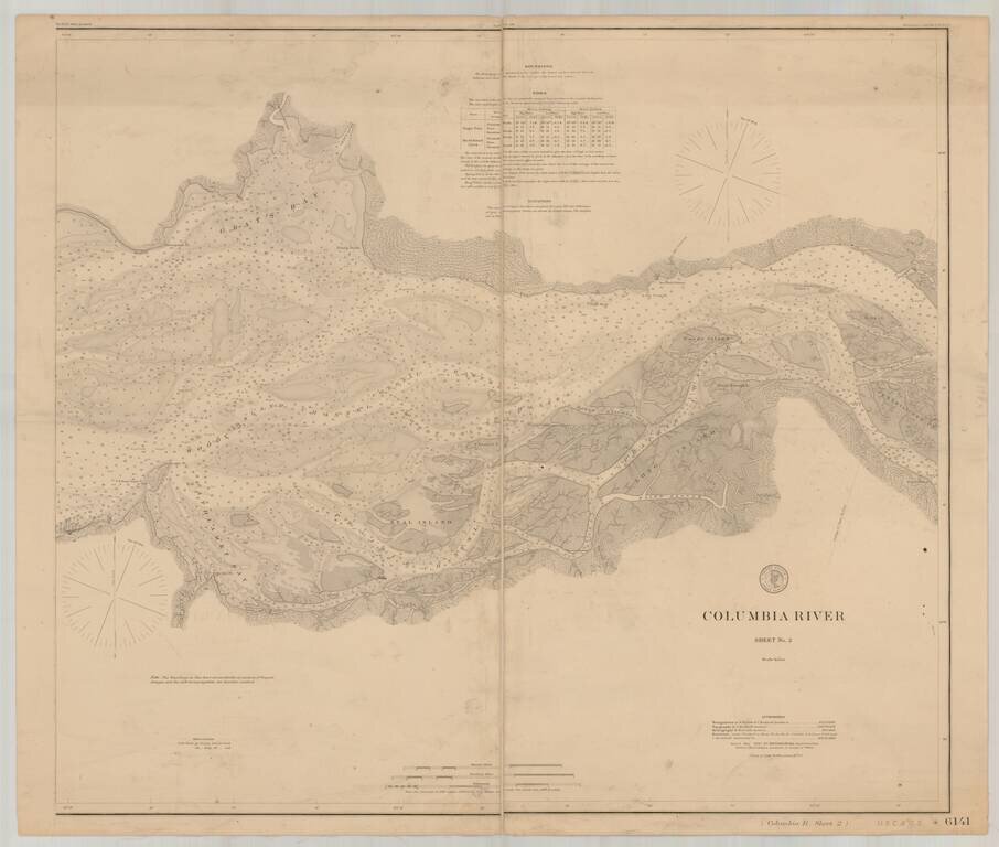
Detailed chart of the Columbia River, extending from the area near Astoria in the west to Skamokawa in the east. The chart is based upon Triangulation data compiled in 1852 and 1871, with topographical data compiled in 1868, 1870 and 1871 and...
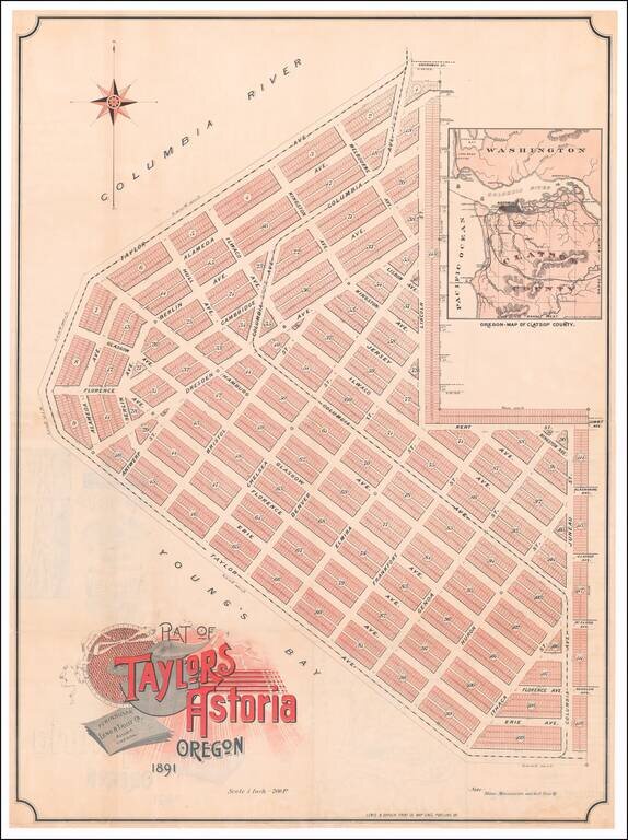
Rare promotional plan of Taylors Astoria subdivision, published in Portland in 1891. Taylors Astoria is situated on the Columbia River at Young's Bay, just east of Fort Stevens and the Astoria Lighthouse. The map inset shows that a proposed rail...
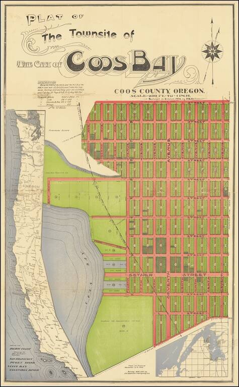
An Oregon Paper City Interesting four-stone color-lithographed real estate promotion map for the city of Coos Bay, Oregon, a proposed settlement on the east side of the bay. In this map, the City of Coos Bay is imagined as a counterpoint to the...
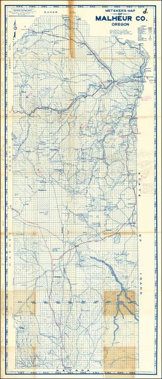
Highly Annotated With New Roads and Mining Details Detailed map of Malheur County in Southwestern Oregon. The map is extensively annotated several different colors. For example, near Owyhee Reservoir (built in 1927), a pencil annotations notes:...
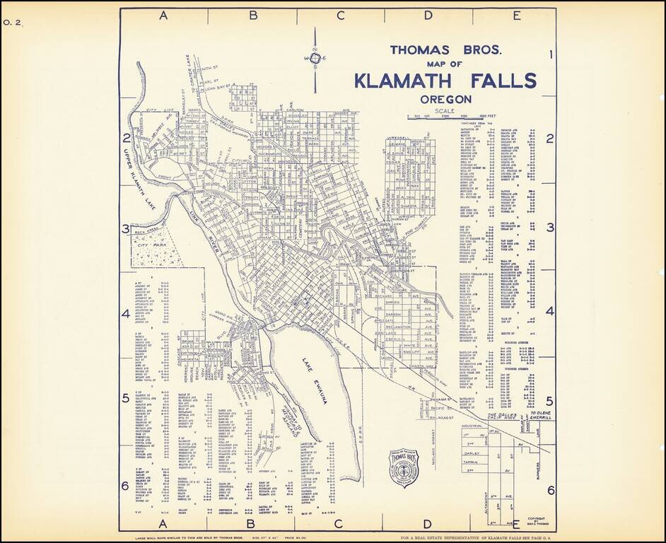
Early map of Klamath Falls, Oregon, with a map of State Highway system of Oregon on the verso. Nice pair of city plans including streets, major buildings, railroad lines, etc.
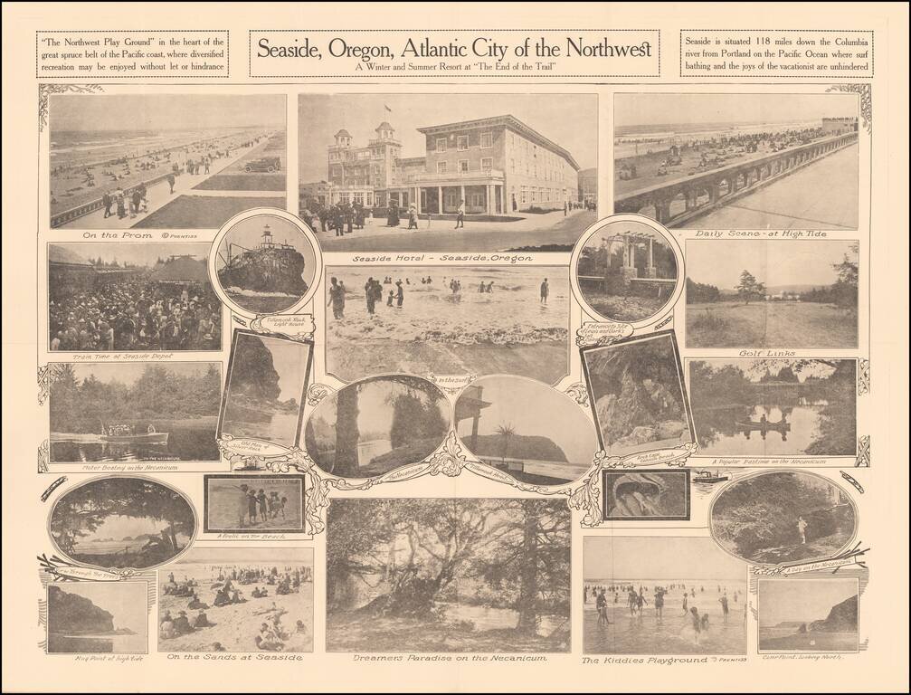
A Winter and Summer Resort at "The End of the Trail" Rare promotional pamphlet for Seaside, Oregon, including approximately 20 black and white photos of the town, beach and tourist features. Promotional text on the verso. Rarity OCLC locates 2...
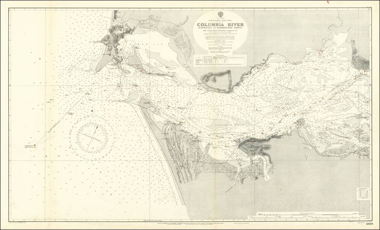
Extremely detailed chart of the mouth of the Columbia River, between the states of Oregon and Washington. The map covers the north and south shore of the Columbia as it exits into the Pacific Ocean. On the north shore, the towns of Ilwaco, Holman, and...
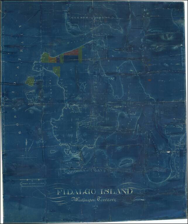
One of the Earliest Surviving Maps of Fidalgo Island Rare map of Fidalgo Island, named after the Spanish explorer and cartographer Salvador Fidalgo who explored the area in 1790. The map is color coded to show the lands owned by several different...
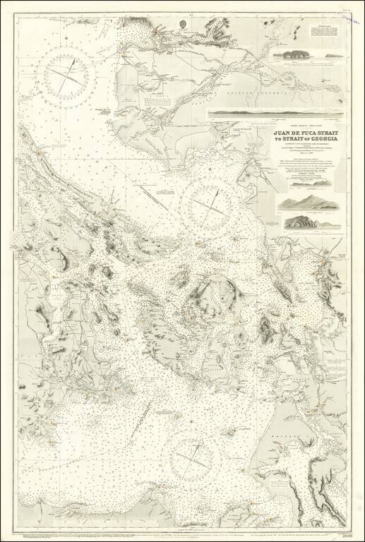
Excellent British Admiralty chart of the Strait of Juan de Fuca, focusing on the San Juan Islands, and also showing Victoria and Vancouver B.C. The chart was originally published in 1882 and was updated numerous times to 1924. Despite the fact that...
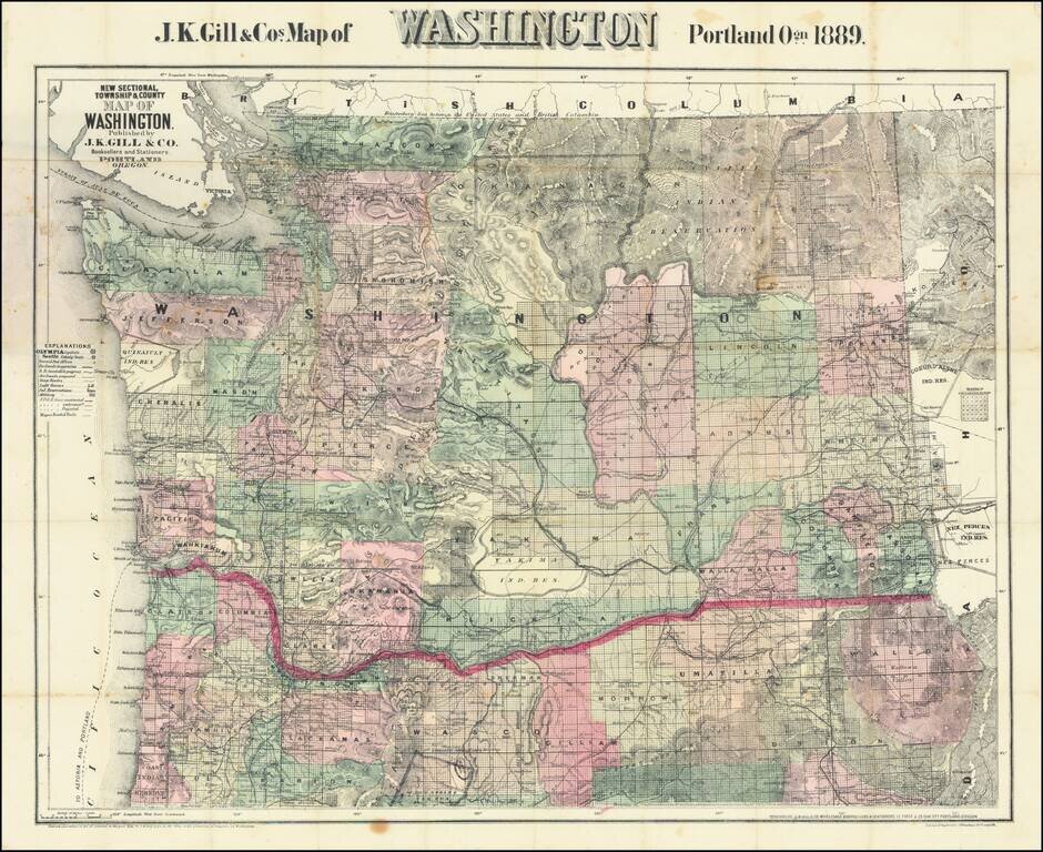
Large Separately published map of Washington. Scarce separately issued map of Washington by J.K. Gill, the leading local seller of books and stationery in Portland at the time. This would appear to be the third state of Gill's map, which was first...
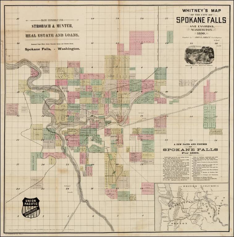
Early promotional map of the City of Spokane Falls (Spokane), Washington, which includes facts and figures encouraging early settlers, published at the beginning of Spokane's major boom period and at the time the Union Pacific Railroad was first...
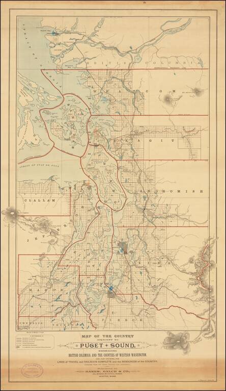
Rare separately published map of "the Puget Sound Country," published by Baker, Balch & Co. Civil, Mechanical and Electrical Engineers and lithographed by A. Zeese & Co. of Chicago. A remarkable advertising map issued to promote settlement,...
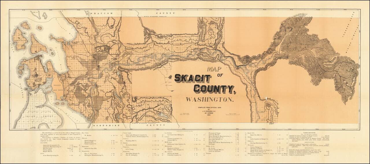
A highly detailed map of Skagit County, showing the county in great detail. The focal point of the map is the lumber industry within the county, with lumber and shingle mills noted in over twenty towns. The map identifies wagon roads, public roads,...