
![[Union Pacific Railway Map]](/map/small/55008.jpg)
Fine large format map of the routes of the Union Pacific Railroad, published in May 1885 by Rand McNally & Company. The map is colored by counties and locates rail lines, stations and other details. The wide black lines locate the lines of the...
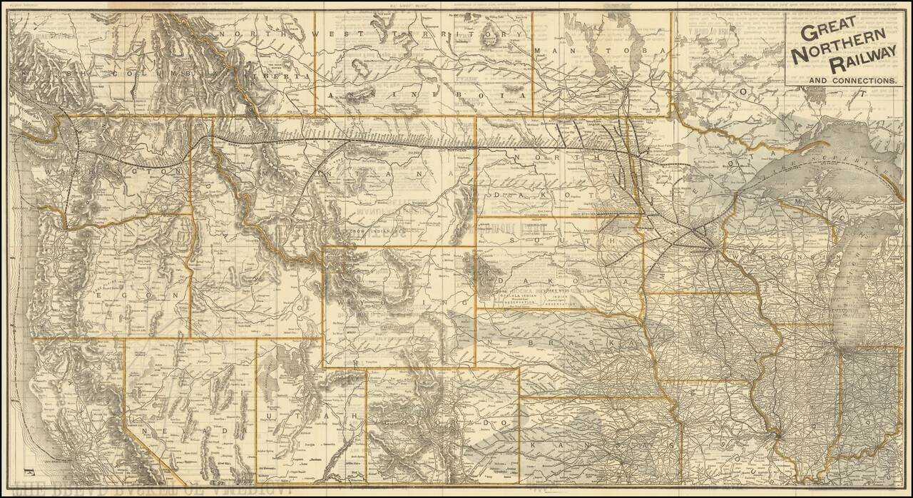
The Bread Basket of America! -- You Are Not Going To the Frontier! Fine large promotional map for the Great Northern Railway, promoting the Government lands available in the Red River Valley. The map shows the railroad lines of the Great Northern,...
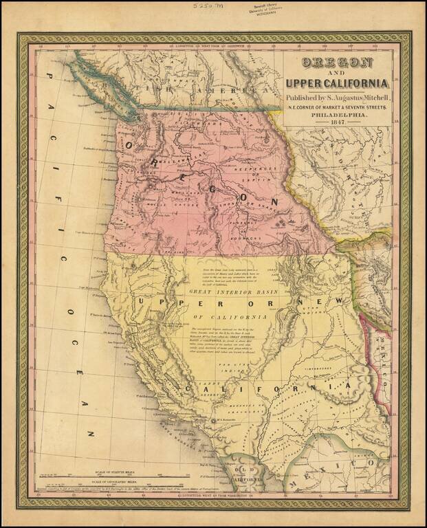
Rare 1847 edition of the best atlas map of the Western United States issued prior to the Civil War, reflecting Americans' contemporary knowledge of the West. The map shows the Spanish Trail, Lewis & Clark's Canoe Route, Oregon Trail, early roads,...
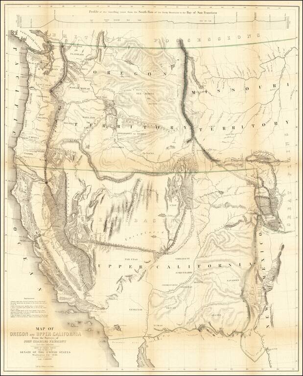
Nice example of Fremont's map of the region west of the Rocky Mountains, widely regarded as the most important and influential map the American West published in the middle of the 19th Century. This example includes the text of the Geographical Memoir...
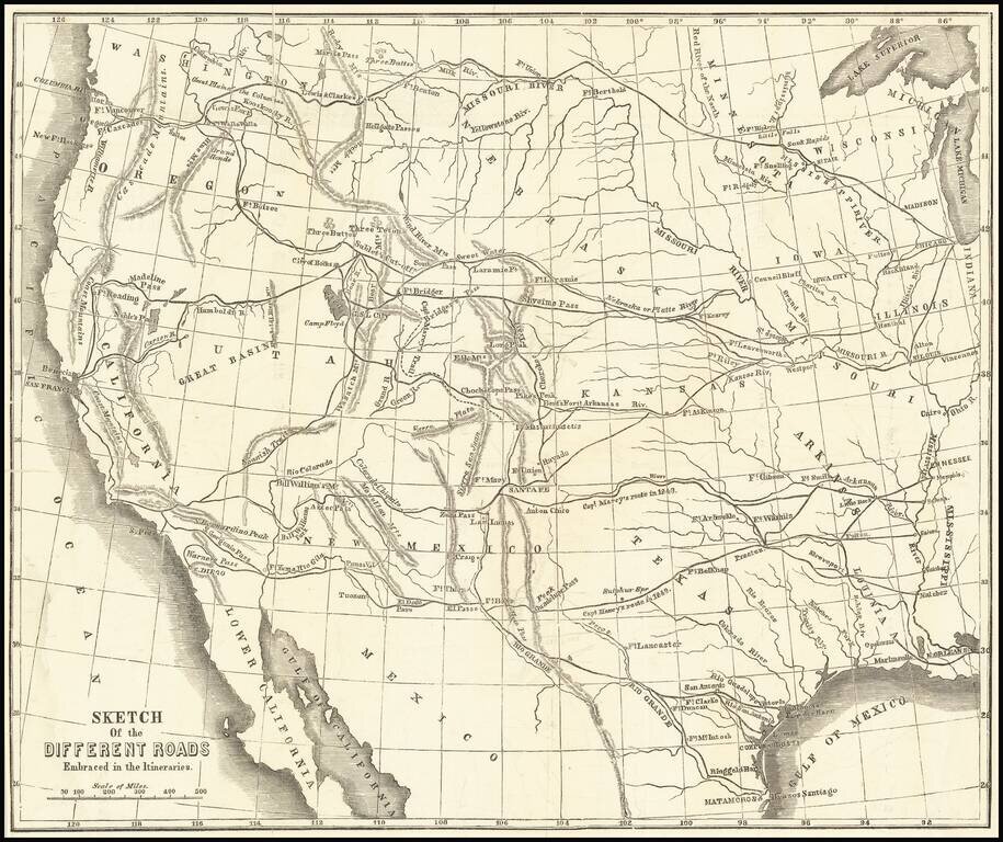
Scarce wood-engraved map of the overland routes to the West discussed in Marcy's The Prairie Traveler: A Hand-Book for Overland Expeditions, with Maps, Illustrations, and Itineraries of the Principal Routes Between the Mississippi and the Pacific...
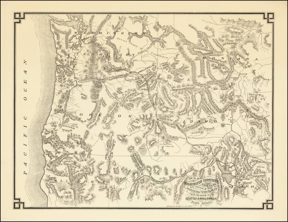
The First Map Printed in Seattle -- Seattle & Walla Walla Rairoad Map With Manuscript Corrections Likely In the Hand of the Maker Fine example of this rare map of the Pacific Northwest, illustrating the proposed route of the Seattle & Walla...
![[Heavily Annotated] Great Shoshone and Twin Falls Water Power Company Map Showing Location of Power houses, Substations and Transmission Lines](/map/small/62919.jpg)
Heavily Annotated Blue Print Copy of One of the Earliest Large Scale Hydro-Electric Power Companies in Idaho Wall map of a portion of the Northwestern United States, centered on Twin Falls and Shoshone Falls, illustrating the area proposed to be...
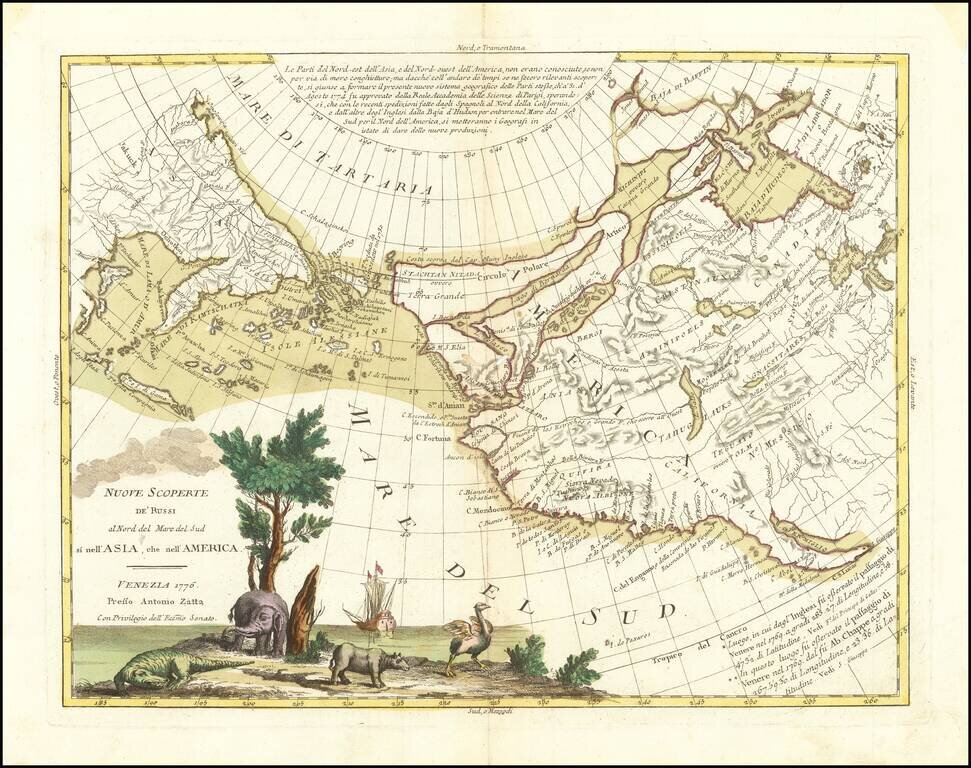
An Ostrich, An Elephant and the Northwest Passage! Striking example of Zatta's map of the northern Pacific Coastal regions and one of the best illustrations of a late rendition of the Northwest Passage, here illustrating two wide passages from the...
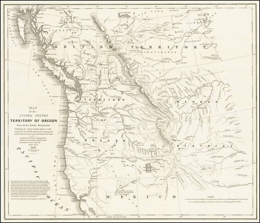
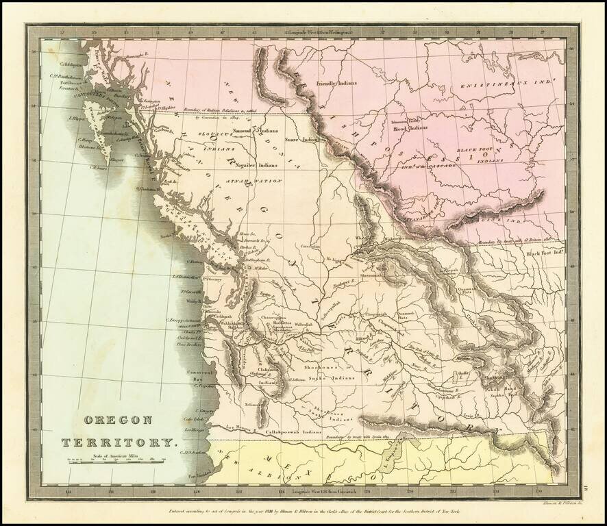
Important Map Showing Oregon Territory used during Congressional Debates about the Status of Oregon Country Hood's landmark map of the Oregon Country was integral to political debates about the area, its place in the growing United States, and its...
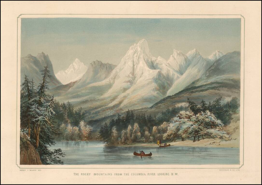
Striking image of the Rocky Mountains, with the Columbia River in the foreground and native Americans with two canoes. One of the earliest obtainable images of a scene from Oregon Territory, based upon actual observations of an earlier traveler,...
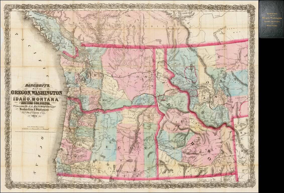
Rare separately issued map of the northwestern United States and British Columbia, issued in 1872 by A.L. Bancroft & Co. in San Francisco. Bancroft's map was first issued by HH Bancroft in 1868. The map was drawn from a section of Bancroft's...
The First Map of Oregon Territory to Appear in a Commercial Atlas Striking example of the first edition of David Burr's map of Oregon Territory, which appeared in Burr's New Universal Atlas, first published in 1835. As is typical of Burr’s style,...
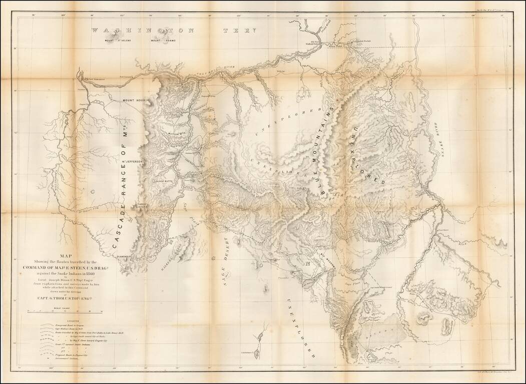
Important early map of Eastern Oregon, bounded by the Willamette, Columbia, and Snake Rivers. Major Enoch Steen, commander of the U.S. Dragoons, was sent to the area in 1860 to determine the feasibility of routes from the Willamette Valley to...
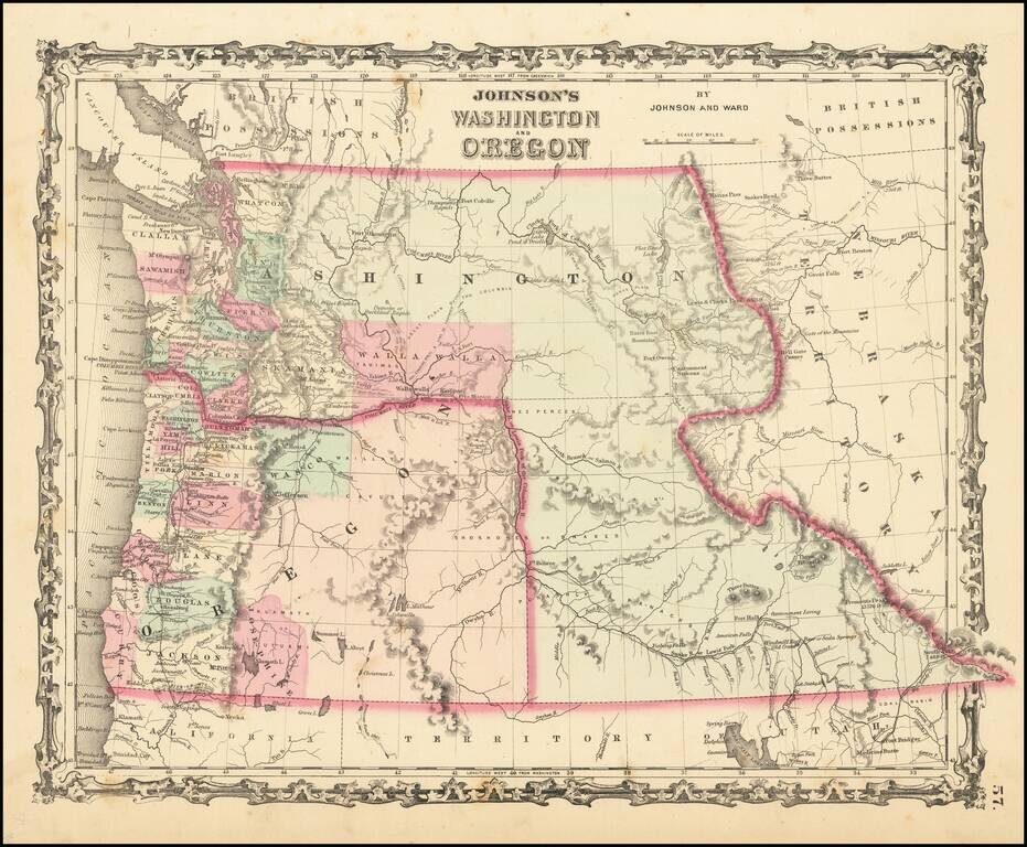
Scarce early edition of Johnson's Washington & Oregon. The map is colored by counties. Washington wraps around Oregon to the east of the Oregon State line, including the yet to be formed Idaho Territory. Includes many Indian tribes, forts, roads...
![(Nothern Half) [Bancroft's Map of the Pacific States]](/map/small/54924.jpg)
Previously Unkown 1863-64 Second State. "Bancroft's, in scope, was probably the most important map yet produced by a publisher of the Pacific coast." - Streeter (TMW 1061) Two northern sheets of an engraved proof of the previously-unknown 1863 second...
![(Northern Half) [Bancroft's Map of the Pacific States]](/map/small/54923.jpg)
Rare Early State with a Massive Idaho Territory Upper half of HH Bancroft's rare map of the Pacific States, first published in 1863. The map includes all of Oregon, Washington, Idaho, and most of Montana and Wyoming, with a large inset of Hawaii. The...