
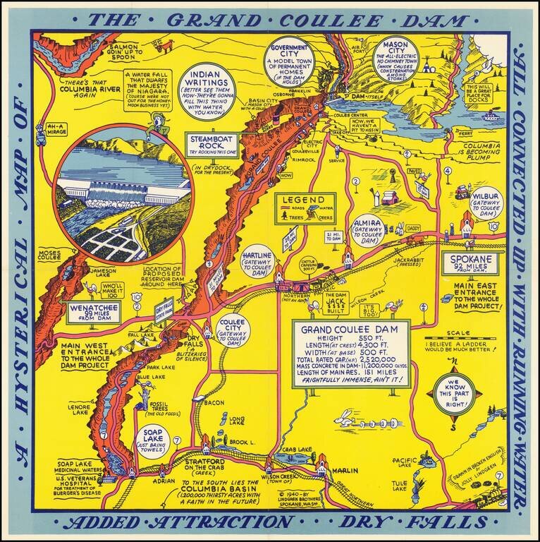
Second of two whimsical maps of Grand Coulee Dam, published by the Lindgren Brothers, "Drawn In Broken English by Jolly Lindgren," this comic pictorial map is full of puns and comic vignettes related to Grand Coulee Dam. The Lindgren Brothers issued a...
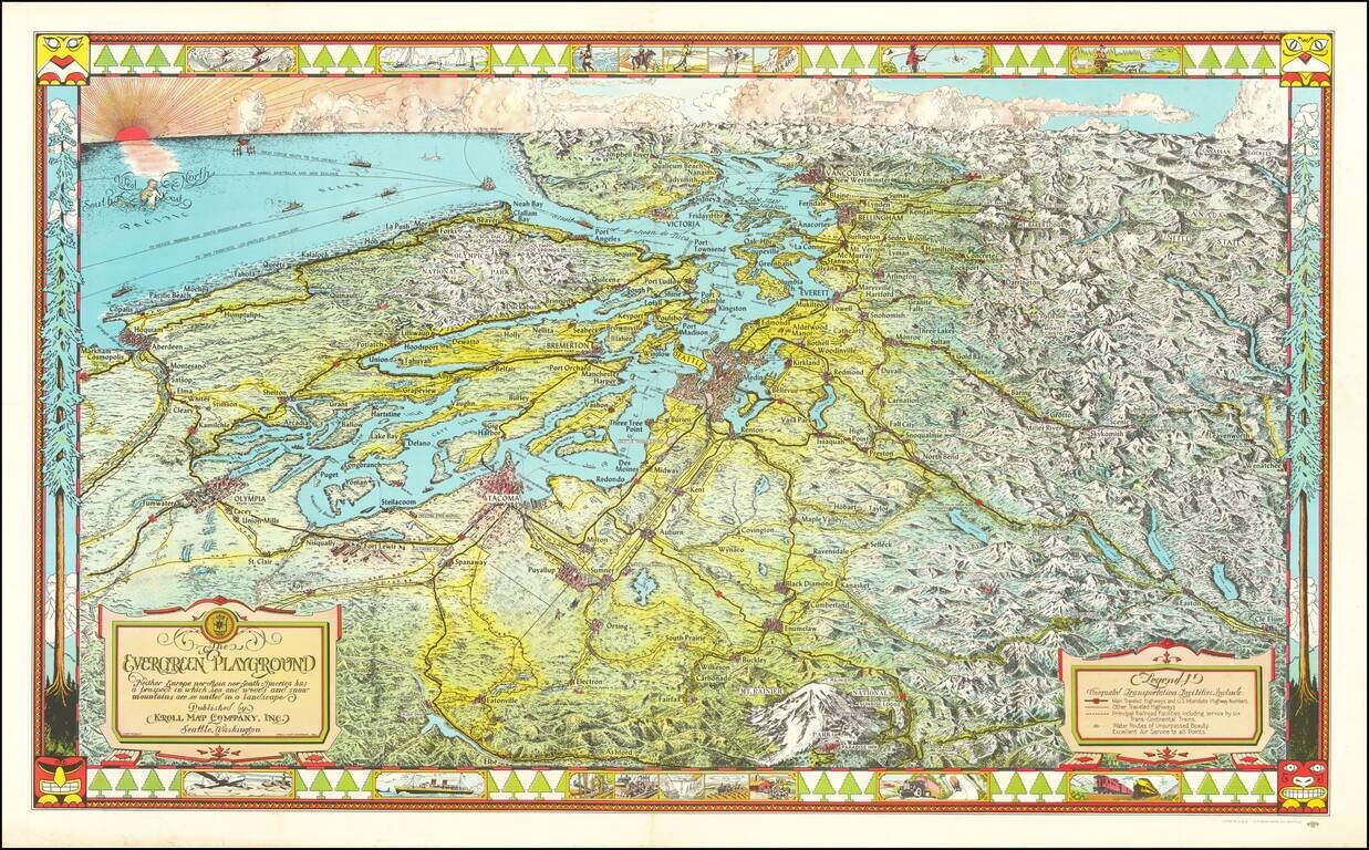
Fine large pictorial map of Puget Sound and the Northwestern Part of Washington State. The Evergreen Playground map was originally drawn during the Great Depression by Ed Poland, cartographer of many years at Kroll Map Company in Seattle, and changed...
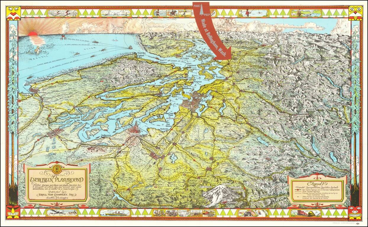
Fine large pictorial map of Puget Sound and the Northwestern Part of Washington State, which was included with a book on the history of paper pulp entitled Making Puget Pulp--A Pictorial Tour of Puget Sound Pulp & Timber's Plant At Bellingham,...
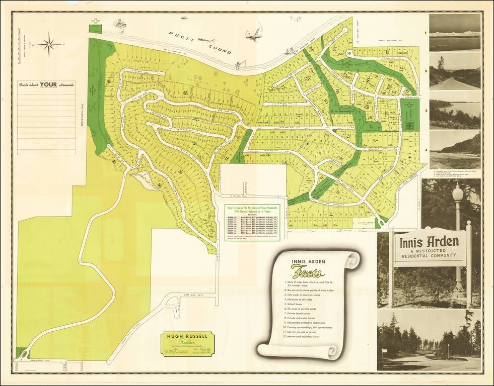
Explicit Racial Segregation in the Pacific Northwest. "Innis Arden A Restricted Residential Community". Interesting Midcentury promotional map for the community of Innis Arden, just north of Seattle, Washington. The map was published in 1950 to...
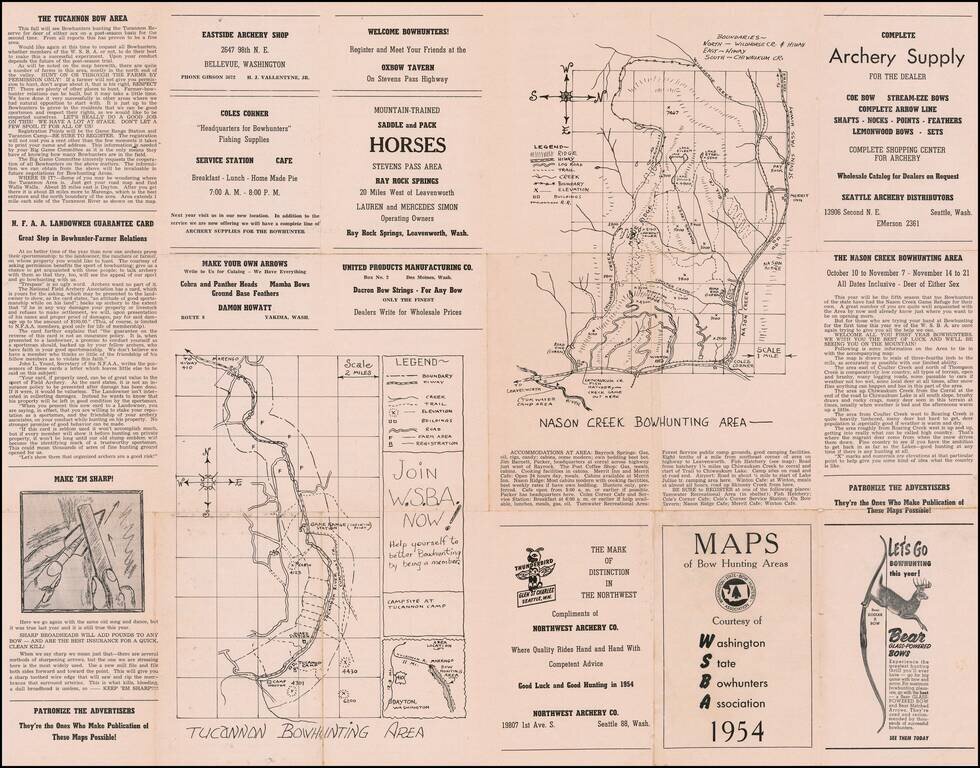
Washington State Bow Hunters Map Interesting guide and advertising map for Washington Bow Hunters, published in 1954. Includes maps of the following bow hunting areas: Tucannon Nason Creek Sherwood Forest Capitol Forest' Rarity We were...
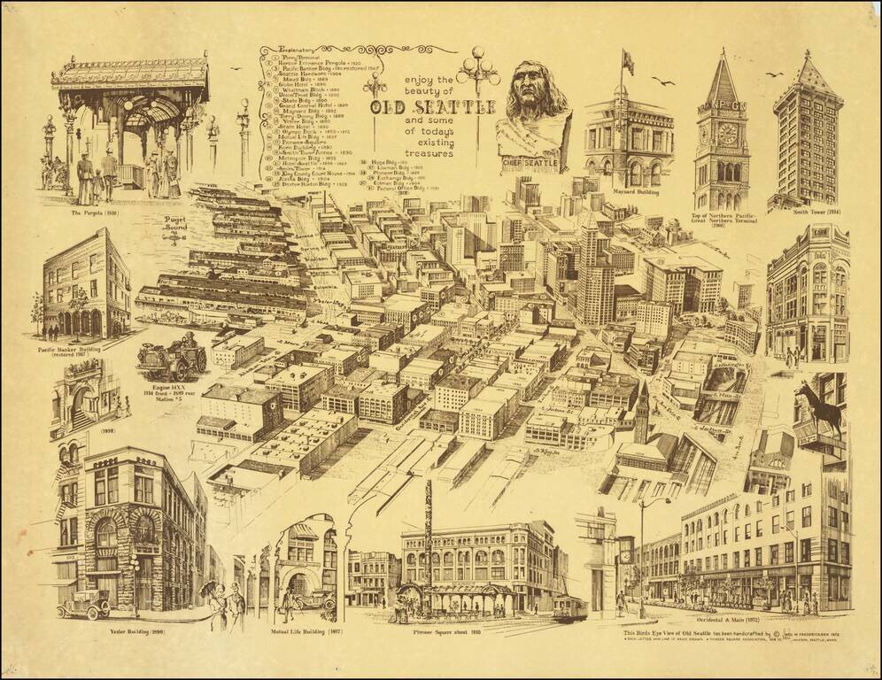
1972 Edition - Completely Revised! Fine large view of Downtown Seattle, published in 1972 and published for the Pioneer Square Association (the 1971 edition was published for Old Seattle Branch of Seattle-First National Bank). The center of the map...
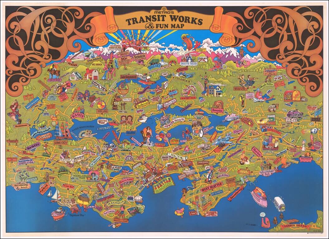
Fine large format pictorial map of the Seattle area, published by the Municipality of Metropolitan Seattle. A lively pictorial map of the Seattle area. We note the David Rumsey copy, but otherwise, the map is apparently very rare, having not been...
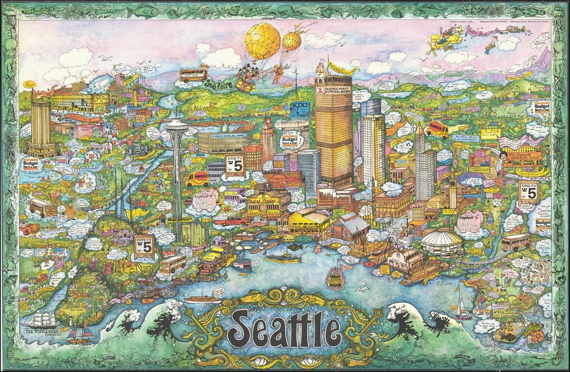
Rare whimsical pictorial view of Seattle, Washington, designed by Penthouse Studios in Vancouver and signed by artist "Robbie." A magnificent tour de force of pictographic detail. Signed only "Robbie," we are relatively certain that the artist is...
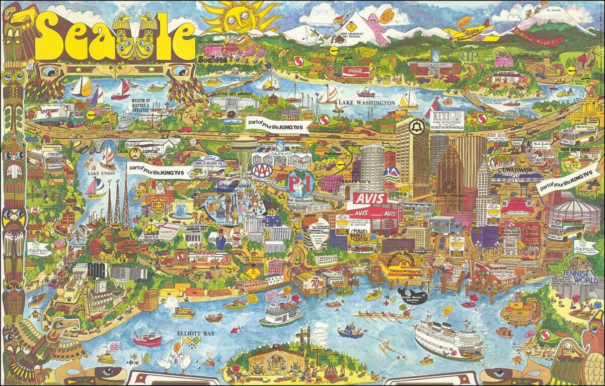
Decorative vintage pictorial map of Seattle, drawn by Roy Bishop and published by Bayside Publishing Company. The map is filled with promotional and advertising graphics, along with landmarks and whimsical images. We locate no other examples of this...
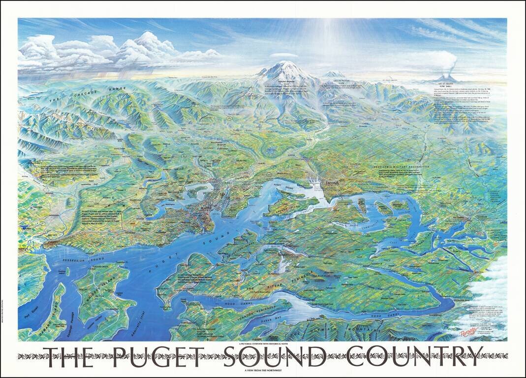
Attractive vintage bird's eye view poster of Puget Sound, showing Seattle, Mount Rainier, the eastern shores of the Olympic Peninsula, etc. The map was published in Seattle in 1981. Interestingly, the view includes a note about Mount St. Helens which...
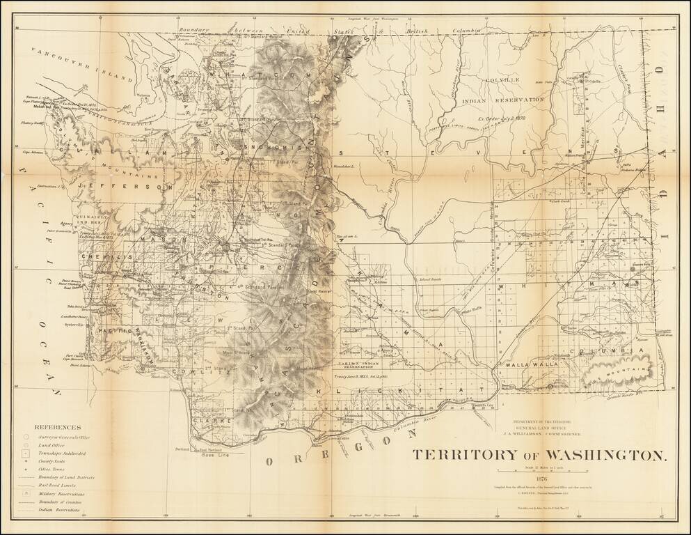
Fine, Detailed Map of the Washington Territory Large and intricate map of Washington Territory issued by the General Land Office under the direction of Principal Draughtsman Charles Roeser. It shows Washington just after it attained its present...
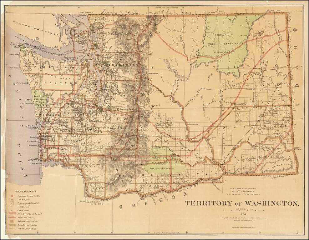
Fine, Detailed Map of the Washington Territory Large and intricate map of Washington Territory issued by the General Land Office under the direction of Principal Draughtsman Charles Roeser. It shows Washington just after it attained its present...
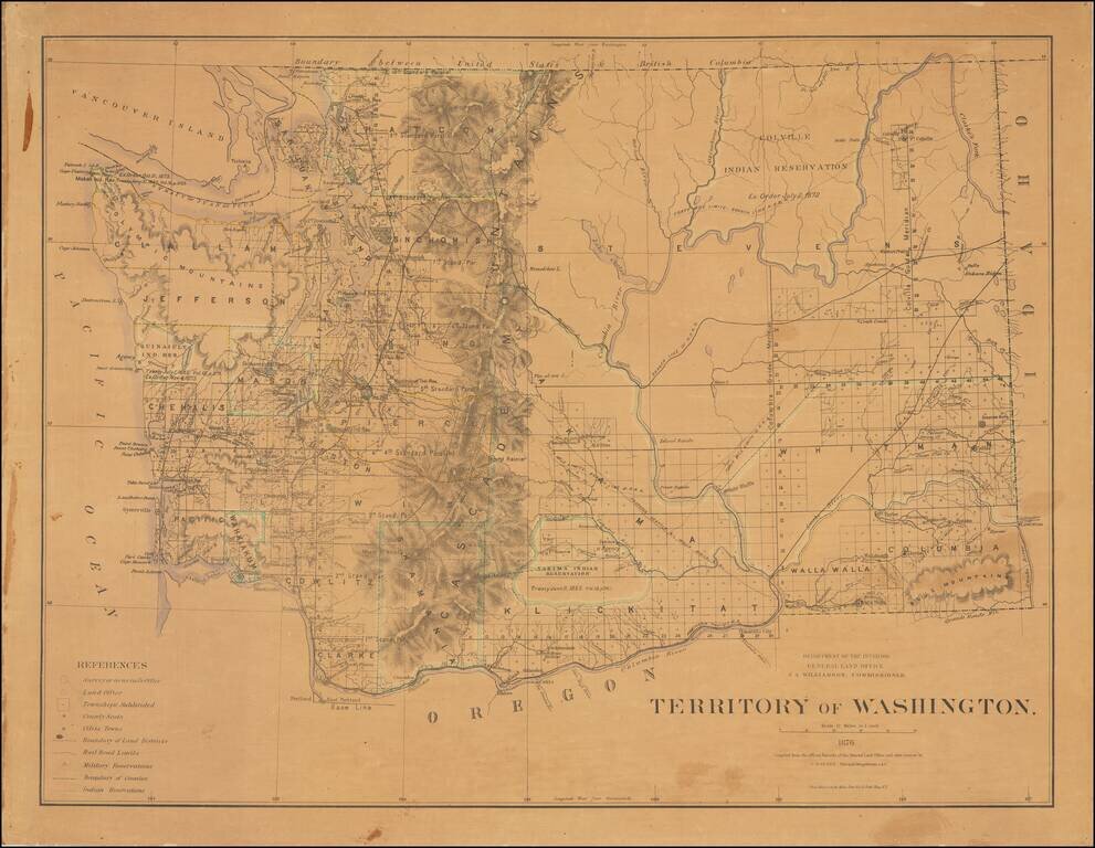
Fine, Detailed Map of the Washington Territory Large and intricate map of Washington Territory issued by the General Land Office under the direction of Principal Draughtsman Charles Roeser. It shows Washington just after it attained its present...
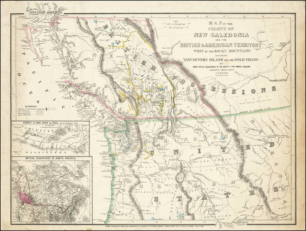
First State of this Exceptional Fraser Canyon Gold Rush Rarity One of the great early mappings of the Pacific Northwest, covering Oregon Territory, Washington Territory, and British Columbia (which was then still "New Caledonia") with information...
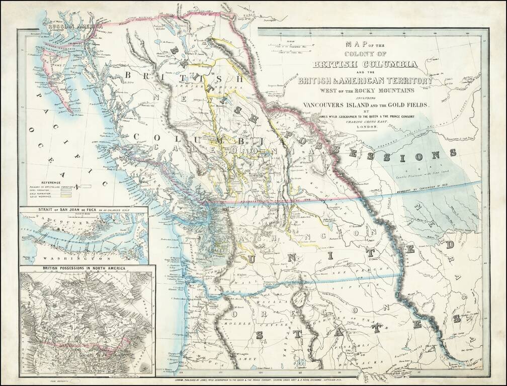
An Exceptional Fraser Canyon Gold Rush Rarity. One of the great early mappings of the Pacific Northwest, covering Oregon and Washington Territories, and British Columbia ("New Caledonia") with information derived from the Hudson Bay Company and Royal...