
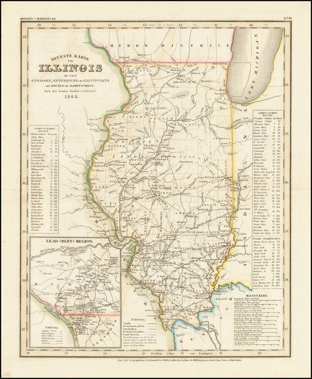
Fine example of this elegantly engraved & detailed map of Illinois, based upon Tanner's work in the early 1840s. Shows counties, towns, roads, rivers, lakes, etc. While often referred to as the German Mitchell, this characterization is unfair, as...
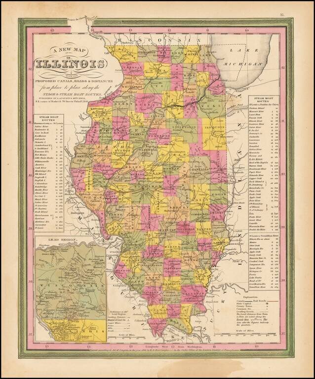
Interesting detailed map of Illinois with an inset of the Lead Region showing Northwestern Illinois and Southwestern Wisconsin. Shows canals, rivers, towns, roads etc. Counties are hand colored. Statistical tables show steam boat routes. Very good...
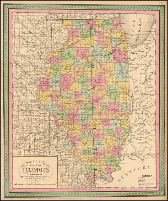
Detailed and interesting map, hand colored by county and showing towns, rivers, lakes, railroads, roads, distances, forts, etc. An exceptional example.
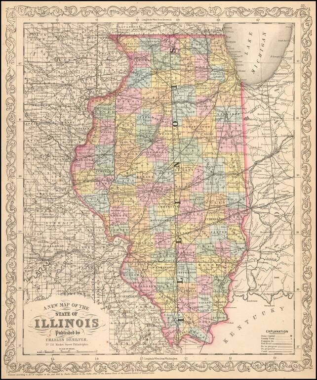
1852 edition of Peck & Messinger's map of Illinois, hand colored by County, published in 1852. Peck & Messenger's map of Illinois was one of the most enduring map legacies of the midwest, with issues dated as early as 1836 and still in...
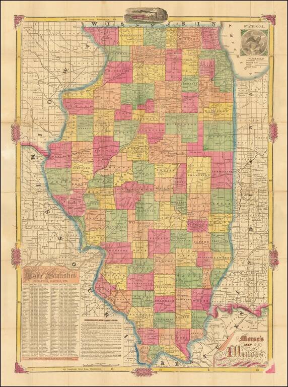
Rare early map of Illinois, published by Rufus Blanchard prior to his move to Chicago. Includes a 'Table of Statistics' and 'Meridians and Baselines' in the lower left corner. The map is printed using the cerographic printed method, an American...
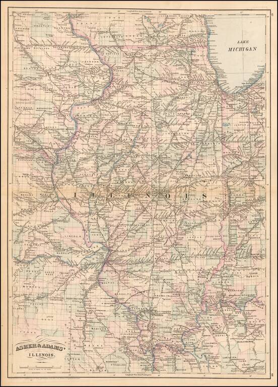
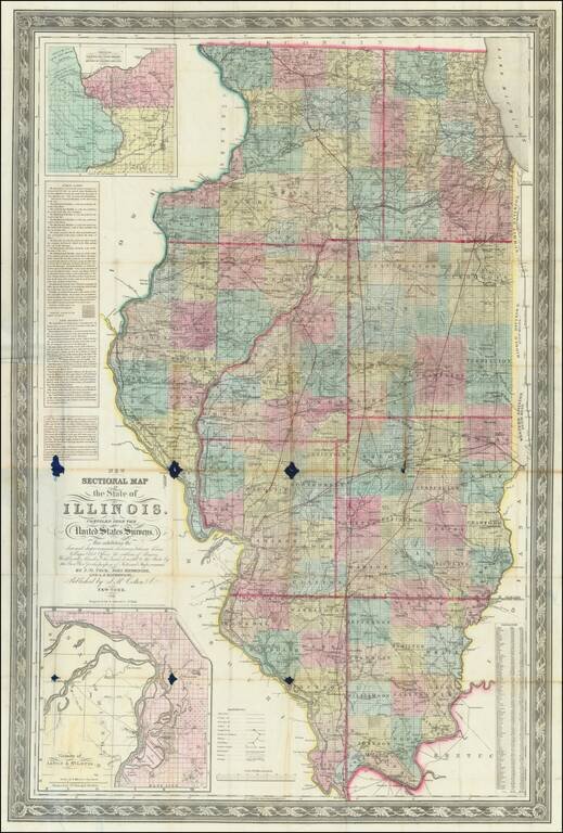
Gorgeous large format railroad map, hand colored by counties. Shows railroads, towns, rivers, lakes, mountains, township surveys, etc. Asher & Adams Atlas was conceived as a Railroad Atlas.
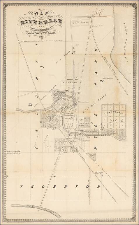
Early Promotional Map for Riverdale, Illinois -- One Year After Its First Post Office Was Established An exceptionally rare 1874 survey map of Riverdale, Illinois, a suburb of Chicago. The map is centered on a bend in the Little Calumet River just...
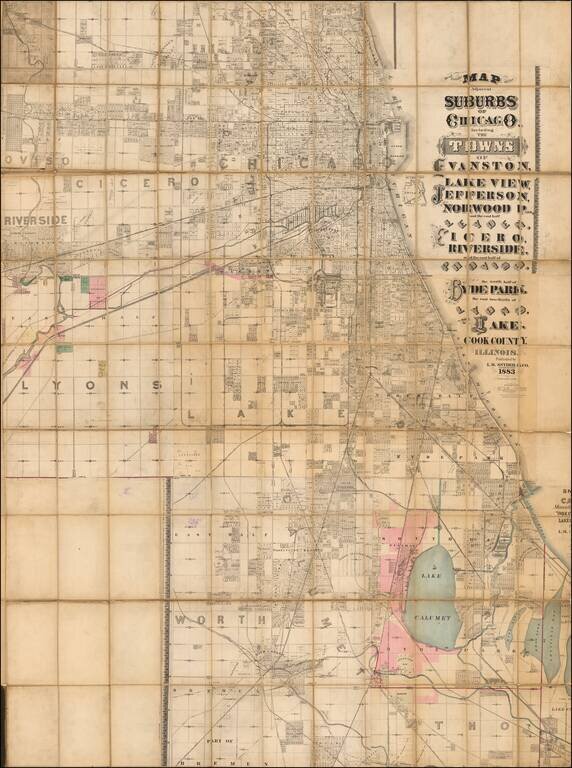
Massive, Detailed Wall Map of Chicago from the 1880s. L.M. Snyder & Co.'s extremely rare lithographed folding map of Chicago, published in Chicago during its major late-19th-century real estate boom. The map has considerable detail for its size;...

Decorative and unusual trading card map from this famous series. Map is surrounded by decorative vignettes.
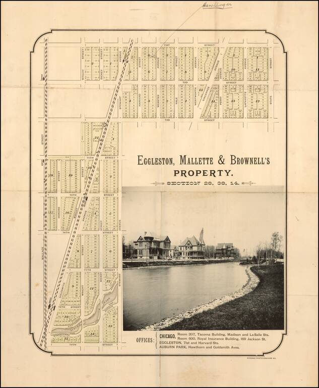
Rare early subdivision map of the Auburn Park area. Auburn Park Auburn Park is part of the area once known as Cummorn, most of which was owned by William B. Ogden, Chicago's first mayor and early real estate promoter. The first railroad line...
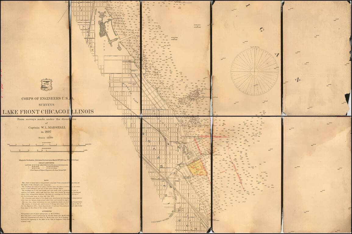
With Manuscript Annotations Showing Proposed Harbor Improvements Detailed map of part of the City of Chicago, from Jackson Park to the Colehour Yard area, prepared by the United States Corps of Topographical Engineers in 1892. The map is centered...
![Illinois Northern Half [and] Illinois Southern Half](/map/small/69643.jpg)
Fine large Railroad map of Illinois, published in Chicago by George Cram. Includes a list of over 60 railroads operating in the state, with color coding.
![[With Original Envelope!] A Geographical Map of the Century of Progress Exposition Held in Chicago, Illinois 1933 Faithfully executed and drawn in a carnival spirit by Tony Sart '33](/map/small/69226.jpg)
Rare large map of the Chicago World's Fair in two parts, published by Tony Sarg in 1933. David Rumsey notes: Two pictorial maps on one sheet, a panorama view of exposition grounds, whimsical sea monsters, whales, planes, and boats in the water....
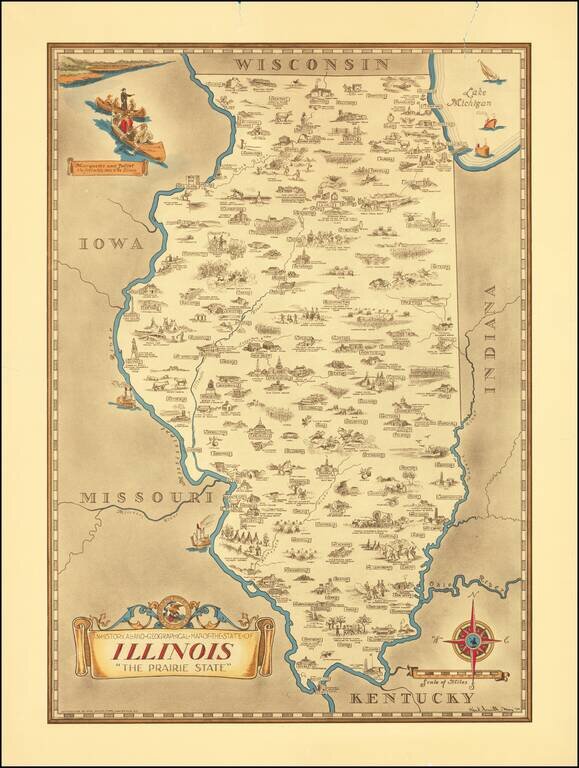
Scarce pictorial map of the Illinois, by the prolific illustrator Karl Smith. The map is filled with historical vignettes, telling the story of Illinois's history. Color vignette on upper left illustrating "Marquette and Jolliet the first white men...
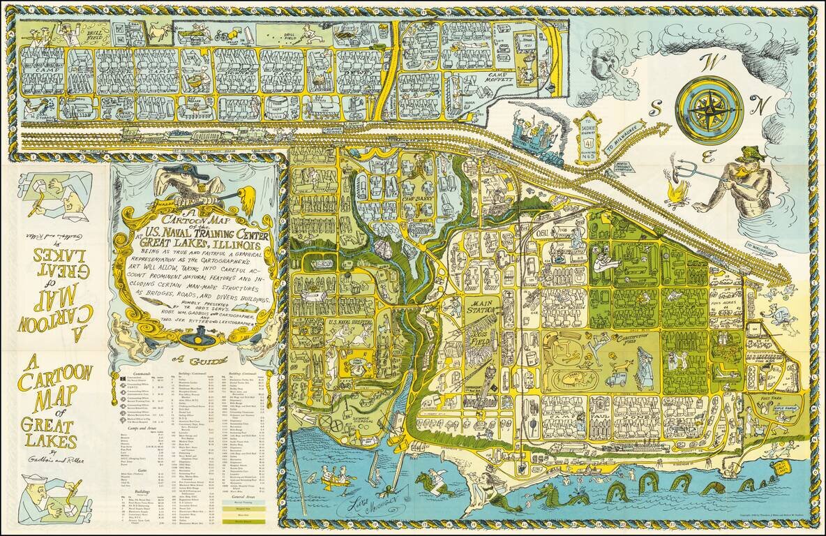
Whimsical map of the Naval Training Center in Great Lakes, Illinois. The station is located north of Chicago and is the Navy's only boot camp. The map is filled with hundreds of buildings and important sites with a key at bottom, along with many...