
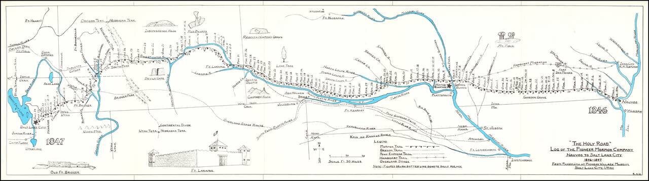
Rare historical / pictorial map of the Mormon Route from Navoo to Salt Lake, drawn by Robert A. Hanson. The map was likely published by the Western Cover Society, a California based society which published the Western Express. Hanson's maps were...
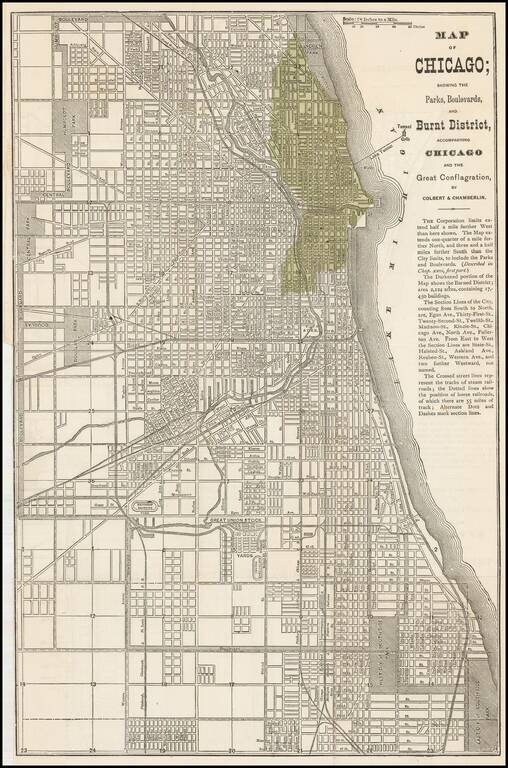
Early map of Chicago issued shortly after the 1871 Fire. The darkened portion of the map shows the Burned District consisting of 2,124 acres and containing 17,450 buildings. A scarce map -- this is the first example we have offered....
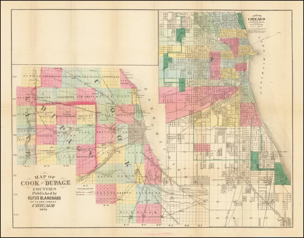
Rare Chicagoland Map Showing Extent of Great Fire. This is a rare separately issued folding map by Rufus Blanchard, creator of some of the earliest maps of Chicago. This 1872 edition of the map shows the extent of the Great Chicago Fire which had...