
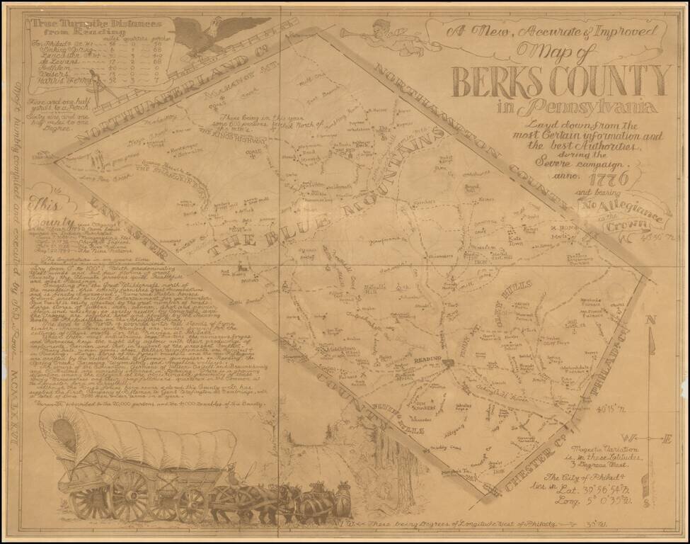
Rare pictorial map of Berks County, Pennsylvania, drawn by J.R. Rowe. The map is well researched and attractively executed, providing a marvelous historical overview of Berks County in Colonial times. The "severe campaign" is a phrase used by George...
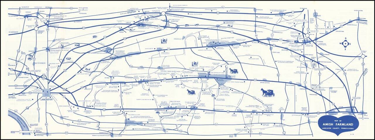
Early edition of this promotional map of the Amish Country. Interesting schematic style road map of the Amish Country, published to promote local businesses by the 340-23 Club. The verso notes that the Free Map of Amish Farmlands, Lancaster County,...
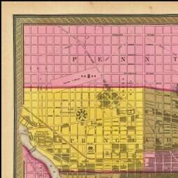
Detailed and interesting map of Philadelphia, published by SA Mitchell in 1846 and engraved by Burroughs. The map is hand colored apparently by Wards, although curiously so. Includes an index of public buildings, hotels, churches (including a Jewish...
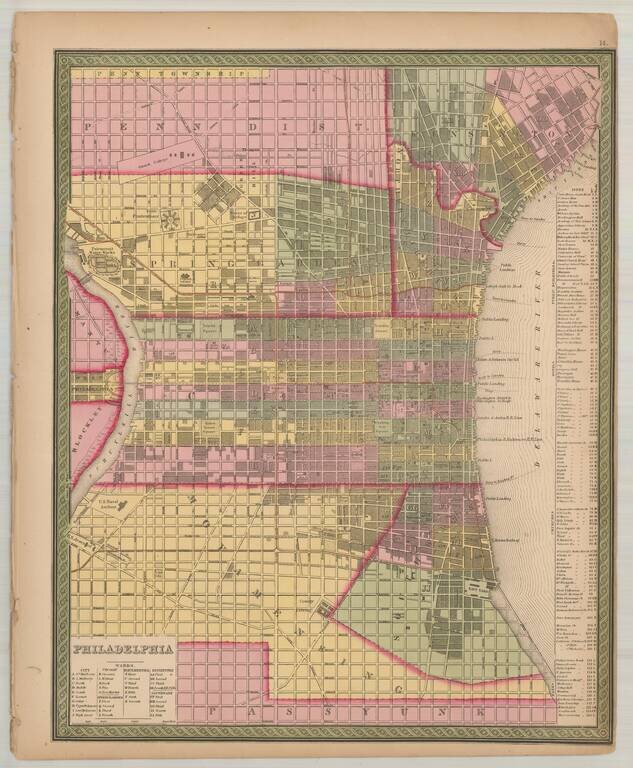
Detailed and interesting map of Philadelphia, includes an index of public buildings, hotels, churches (including a "Jews Synagogue") and banks. The map has been updated from the pre-1850 edition of the map, to include several new townships, etc.
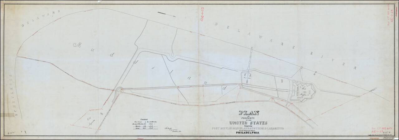
Antique hand-drawn map of the Fort Mifflin area on a mammoth scale. The fort is the only active American military base to predate the Declaration of Independence. This map presents the fort and mud island it occupies on as they stood at the beginning...
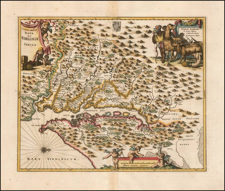
Nice example of Ogilby's edition of Smith's map of the Virginia & Chesapeake region. The map is based upon the earlier maps by Hondius and Blaeu, a bit smaller, but with 3 large cartouches, one of which includes fascinating indigenous animals,...
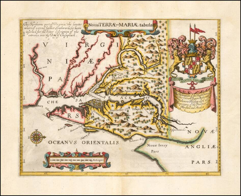
Second Edition of the First Map of the Province of Maryland -- Prepared To Promote The Newly Created Province Fine example of John Ogilby's rare Lord Baltimore Map, the second edition of the first printed map of Maryland and the first to show the...
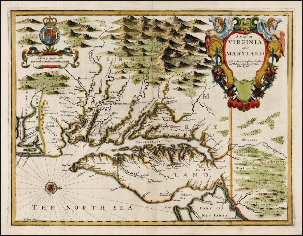
John Speed's Edition of John Smith's Seminal Map of Virginia. Nice example of John Speed's map of Virginia and Maryland, which was engraved by Francis Lamb and first appeared in the enlarged edition of Speed's Atlas in 1676. Speed's map of Virginia...
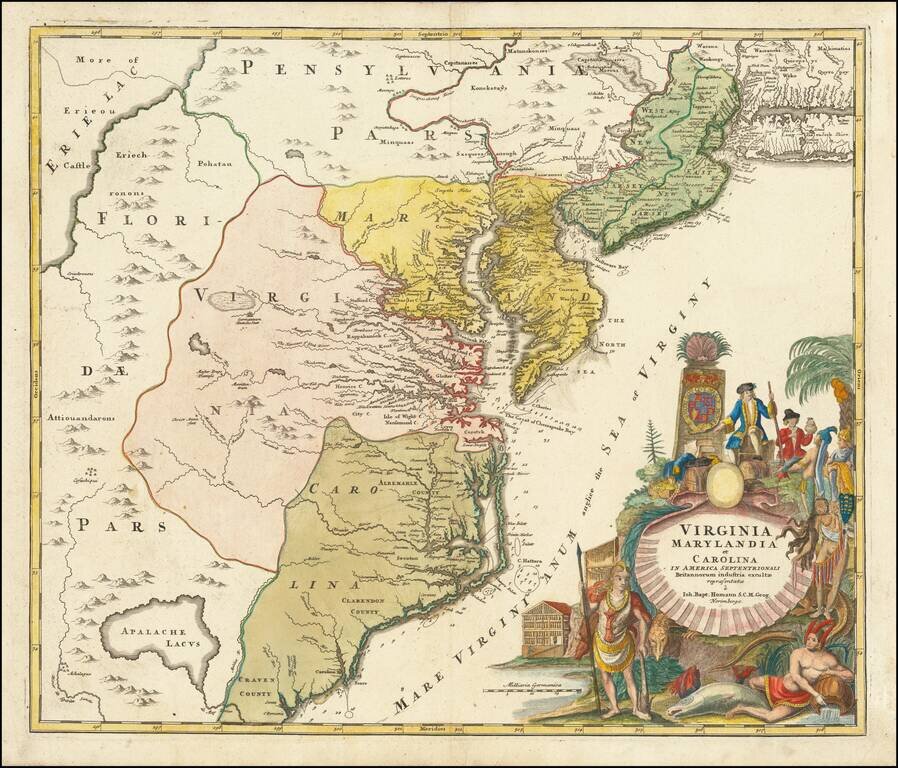
A nice example of JB Homann's map of Virginia, Maryland, New Jersey, North Carolina and South Carolina. Cartouche shows the splendor of the new world and the riches it provides. One of the most decorative maps of the area, intended to promote German...
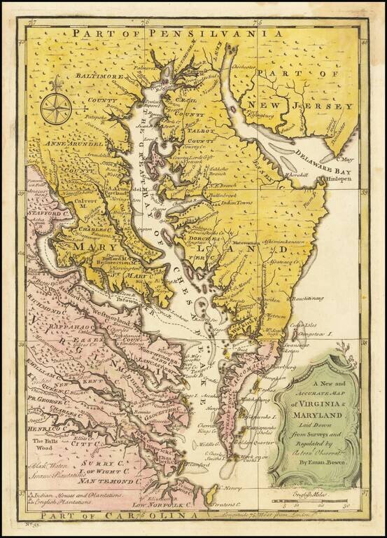
Scarce map of the Chesapeake region, based upon Augustine Hermann's map of 1673 and Henry Popple's map of 1733. The map includes a number of interesting annotations and place names, including Indian House and Plantations, English Plantations, Black...
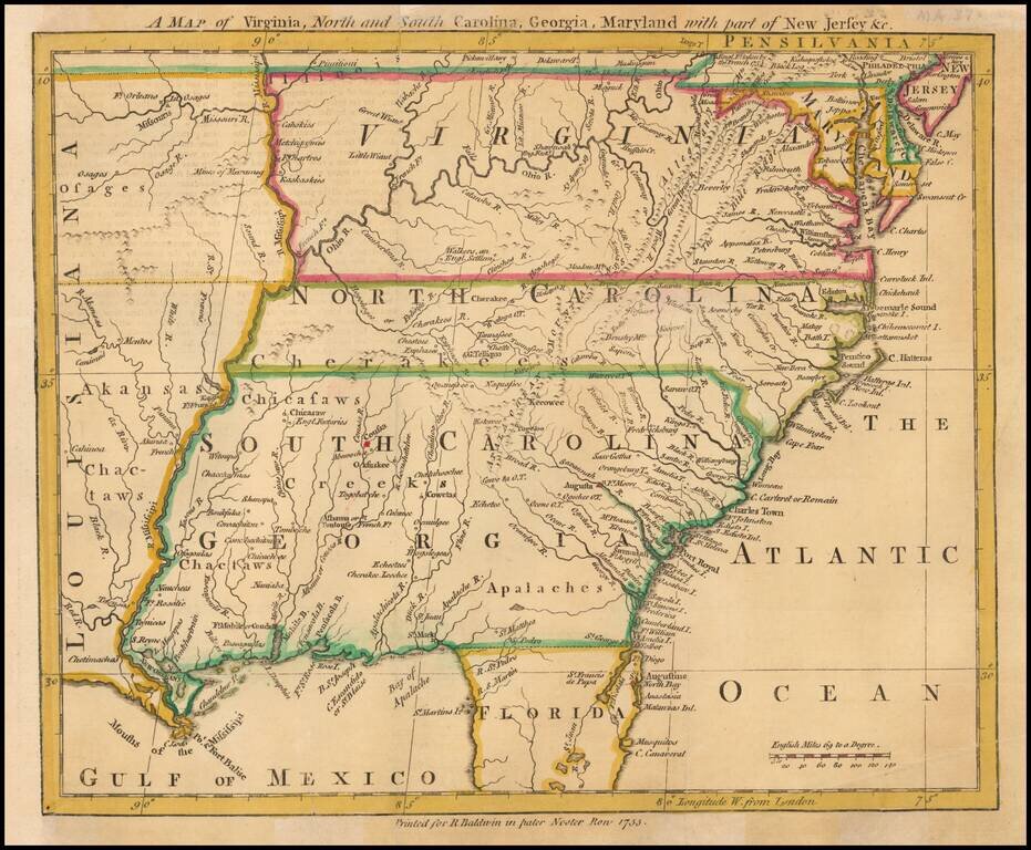
Scarce map of the Southeastern portion of the British Colonies, extending tothe Mississippi River and lower Missouri River, based upon John Mitchell's Map of the British Colonies, also issued in 1755. The map extends to West of the Mississippi River...
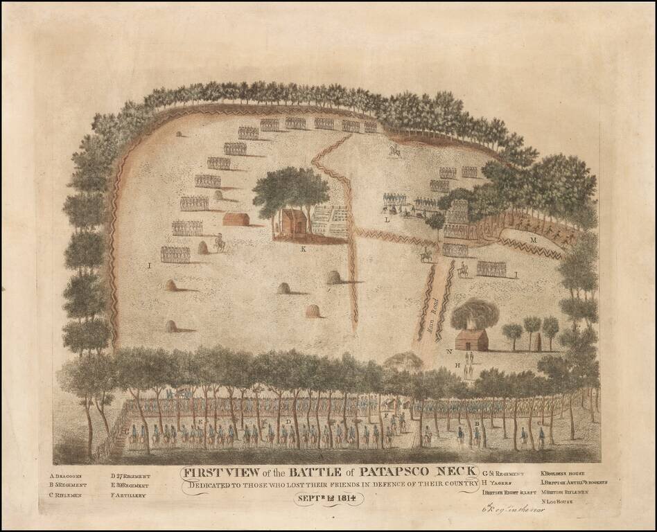
Previously Unrecorded First State of the Battle of North Point, Maryland -- A Contemporary American view of the Battle of North Point, which saved Baltimore from British invasion A contemporary view, by an American participant, of the September 1814...
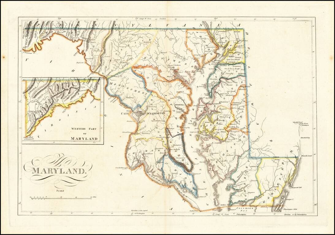
Antique Map of Maryland from the Early 19th Century Nice example of Carey's map of Maryland, one of the best large format maps of the state to appear in a Commercial Atlas. The map is attractively hand-colored by counties and shows, towns, roads,...
Nice example of Carey's map of Maryland. A highly detailed map, which includes towns, roads, rivers, mountains, and many other details.
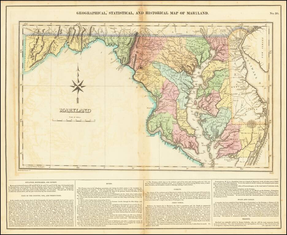
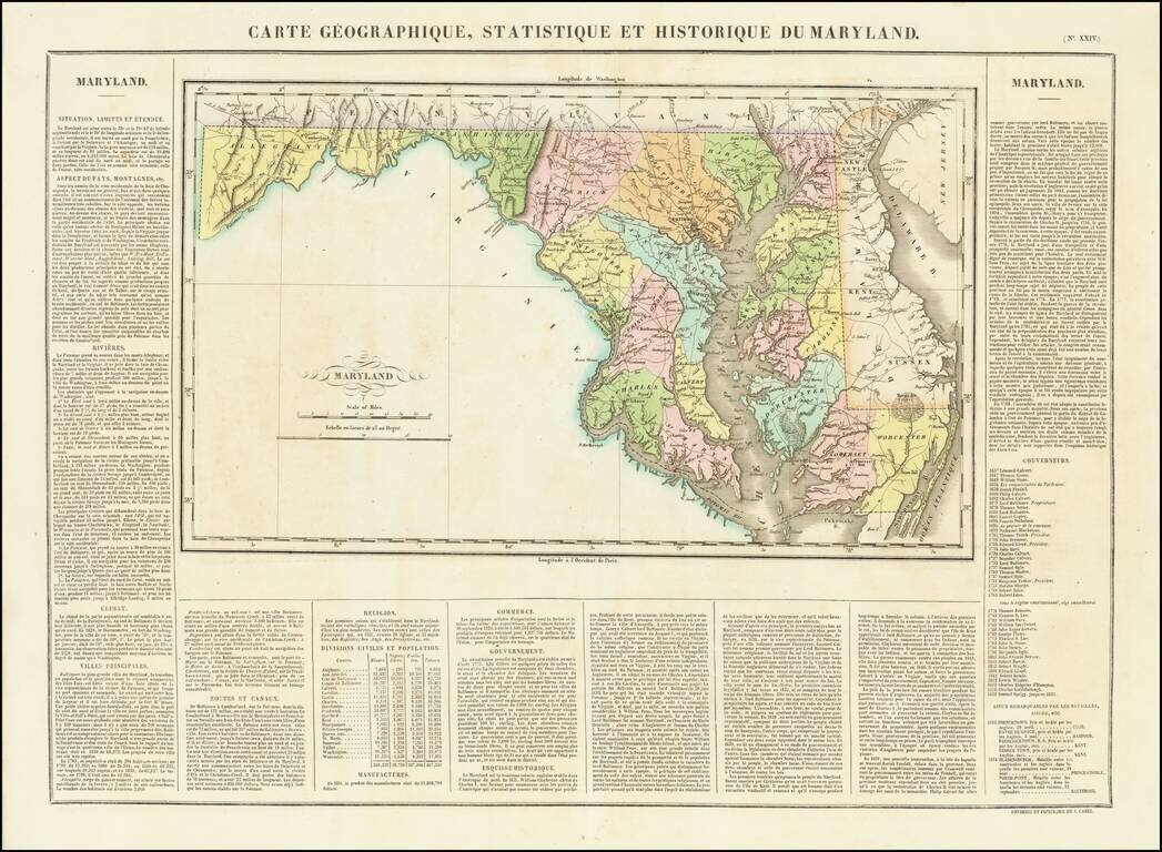
Finely colored example of the first edition of this highly desirable map of Maryland, from Carey & Lea's Atlas. Size includes text surrounding map, which includes wonderful contemporary details concerning the topography, indigenous lands, rivers,...
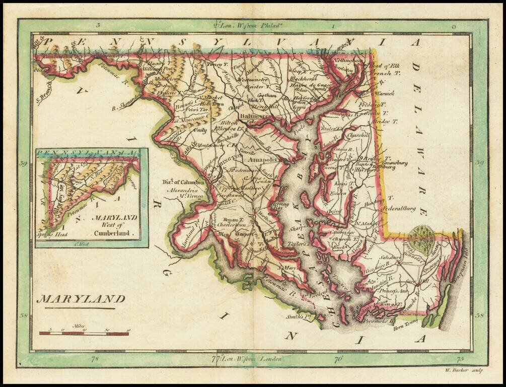
Finely engraved hand colored map of Maryland, colored by county and showing the various towns, roads, rivers, bridges, and a host of other details. This is one of the earliest maps of Maryland published outside of the United States. Overall plate...