logo

1926. A New, Accurate & Improved Map of Berks County in Pennsylvania Layd down from the most Certain information and best Authorities during the Severe campaign anno 1776 and bearing no Allegiance to the Crown . . . Most humbly compiled and executed by J.R. Ro

  • A New, Accurate & Improved Map of Berks County in Pennsylvania Layd down from the most Certain information and best Authorities during the Severe campaign anno 1776 and bearing no Allegiance to the Crown . . .  Most humbly compiled and executed by J.R. Ro

A New, Accurate & Improved Map of Berks County in Pennsylvania Layd down from the most Certain information and best Authorities during the Severe campaign anno 1776 and bearing no Allegiance to the Crown . . . Most humbly compiled and executed by J.R. Ro information:

Year of creation: 
Resolution size (pixels): 
 2174x1712 px
Disk Size: 
 787753B
Number of pages: 
 1
Place: 
 n.p.
Author: 

Print information. Print size (Width x height in inches):
Printing at 72 dpi 
  30.19 х 23.78
Printing at 150 dpi 
 14.49 х 11.41
Printing at 300 dpi 
 7.25 х 5.71

An example of detailing the file of this map of in a printable high-resolution:

Click to open in high resolution (open in new tab).
Attention! this is just the central piece (central area 960x960 px) of the map file!
This is an example, so that you can see and study the level of detail of a given map. The entire Map will be fully available after payment!

A New, Accurate & Improved Map of Berks County in Pennsylvania Layd down from the most Certain information and best Authorities during the Severe campaign anno 1776 and bearing no Allegiance to the Crown . . .  Most humbly compiled and executed by J.R. Ro

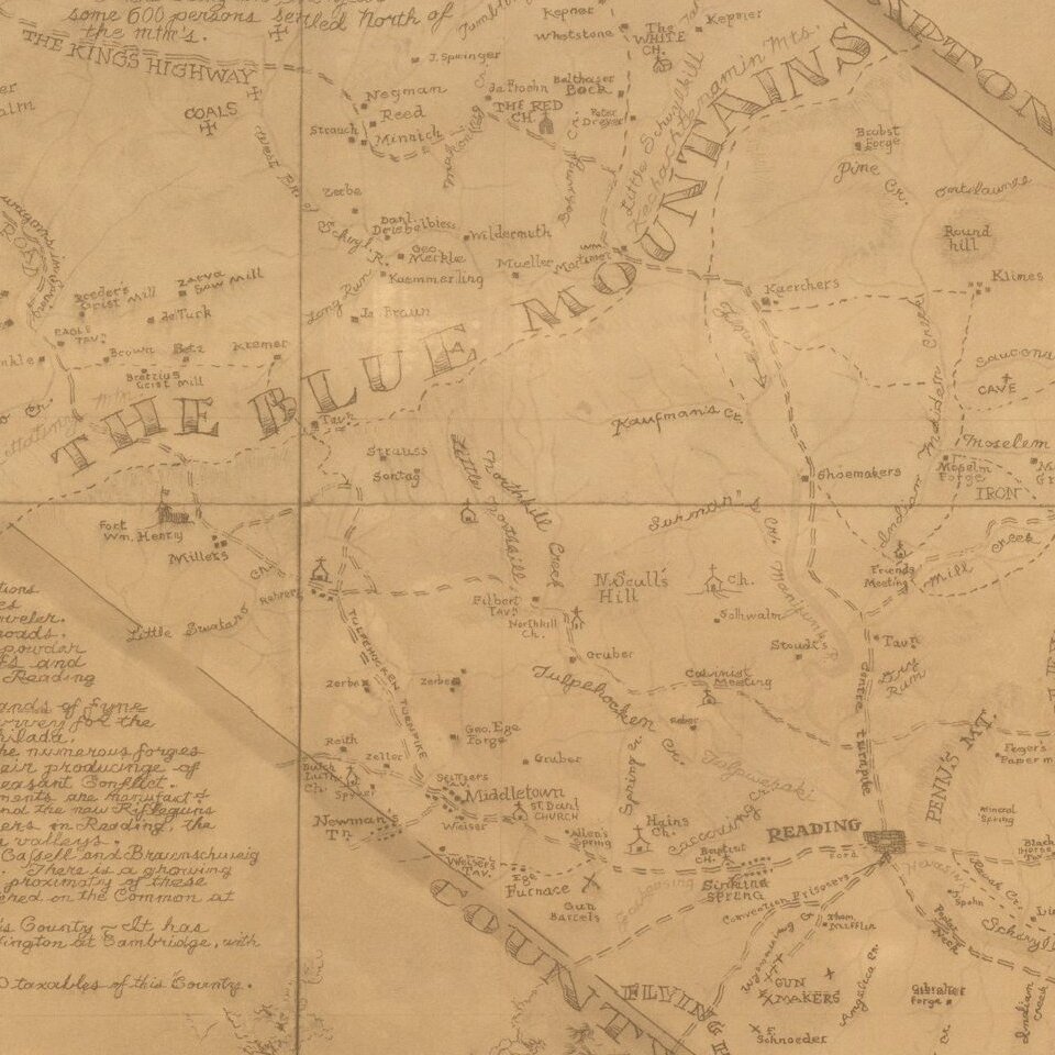
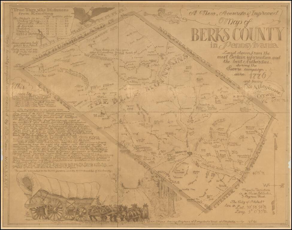
Rare pictorial map of Berks County, Pennsylvania, drawn by J.R. Rowe.

The map is well researched and attractively executed, providing a marvelous historical overview of Berks County in Colonial times.

The "severe campaign" is a phrase used by George Washington in correspondence on several occasions early in the Revolutionary War.

The Pennsylvania Archives (mapsofpa.com) entry for this map reads as follows:

1777.29 A NEW, ACCURATE & IMPROVED MAP OF BERKS COUNTY IN PENNSYLVANIA...Layd down from the most certain information and the best of authorities, during the severe campaign...anno...1776...and bearing No Allegiance to the Crown. Text in the left hand corner reads "True Turnpike Distances from Reading" and lists certain landmarks. The middle left corner reads "this Country was organized in the year 1752 from lands aquired in Indian Purchases June 7, 1684~Moungougsins Rles., Sept. 7, 1732~Sckuykill Indians, Oct. 25, 1736~the Five Nations, Aug. 22, 1749~The Nine Nations." Far left corner edge reads "Moft humbly compiled and executed by J.R. Rowe MCMLXXVII." This map was seen for sale as a reproduction and its authenticity has not been verified.

Curiously, our copy is dated a year earlier (1926). We see no evidence that the map dates to 1777, as suggested above.


Special conditions for students!

If you are a student, write to us in telegram: @antiquemaps and indicate what material you need and for what work you need a map in high detail. We are ready to provide material on special terms. For students only!

Item information:

Year of creation:
Size:
2174x1712 px
Disk:
787753B
Number of pages:
1
Place:
n.p.
Author:
J. R. Rowe.
$9.99

Related item