
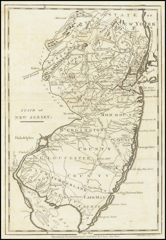
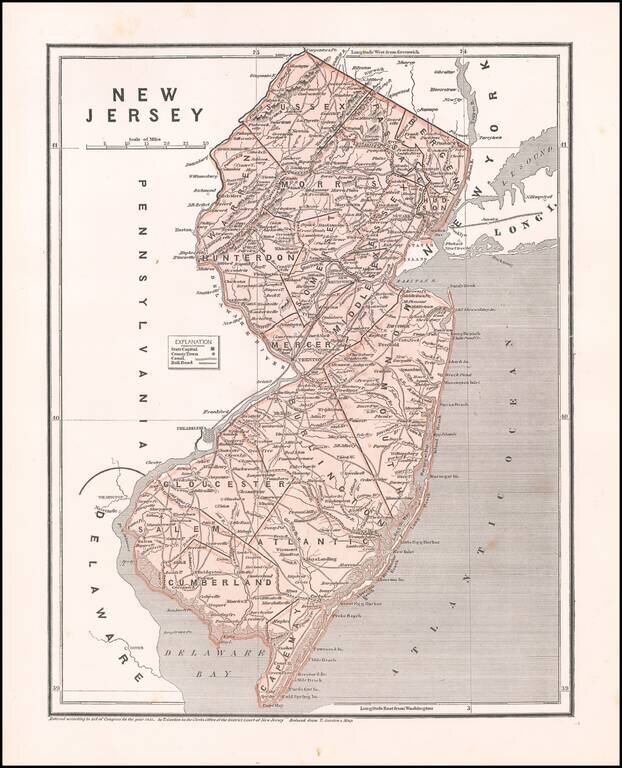
One of the earliest obtainable maps of the state of New Jersey. Shows counties, towns, roads, rivers, lakes, islands, churches, court houses, and other early details. Includes topographical details. The map is reduced from the Reid map, which in...
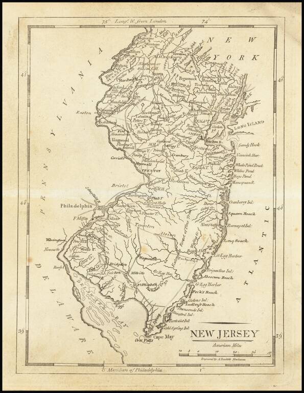
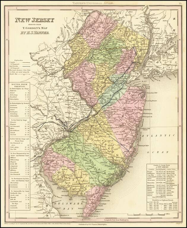
Early map of the state of New Jersey, from Arrowsmith & Lewis's Atlas. Tanner was the engraver of the map and signed it under the title "Tanner, Sc."
Fine Early Map of the State of New Jersey Nice example of Mathew Carey's map of New Jersey, first published in Carey's General Atlas in 1814. The map is exceptionally detailed for the period, being one of the earliest maps to show in detail the road...
Nice example of Mathew Carey's map of New Jersey. A highly detailed map, which includes towns, roads, rivers, mountains, and many other details.
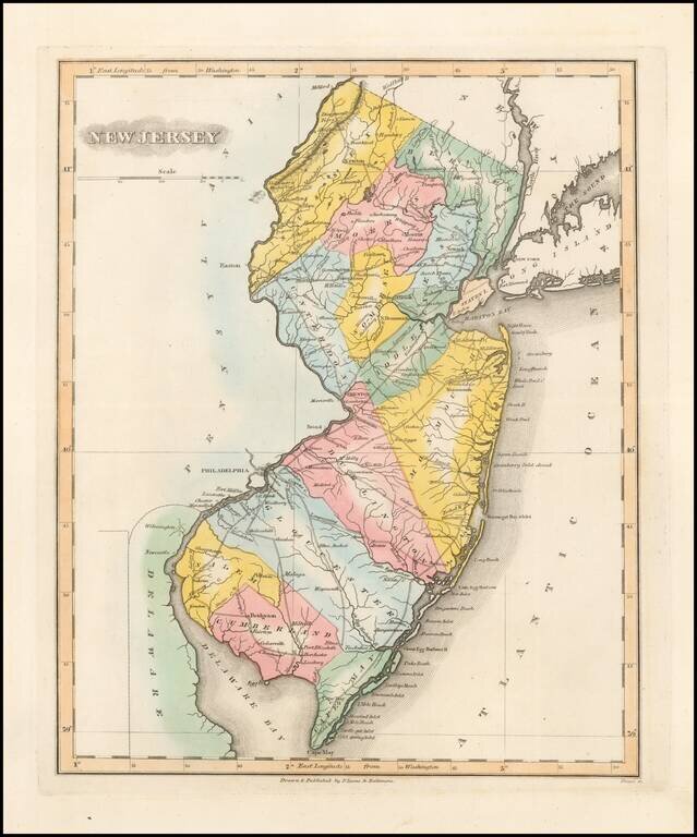
Rare First Edition of The Lucas Map of New Jersey Nice example of Fielding Lucas' early map of New Jersey, from his New & Elegant General Atlas of the United States . . . Hand colored by counties, this is one of the first maps of New Jersey...
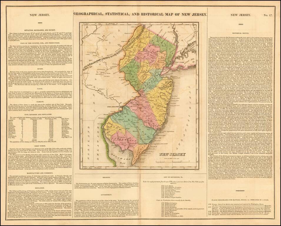
Fine old color map of this early map of New Jersey, from the first edition of Carey & Lea's Atlas. Size includes text surrounding map, which includes wonderful contemporary details concerning the topography, indigenous lands, rivers, climate,...
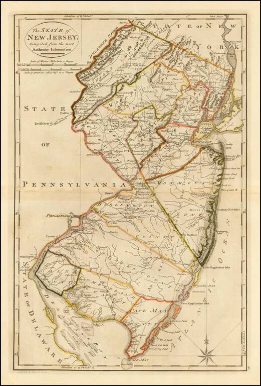
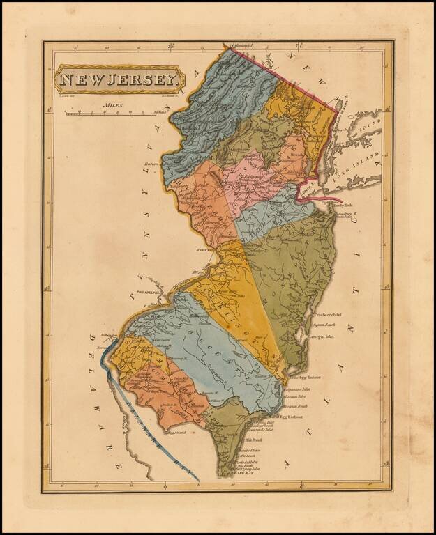
Nice example of Fielding Lucas' rare map of New Jersey, hand colored by counties. Shows towns, roads, rivers, lakes, islands, etc. One of the rarest atlas maps of the early 19th Century and one of the first finely engraved American printed maps of New...
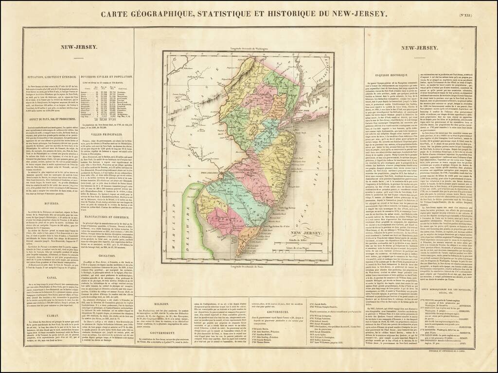
First Map of New Jersey Printed in France One of the earliest obtainable maps of the State of New Jersey published outside of the United States. The map appeared in Buchon's edition of Carey & Lea's Atlas, which was highly prized not only for its...
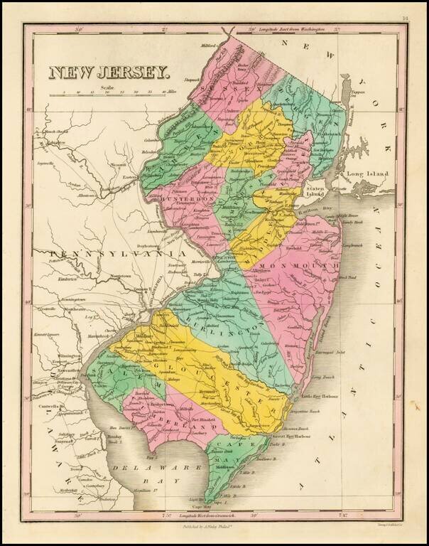
Striking map of the state of New Jersey, from Finley's New General Atlas. The map is hand colored by counties and showing towns, roads, rivers, mountains and other geographical features.
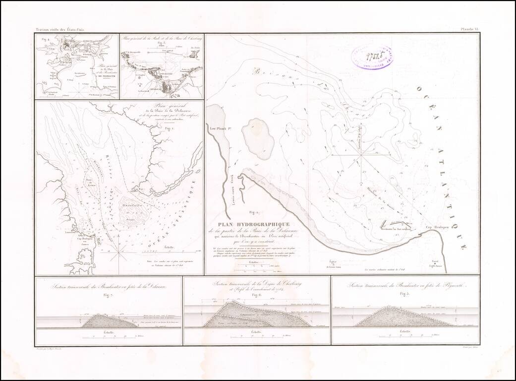
Building the First Breakwater and Artificial Port of Its Kind in America. Rare engraved map by Guillaume-Tell Poussin, related to the construction of the Delaware Breakwater in the Delaware Bay in the 1820s. The sheet features a map of the mouth of...
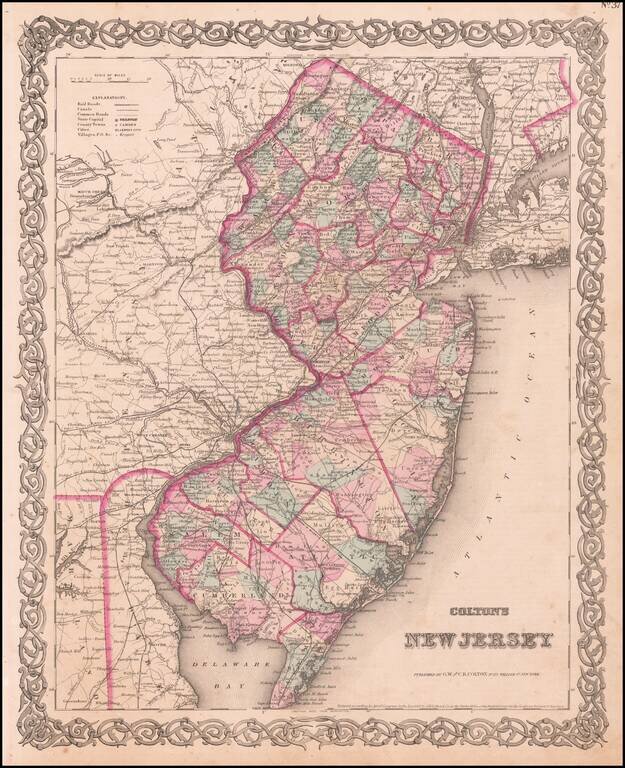
A detailed and attractive map of New Jersey, hand-colored by county, showing roads, canals, towns, steamship routes and other interesting details. Includes railroads and proposed railroads and a number of tables of distances, stage routes, canal...
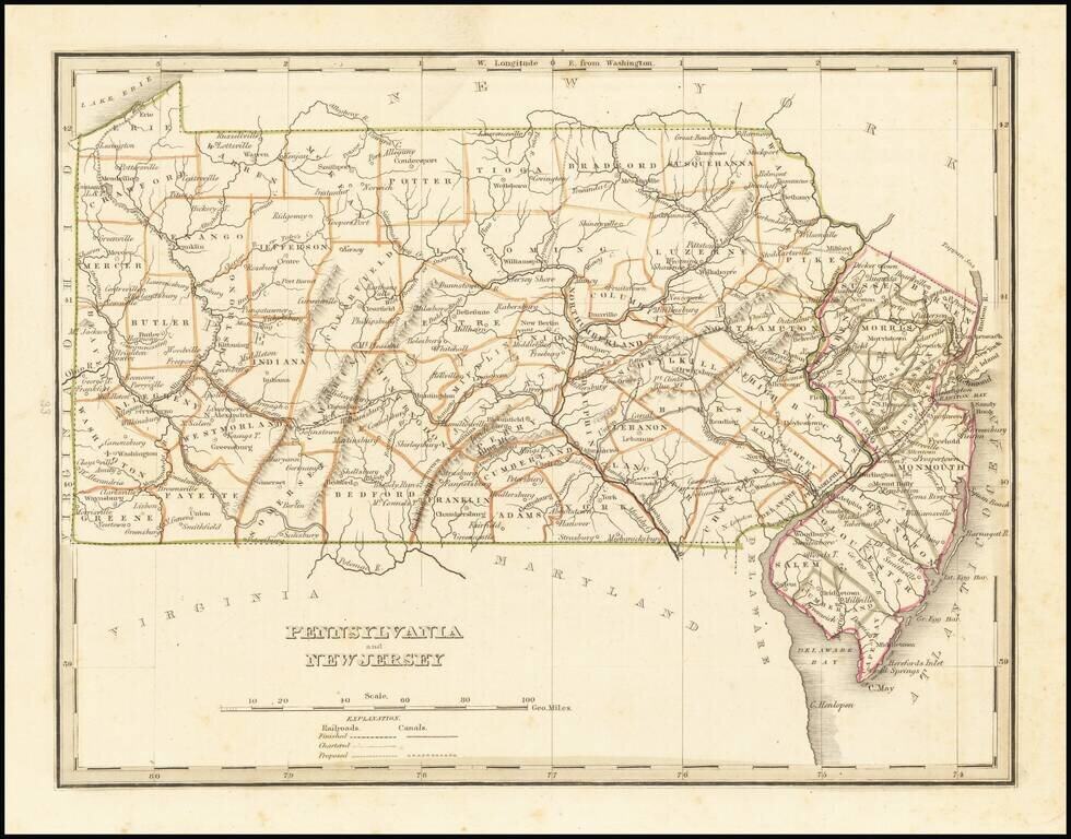
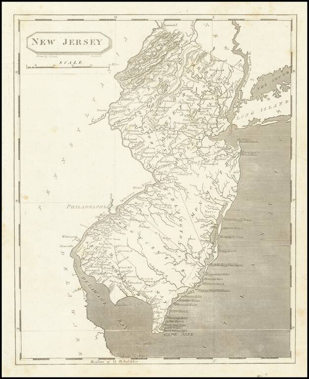
Early map of Pennsylvania and New Jersey, from an early edition of Bradford's Comprehensive Atlas. The map is colored by counties and shows towns, rivers, lakes, bays, harbors, islands and other important places. Bradford's Comprehensive Atlas...
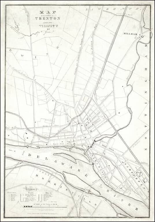
A Trenton Rarity One of the earliest printed maps of Trenton, New Jersey, by one its most important early mapmakers. The map was lithographed by "J.F. & C.A. Watson, Lithrs. No. 62 Walnut Street Philadelphia." The map credits "T Gordon." This...
Marvelous and highly detailed map of New Jersey. Shows towns, roads, rivers, townships, etc. Morse & Breese's North American Atlas was a landmark in American Cartography, being the first atlas to employ the cerographic printing process, which...
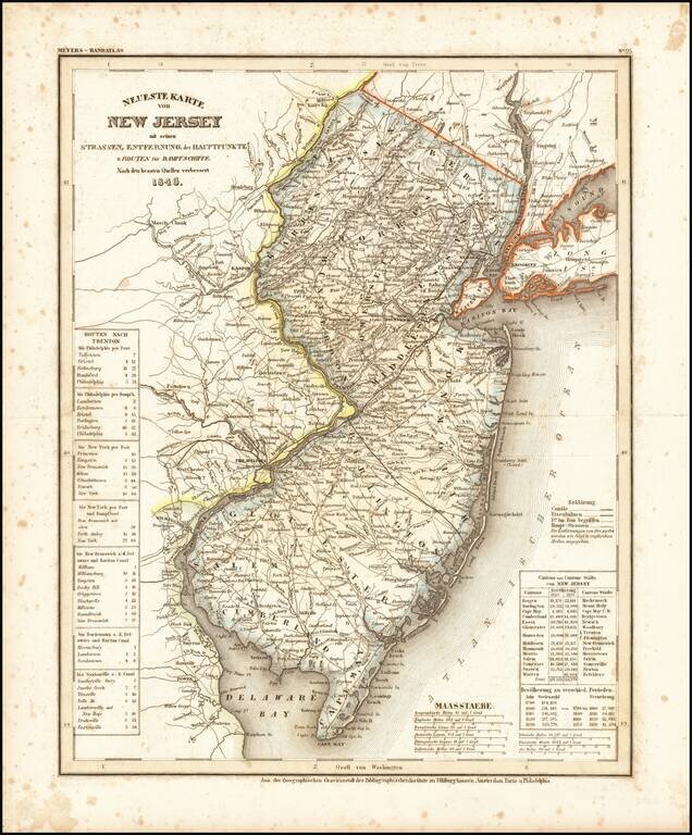
An elegantly engraved and highly detailed map of New Jersey, based upon Tanner's work in the early 1840s. Shows counties, towns, roads, canals, lakes, etc.
Attractive map of the state, hand colored by counties. Shows towns, rivers, railroads, train stations, islands, some townships, and other fine details. A wide margined example in vivid color. This is the rare 1859 edition which bears Johnson &...