
![Johnson's Delaware and Maryland [Inset map of Washington DC]](/map/small/54984.jpg)
Detailed map of Maryland and Delaware, hand colored by counties. Includes vignettes of the Post Office, Treasury Building, Patent Office, Harpers Ferry and the Capitol. The map shows towns, railroads, roads, post offices, rivers and a host of other...
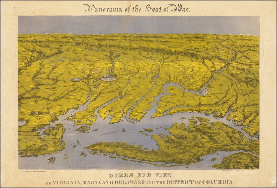
Bachman's Panorama of the Chesapeake Region Striking combination map and view of the northernmost part of the east coast of the Confederacy, and the southernmost areas of the Union, including Washington: this third issue, printed after the smoke that...
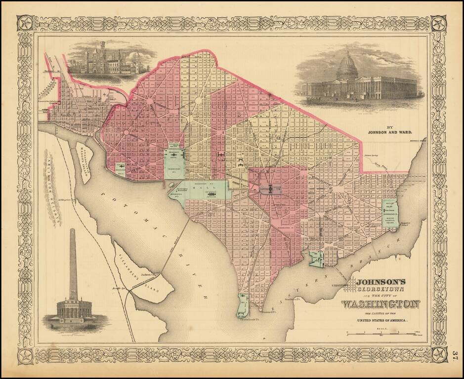
Decorative map of Washington DC and Georgetown, with excellent detail and insets of several area monuments. One of the most decorative maps of Washington DC during the Civil War to appear in a commercial atlas.
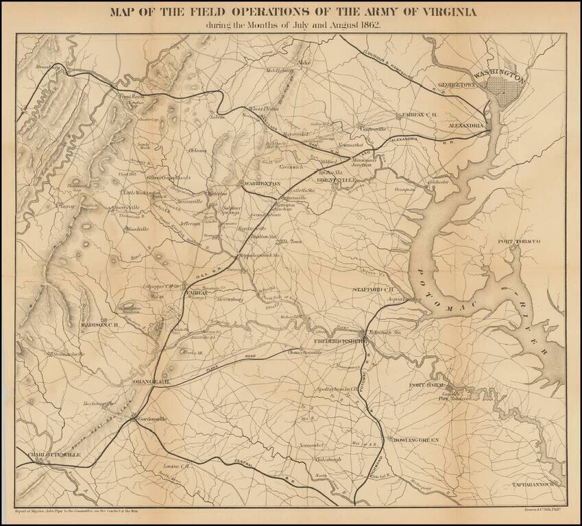
Detailed map of the Theater of War in Virginia. Washington D. C. is at the upper right. Charlottesville, Virginia is at the lower left. Shows roads, railroads, place names and terrain features. General Pope was the new commander of Federal forces in...
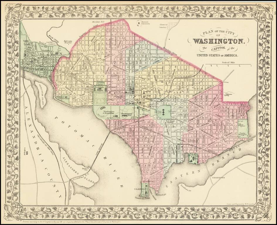
Detailed map of Washington DC, hand colored by wards. Shows the Long Bridge, Bridge to Union Town and the streets, buildings and other places of significance in the District. Decorative grapevine border. A nice map of Washington DC, one of the best...
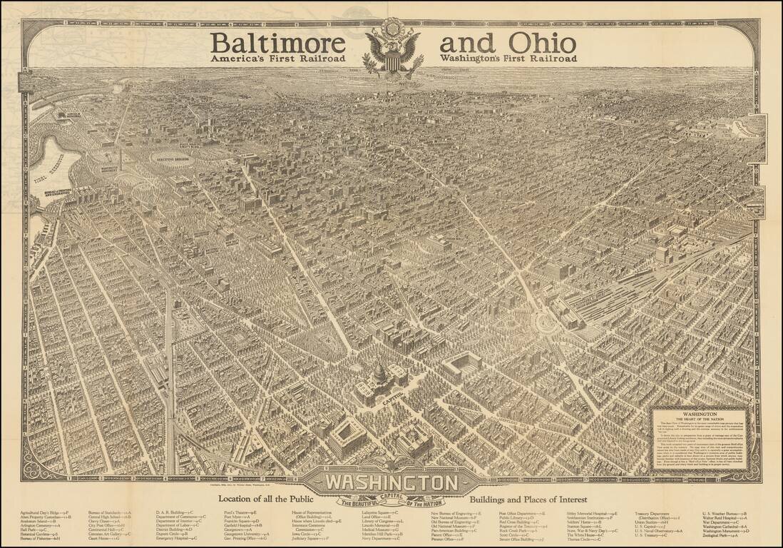
This is a great vintage tourist advertisement by the Baltimore and Ohio Railroad showing a birdseye view of Washington, D.C. The expansive view of Washington, supposedly the result of two years of ground surveys and sketches, shows many features of the...
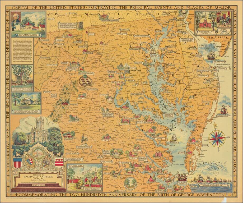
Beautiful color-printed vintage pictorial map of "the region within one hundred miles of the capital of the United States", showing Northern Virginia, Maryland, and Delaware. The title cartouche illustrates Washington Cathedral, the publisher of the...
![Washington Warning Area Map I [and] Washington Warning Area Map II](/map/small/65353.jpg)
Nuclear War Evacuation Routes During The Cold War 1959 Office of Civil and Defense Mobilization map of Washington, D.C., published during the Cold War. The map extends from Falls Church and Springfield, Virginia to District Heights and Randolph...
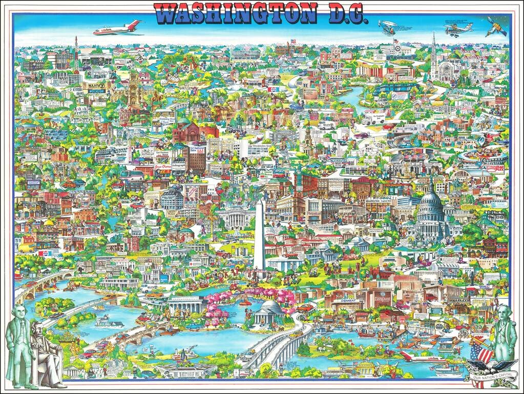
Richly embellished advertising oriented pictorial map / birdseye view of the Washington D.C., published by Archar Inc. of Canada. Packed with advertising for local businesses, the images shows buildings, tourism and other landmarks, recreational...
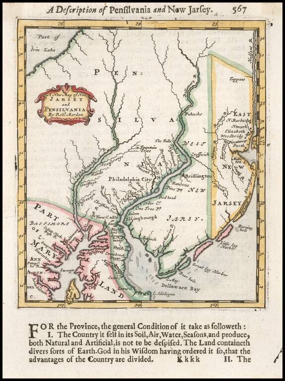
Fine example of Robert Morden's early map of New Jersey and Pennsylvania, one of the earliest obtainable English maps of New Jersey and the region around Philadelphia (then called Philadelphia City). Beginning in the 1670s, the English fortunes in...
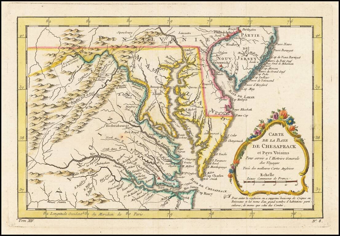
An excellent map of Virginia, Maryland, Delaware, and part of New Jersey. Extends west to the Applachians and shows towns, roads, mountains, rivers, islands, capes, ports and other nice details. A nice French & Indian War map of the Southern...
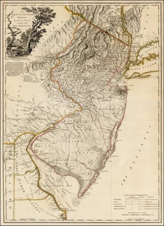
Rare second state of Faden's map of New Jersey, based upon Bernard Ratzer's surveys in 1769, as significantly revised and improved by Faden in December 1778. This rare second state of the map, issued 12 months after the first edition, is based upon...
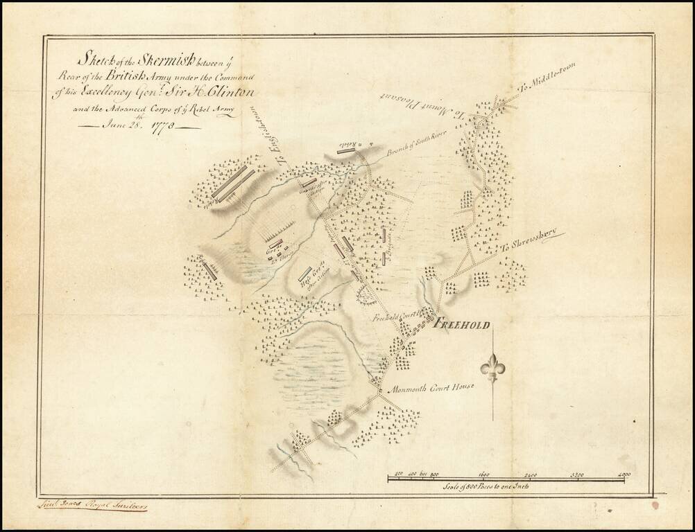
Unique Contemporary Manuscript Plan of Battle which Secured George Washington’s Role as “Father of the Nation” Finely-executed contemporary manuscript map of the Battle of Monmouth, the last major engagement of the Northern Theater of the...
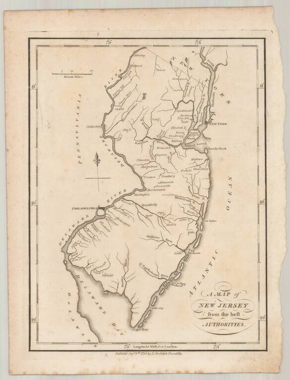
Rare example of John Stockdale's map of New Jersey from the London edition of Morse's Geography. This map is quite possibly the first English language map of New Jersey published following the conclusion of the American Revolution and one of only a...
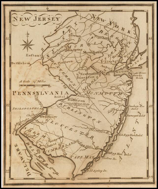
One of the earliest American maps of the state of New Jersey from the first American gazetteer. Joseph T. Scott, a Philadelphia engraver and publisher, issued his gazetteer during the early days of American cartography. Scott included much detail of...
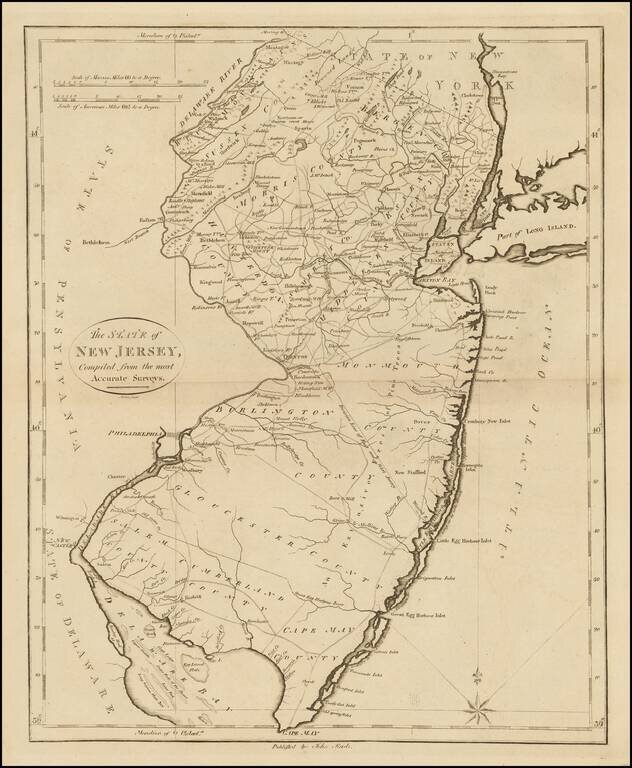
Nice example of John Reid's map of New Jersey, the second folio map of the state to appear in a commercial atlas. The map is drawn largely from Carey's map by Samuel Lewis, issued the prior year. An excellent topographical map, showing the counties,...