
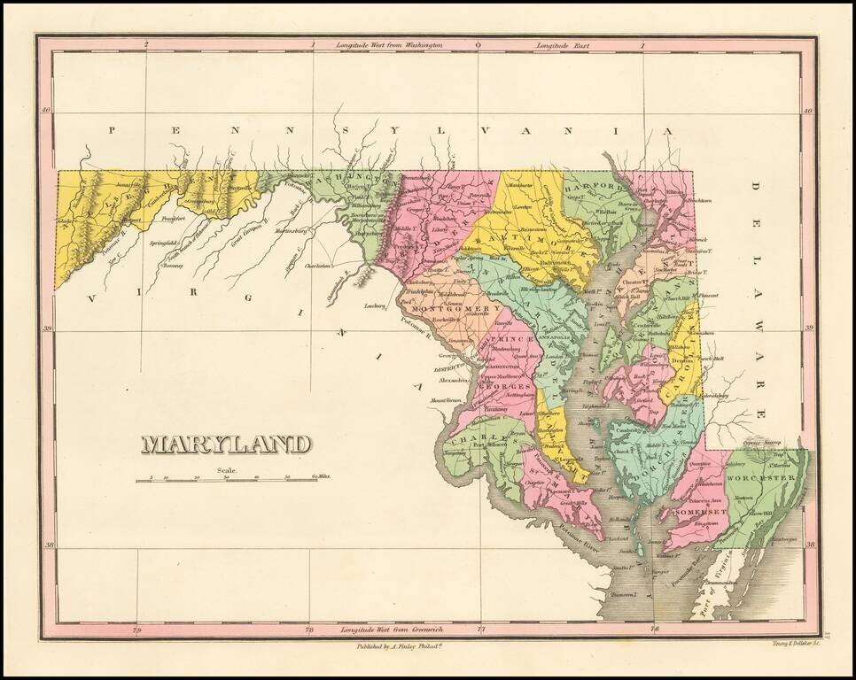
Map of Maryland, from Finley's General Atlas. The map is hand colored by counties and showing towns, roads, rivers, mountains and other geographical features.
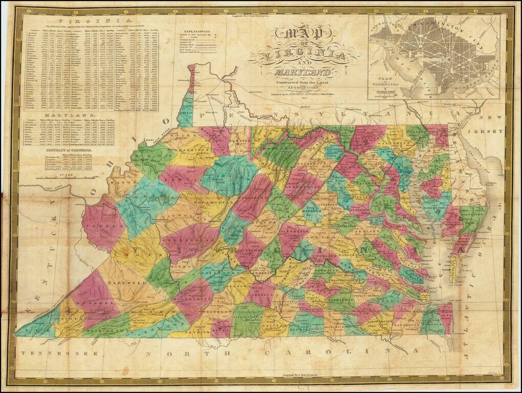
An Early American Map of Virginia & Maryland - Includes White, Free Black & Slave Population Table Second edition of Samuel Augustus Mitchell's separately published map of Virginia and Maryland (with a large inset of Washington DC). The map...
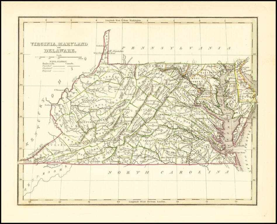
Scarce full original color map of Virginia, Maryland and Delaware from Bradford's Comprehensive Atlas. Shows counties, towns, rivers, and other details. Bradford's Comprehensive Atlas was one of the most successful commercial atlases of the 1830s, at...
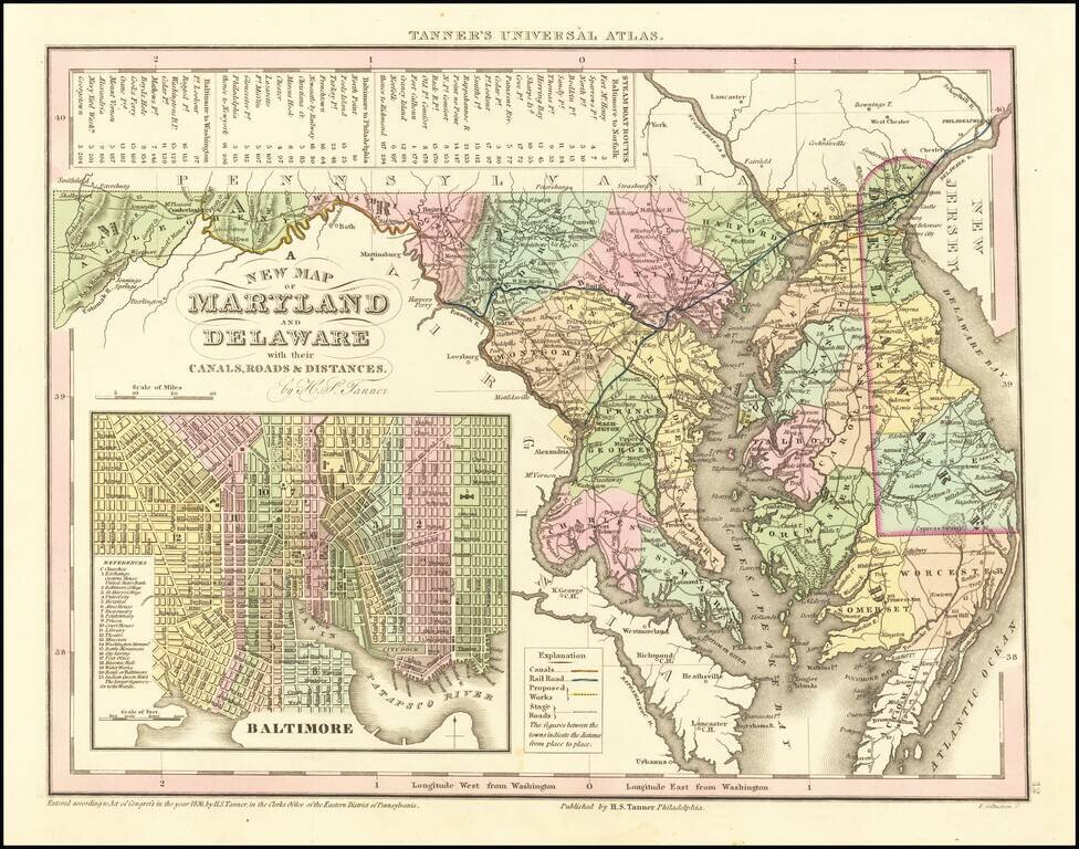
Scarce Carey & Hart edition of Tanner's map of Maryland and Delaware, from Tanner's Universal Atlas. Detailed and interesting map, hand colored by county and showing towns, rivers, bays, lakes, railroads, roads, distances, etc. Tables of Steam...
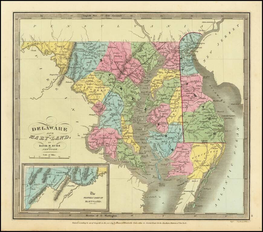
Rare example of the first edition of David Burr's map of Maryland and Delaware, which appeared in his Universal Atlas, first issued in 1836. Shows counties, towns, rivers, roads, courthouses and other details. Burr's Atlas was perhaps the most...
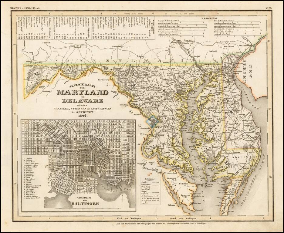
An elegantly engraved and highly detailed map of Maryland and Delaware, with a large inset plan of Baltimore. The map is based upon Tanner's work in the early 1840s. Shows counties, towns, roads, canals, lakes, etc. While often referred to as the...
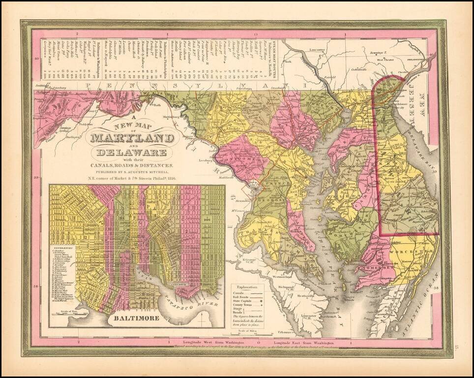
Detailed and interesting map of Maryland and Delaware, hand colored by county and showing towns, rivers, bays, lakes, railroads, roads, distances, etc. This 1849 state of the map includes for the first time a number of railroads not present in earlier...
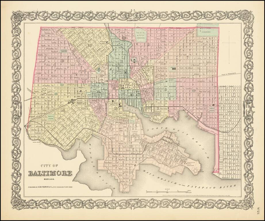
Detailed map of Baltimore, published in the first edition of Colton's General Atlas. The map shows streets, railroads, buildings, etc. Many public buildings along with City Dock, Ferry Point, Fort McHenry, Mt. Claire Station, etc. Hand colored by...
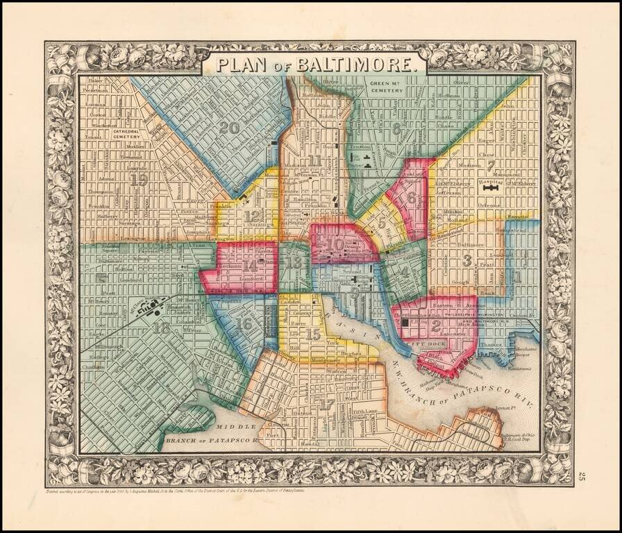
Mitchell's detailed plan of the city, colored by wards and showing streets, docks, train lines and stations, public buildings, shipyards, wharves, and a host of other details. SA Mitchell Jr. acquired his father's former business from DeSilver in 1860...
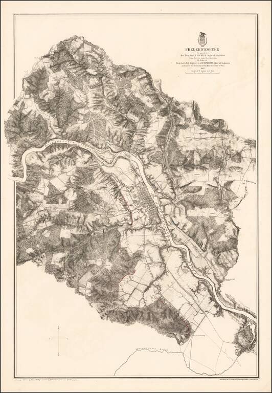
Highly detailed map of the area around Fredericksburg, Virginia, showing the theater of the Battle of Fredericksburg. The map is colored to show the troop positions of the respective armies, with red (Confederate) and blue (Union) positions shown on...
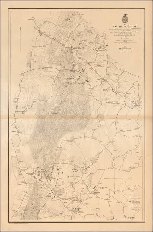
Large, detailed lithographed map of the Battle of South Mountain, a somewhat mixed Union Victory, which set the stage for the Battle of Antietam three days later. The Civil War Trust says of the Battle of South Mountain: After his success at Second...
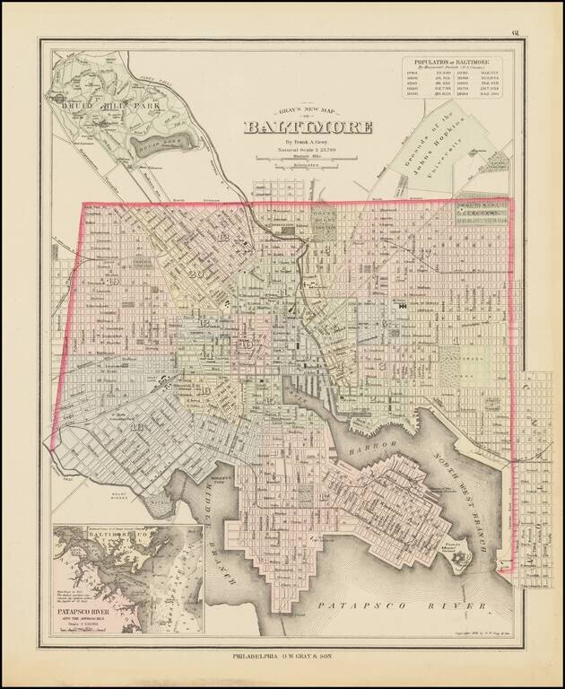
Detailed map of Baltimore, colored by wards and showing streets, rail lines, parks, buildings, stations, and a host of other details. Large inset of the Patapsco River and approaches. Includes a population table, showing the various census populations...
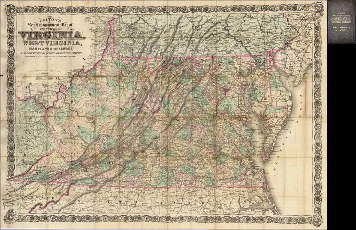
Fine large scale map of Virginia, West Virginia, Maryland and Delaware, published by Colton. This is the second edition of a map originally published in 1866 to supply a detailed representation of the area of the civil war. The geographical data was...

Fine large map illustrating the route of the Richmond & Louisville Railroad. Exceptionally detailed Railroad map of portions of Virginia, West Virginia, Kentucky and Tennessee, on a scale of 12 miles per inch. Timber and coal regions are noted,...
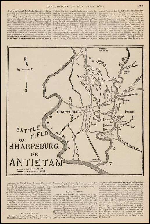
Fine sketch map of the Battlefield at Antietem, which appeared in The Soldier In Our Civil War, published by Frank Leslie. The map shows Confederate and Federal Works, various positions naming commanding officers, Roads and other important battle...
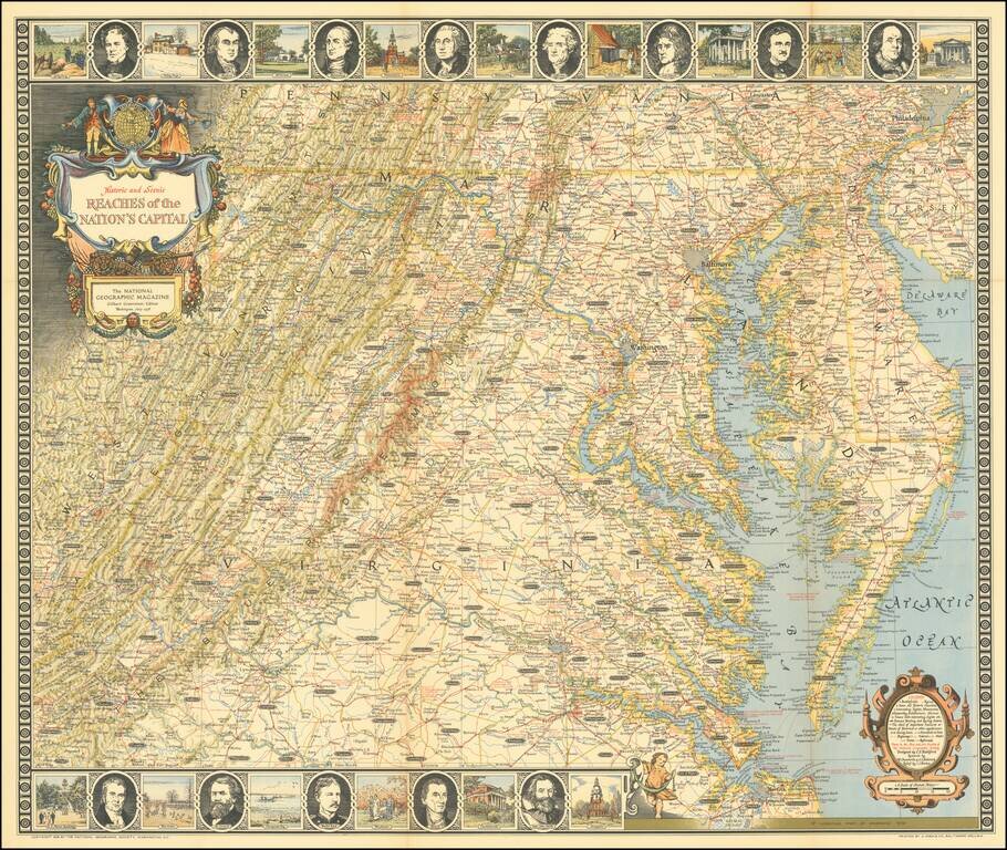
Entertaining map of the the Chesapeake Region, topped with portraits of 8 of the founding fathers and vignettes of important places in American history.