
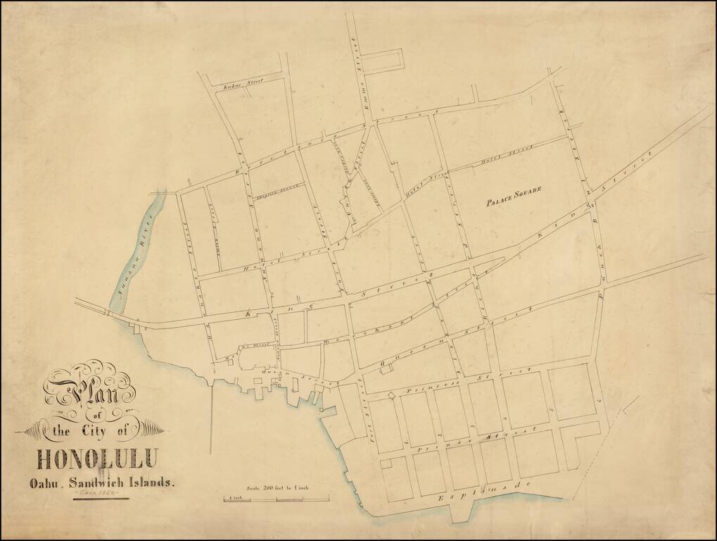
A Remarkable and Previously Unknown Early Manuscript Survey of Honolulu Highly important early manuscript map of Honolulu, Hawaii, likely dating from the late 1850s, and most likely the work of Hawaii's most important early surveyor William C....
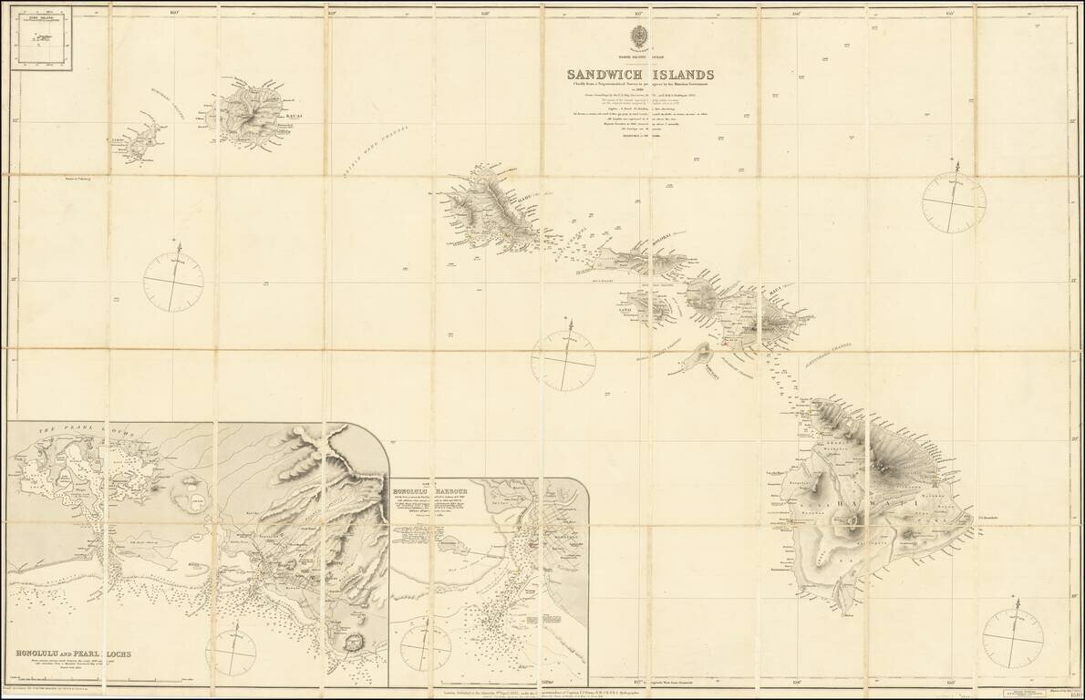
Fine and Rare Admiralty Chart of the Sandwich Islands from the First Government Survey of Hawaii Good example of Admiralty chart of the Hawaiians Islands, then known as the Sandwich Islands, with input from the first trigonometric survey of the...
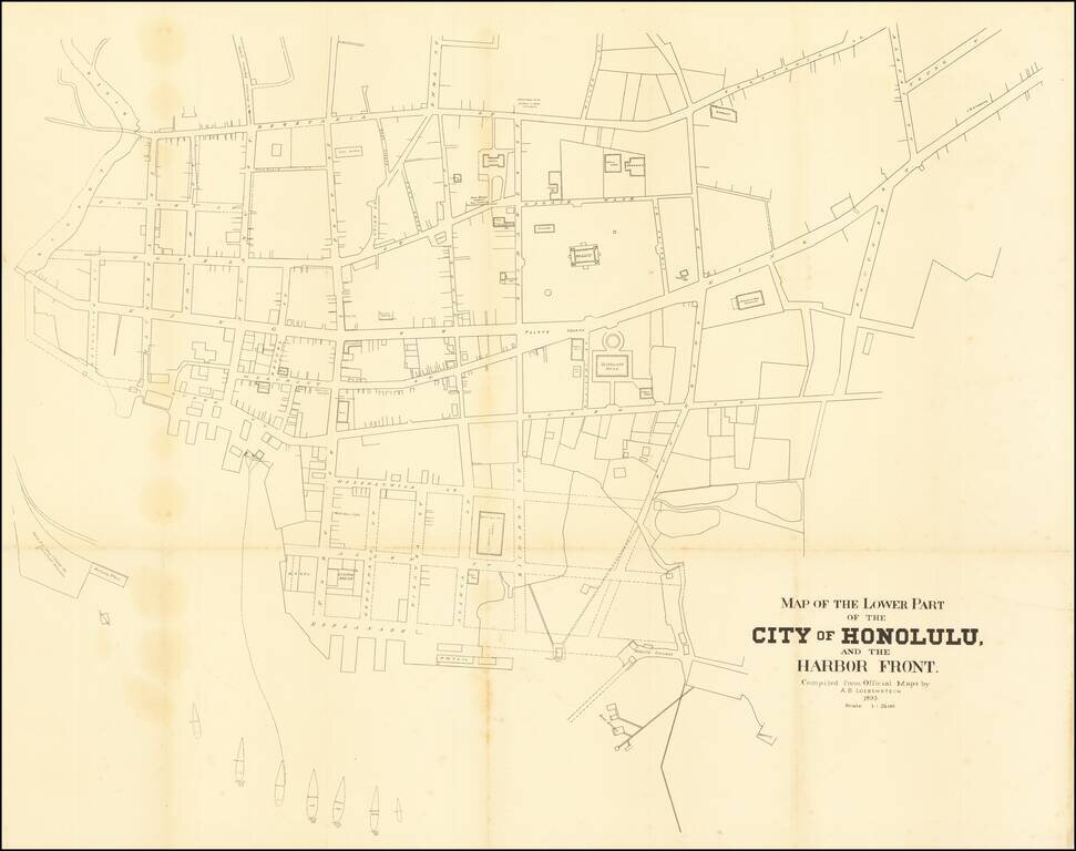
A highly detailed map of downtown Honolulu, one of the finest plans of the city made in the twilight years of the independent Hawaiian Kingdom. This fine map is a detailed engineer's plan of downtown Honolulu, done to very precise standards of...
![[Pearl Harbor] Pearl River and Lochs From The United States Government Plan of 1899 . . .](/map/small/67434.jpg)
Finely detailed chart of the Pearl River and "Lochs", illustrating the environs of Pearl Harbor, published by the British Admiralty. First issued in 1901, this chart includes major revisions to 1920 and smaller revisions to 1931. The use of the term...
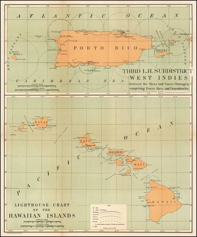
Rare pair of maps showing the lighthouses in Hawaii and the Puerto Rico areas, including proposed light houses, fog lights, light vessels, lighted buoys and a host of other navigational details within the state. This is the first time we have ever...
![(Maui). Harbours and Anchorages in the Hawaiian or Sandwich Islands. [Maalaea Bay and Kahului Harbor and Approaches]](/map/small/69674.jpg)
Maui Harbors Rare British Admiralty Chart, showing Kahului Harbor and Maalaea Bay, on the island of Maui Maalaea Bay includes a number of early placenames, including Kihei. Kahului Harbor shows the breakwaters, town plan, etc., extending north to...
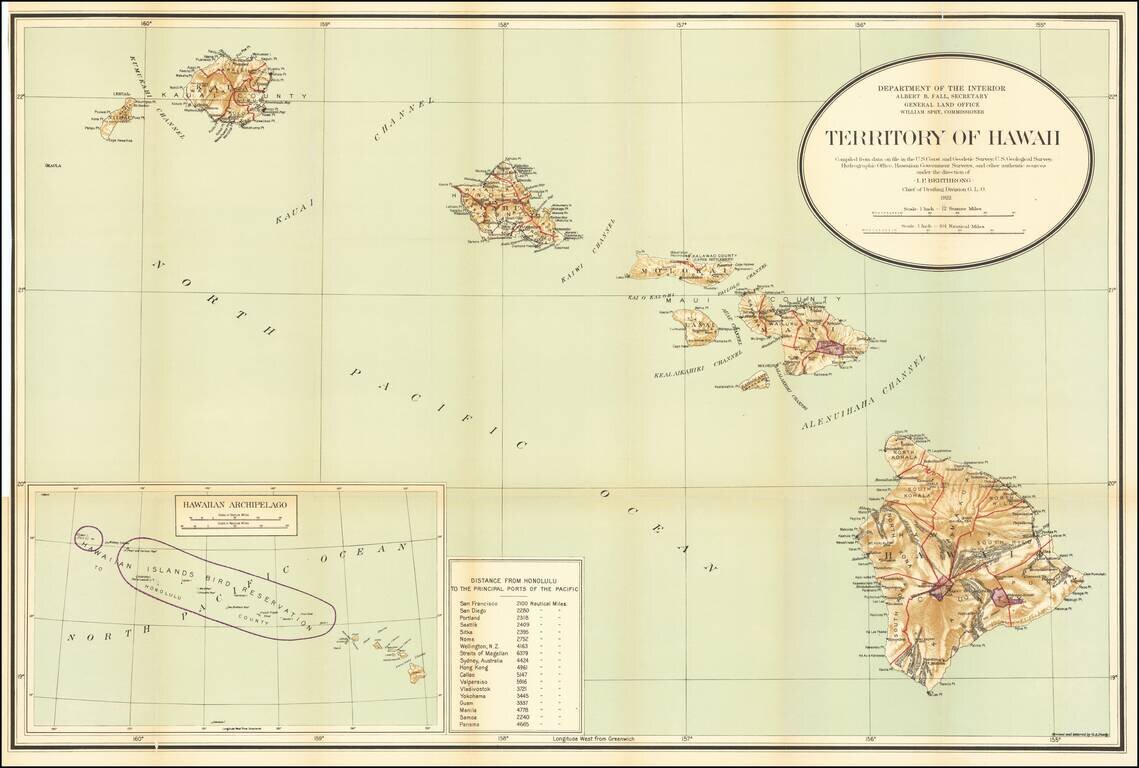
Detailed large format map of the Hawaiian Islands, published by the General Land Office. Finely detailed map, showing counties, towns, bays, points, mountain, rivers, elevations, volcanoes, volcano houses, halfway houses and Lava flows from various...
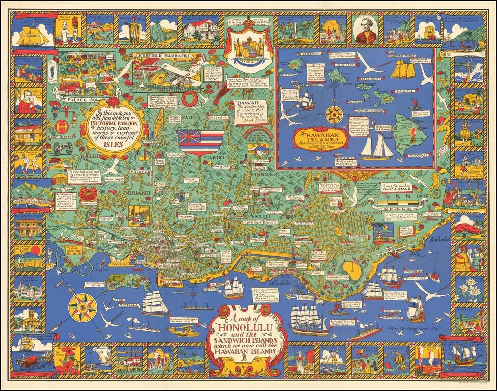
Marvelous rare pictorial map of Honolulu with inset of the Hawaiian Islands. The map includes pictorial features on the map and in vignettes surrounding the map, noting that, "In this map you will find depicted in pictorial fashion the history,...
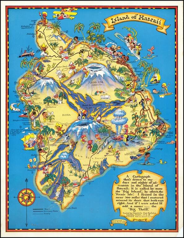
Marvelous whimsical map of the Big Island by Ruth Taylor White one of the most famous pictograph artists of the period. Ruth Taylor White was among the most prolific makers of pictographic maps. Her whimsical style combines her artistic skills with...
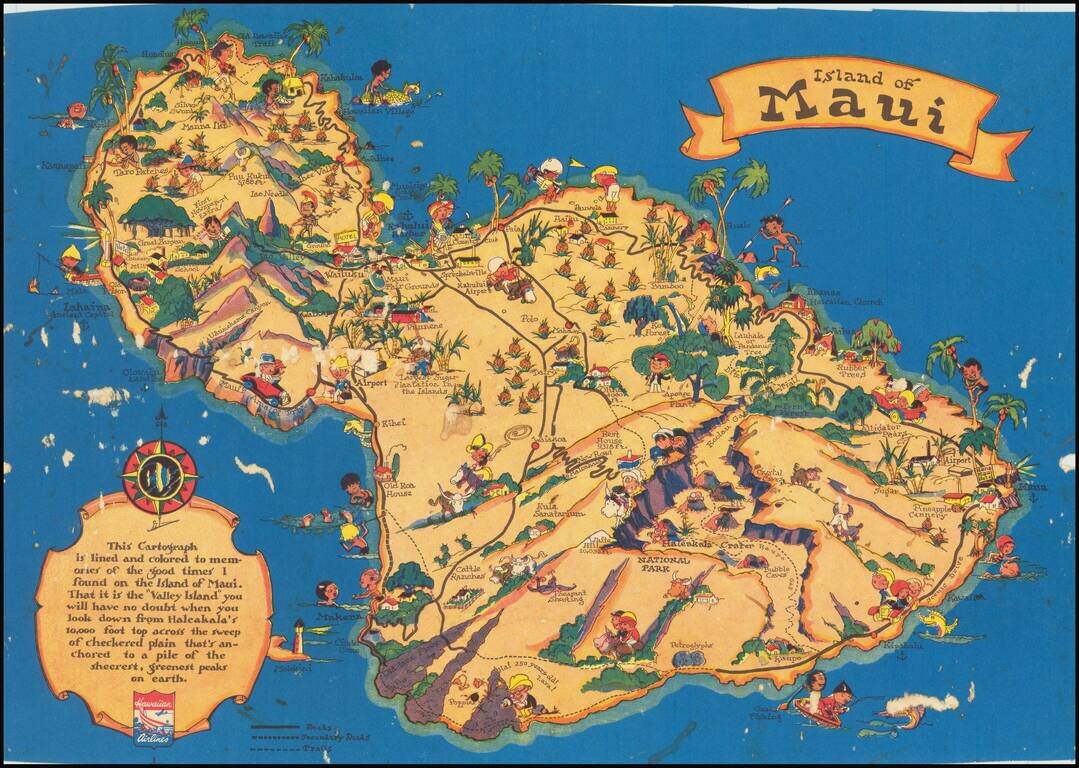
Marvelous whimsical map of Maui by Ruth Taylor White, one of the most famous pictograph artists of the period. Ruth Taylor White was among the most prolific makers of pictographic maps. Her whimsical style combines her artistic skills with local color...
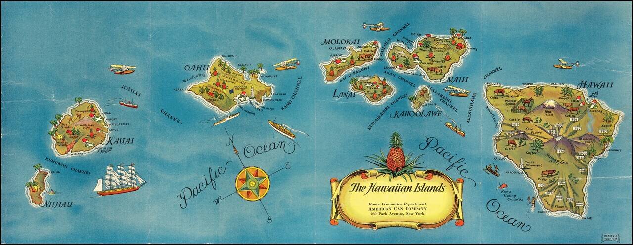
Pictorial map of Hawaii, published for the American Can Company. Each of the Hawaiian Islands includes monuments illustrating indigenous crops (lots of pineapples!), live stock, volcanoes, airports and other points of local interest. This is the...
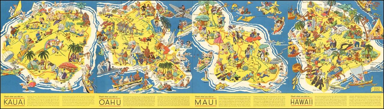
Very rare Ruth Taylor White pictorial map of Hawaii, really four separate maps of Kauai, Oahu, Maui, and Hawaii all on one sheet. This set is far rarer than her other Hawaiian maps. The maps were completed two years after she made "The Story of...
![[Confidential / Restricted Map -- Hawaiian Islands] Long Range Air Navigation Chart](/map/small/63172.jpg)
World War II Confidential / Restricted Aeronautical Map of Hawaiian Islands Detailed aeronautical map of the Hawaiian Islands, compiled by the U.S. Army Air Force Army Map Service. The front side map illustrates the Hawaiian Islands and Midway...
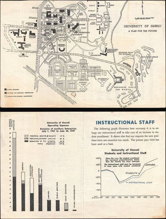
This is a 1946 University of Hawaii map of the Mānoa campus highlighting proposed building projects. Because of the G.I. Bill, which was passed in 1944, American servicemen returning from World War II could pursue higher education at American...
![[Aloha - Christmas Post Card]](/map/small/67516.jpg)
An Orpha Mae Klinker Christmas Card Marvelous illustration of a portion of Oahu (Diamond Head, Waikiki, Oahu, Pearl Harbor, Kaneohe Bay, etc), prepared as a 1947 Christmas card by artist Orpha Klinker. The map provides a lively look at Oahu...
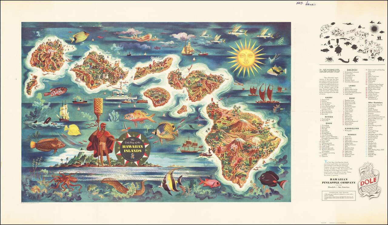
Decorative map of Hawaii, from a painting by Joseph Feher, commissioned by the Hawaiian Pineapple Company. This is the second of Dole's iconic maps, which have been sought after by collectors almost since the initial printing.