
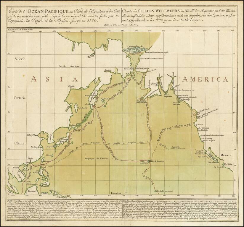
Striking Chart of the Northern Pacific, One of the Earliest to Show Hawai’i Rare chart of the Northern Pacific with the coasts of Asia and America, showing the voyage of the Spanish treasure galleons and Captain Cook’s third voyage. Based on...
Detailed charting of Cook's exploration of the Northwest Coast of America and the Northeast Coast of Asia. Includes daily tracks and a number of place names, showing the tracks of Cook's Voyage on a daily basis. Cook's Voyage to the region was one of...
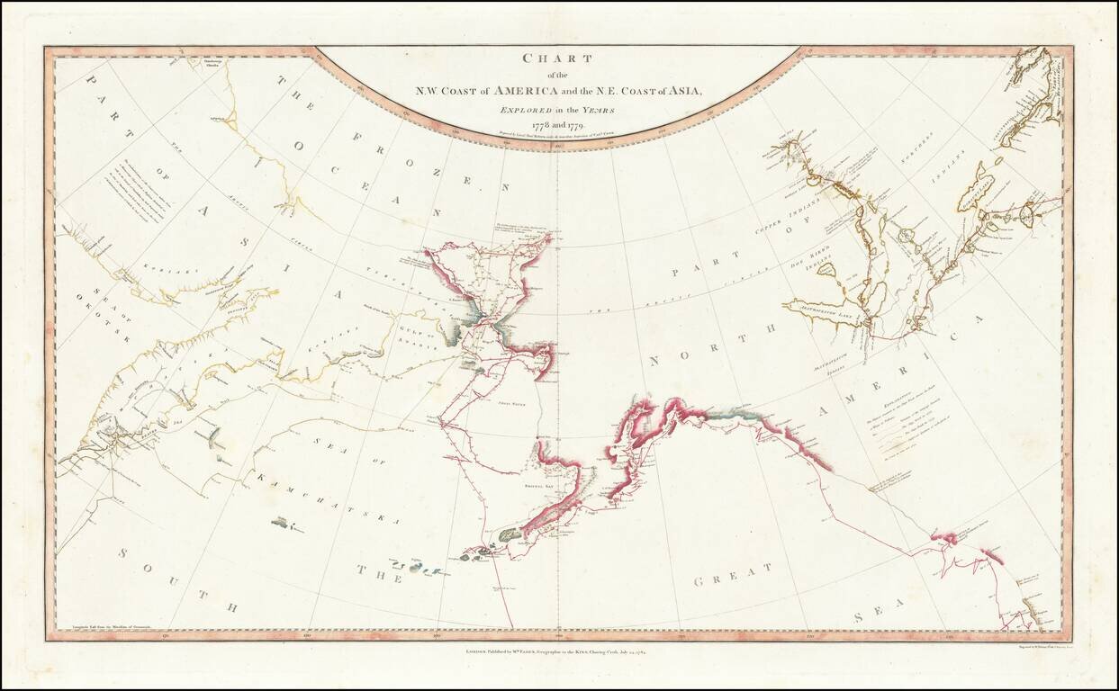
Fine, Famed Map of the North Pacific from Cook’s Third Voyage—First Edition! Rare, first edition of the so-called “lost” chart of Captain James Cook, published in 1784 by William Faden. The map illustrates in great detail the known and...
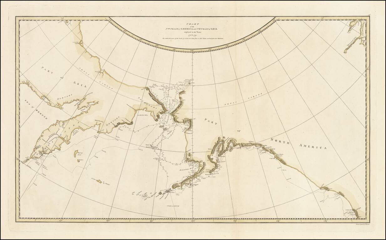
Striking Map of the North Pacific From Cook’s Third Voyage Account Fine example of the map of the Northern Pacific and contiguous coasts of America and Asia, from the official account of Captain James Cook’s third voyage, published in London in...
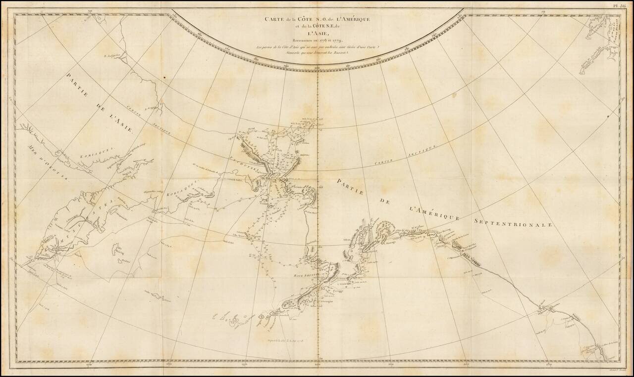
Finely engraved map of the North Pacific and contiguous coastlines of Alaska and Russia, published in the first French edition of the official account of James Cook's Third Voyage. The present map is of the utmost importance in the cartographic...
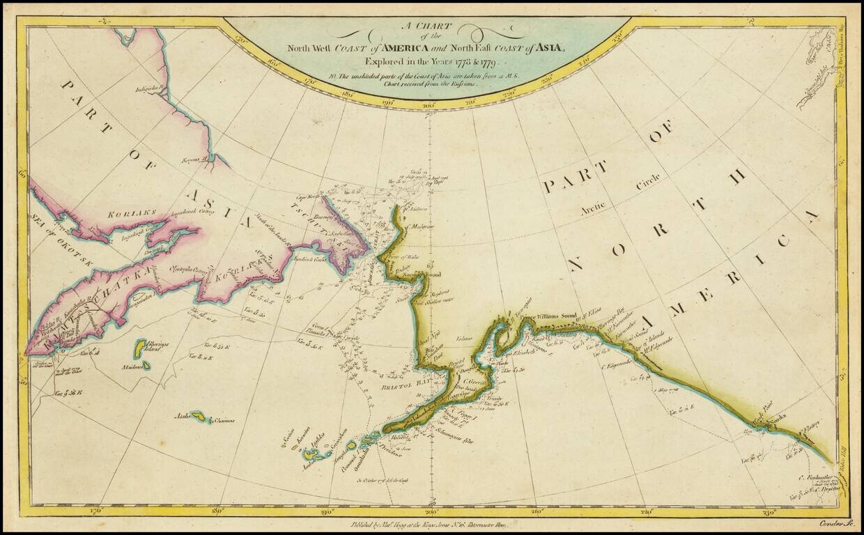
Rare map of the Northwest Coast of America and Northeast Coast of Asia, illustrating the tracks of Captain James Cook's Voyage in the region in 1778 and 1779. This edition of the map is apparently very rare. This is the first example we have ever seen.
![Naufrage De M.M. De Laborde Sur Les Canots De La Peyrouse Au Port Des Francois Dans La Californie . . . [Shipwreck of the Astrolabe's yawl at Port des Francais, Lituya Bay, Alaska]](/map/small/52480.jpg)
Rare copper engraving showing the shipwreck of two small boats that were part of the La Perouse Expedition, during their reconnaissance of Lituya Bay, near Juneau, Alaska. The view depicts a group of French crew members fight storm in small boats as...
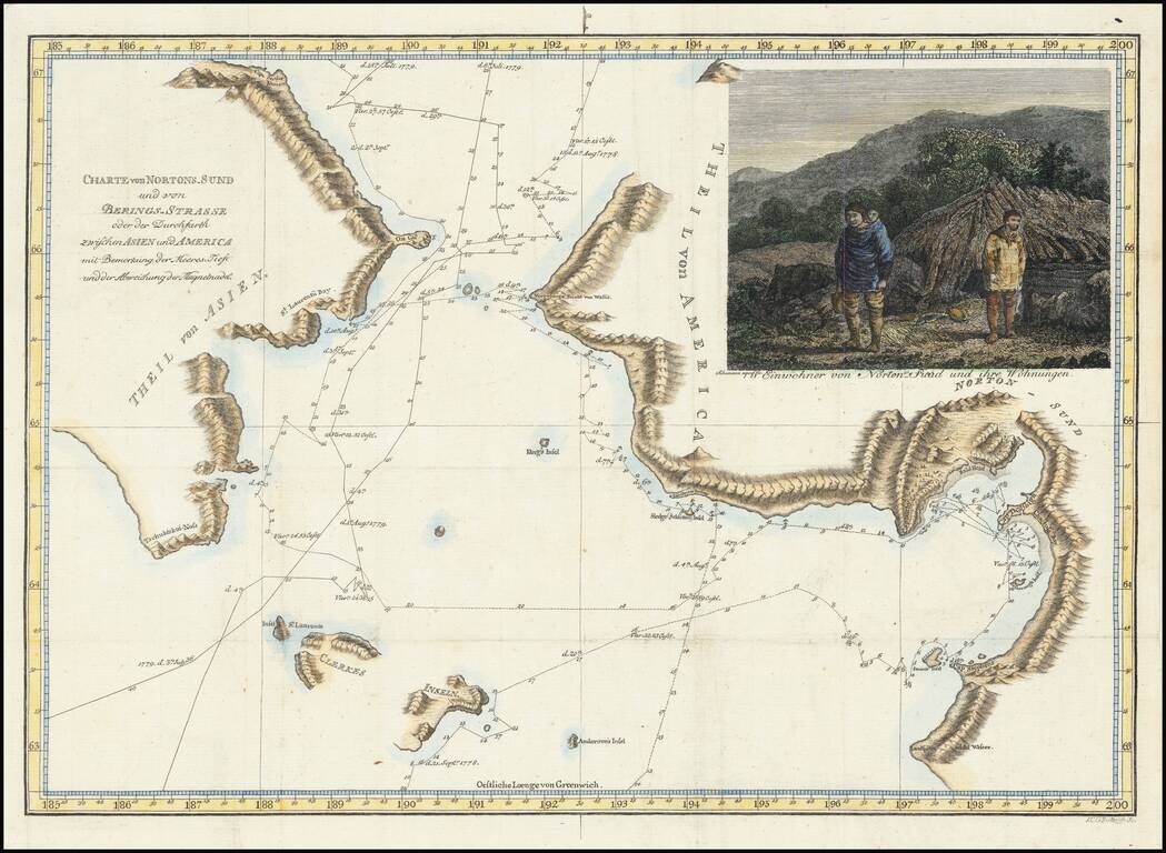
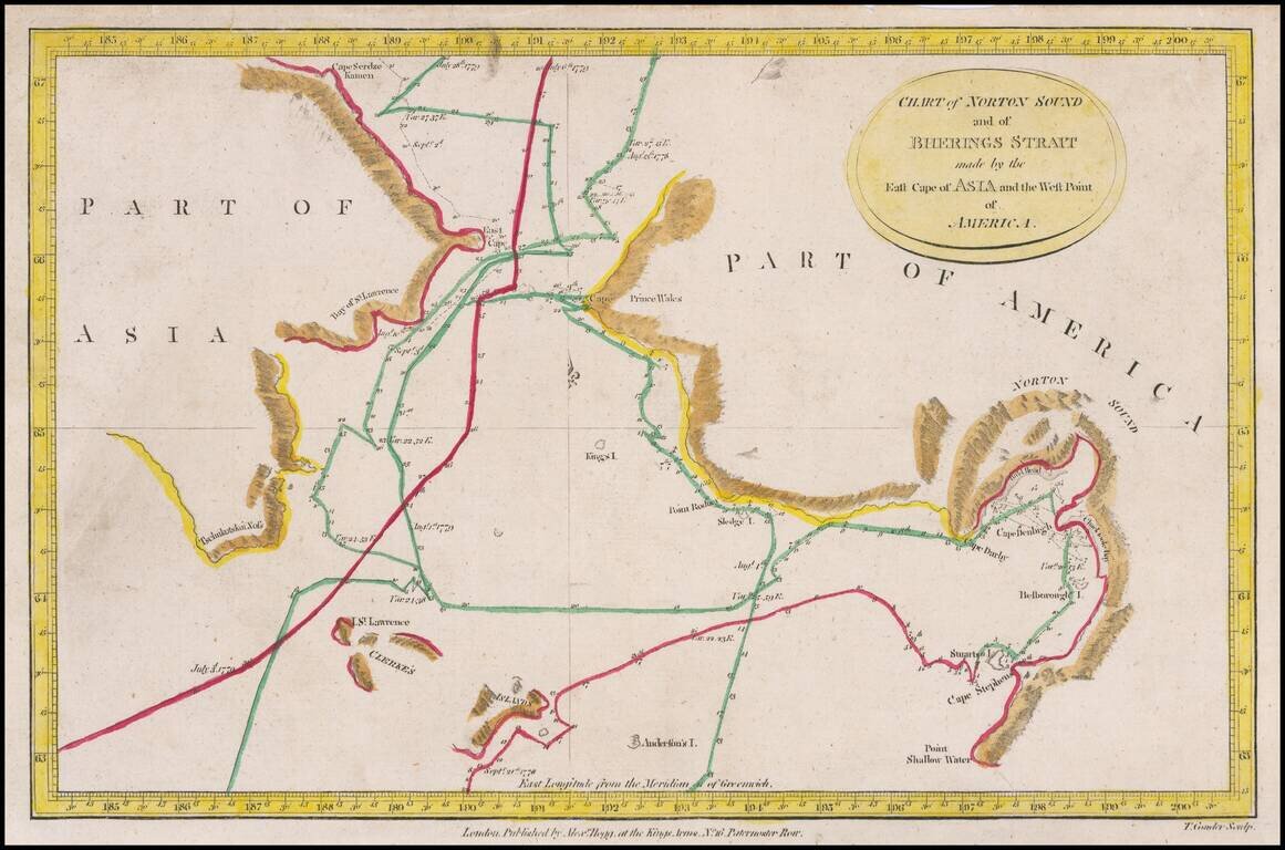
Rare illustrated map of Alaska and the Bering Straits, which appeared in the first German edition of the Account of Cook's Voyages. The map covers the area from the Bering Strait and the coast south of Norton Sound to the coast north of Cap du Prince...

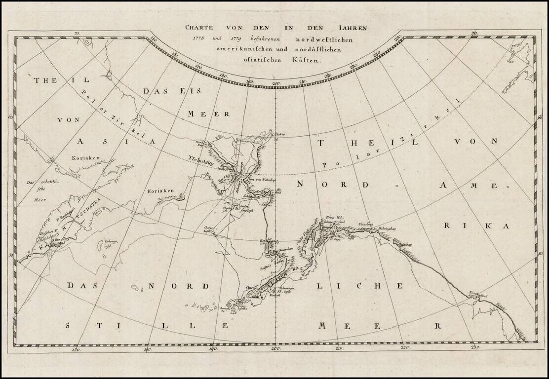
Fine example of this German edition of Cook's explorations along the northwest coast of America and northeast coast of Asia, based upon the original work by Lieutenant Henry Roberts. Excellent detail in the Behring Straits, including extensive notes...
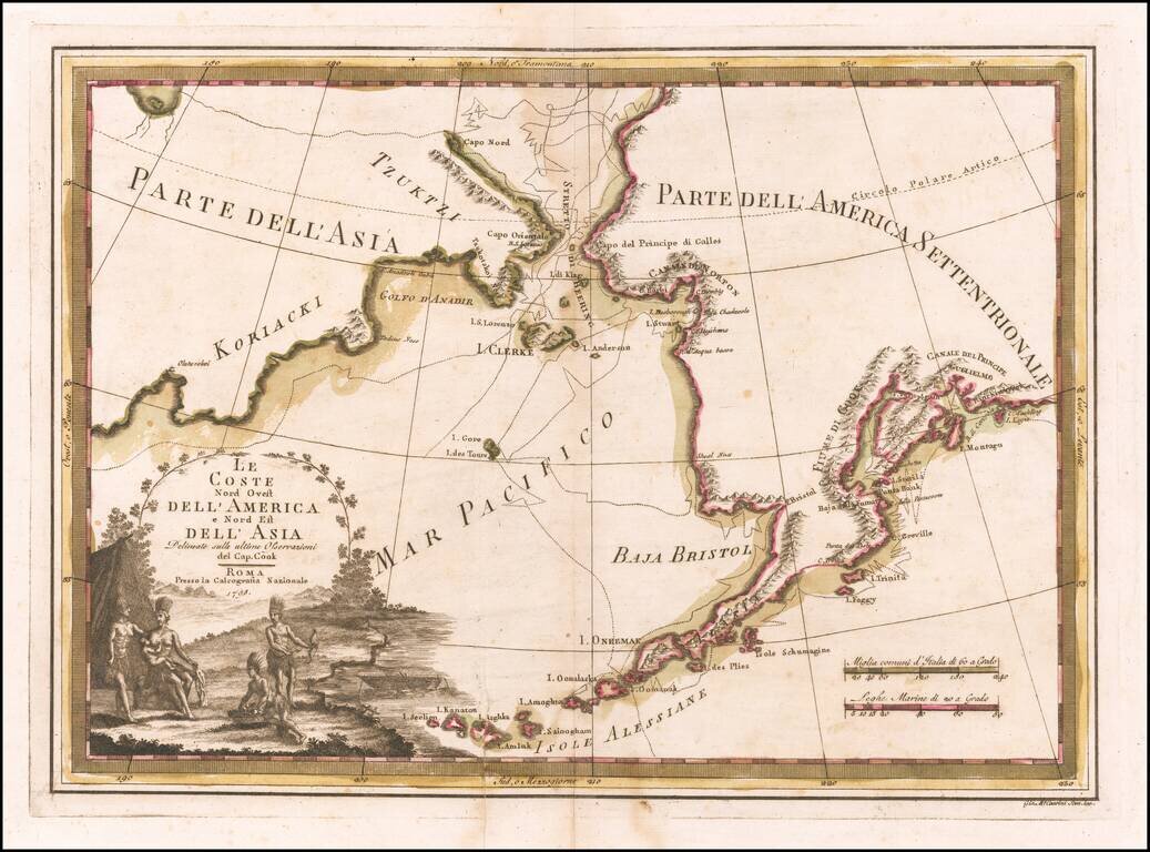
Nice old color example of Cassin's map of the Northwest Coast of America and Northeast Coast of Asia, showing Captain James Cook's tracks through the region. This is without doubt the most decorative map of the period covering this region. It also...
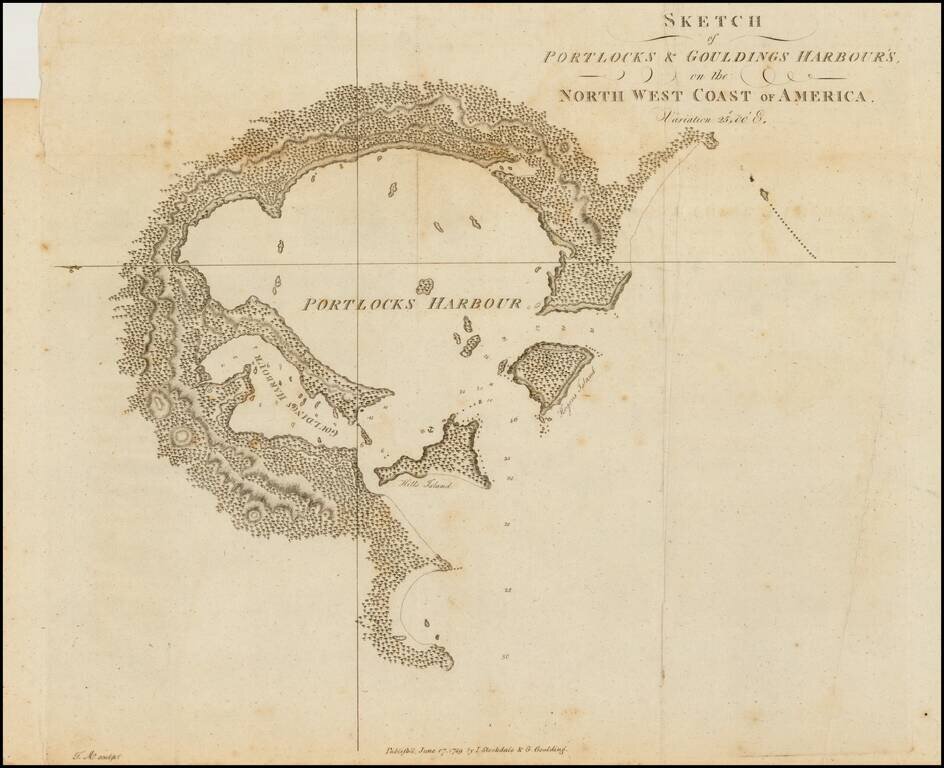
Rare early sketch map of Portock Harbor and Goudling Harbor, north of Sitka and west of Juneau Alaska, from Geroge Dixon's Voyage round the World; but More Particularly to the North-West Coast of America: Performed in 1785, 1786, 1787, and 1788, in the...
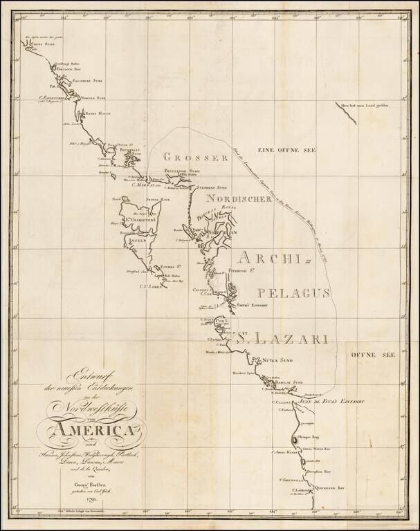
Rare chart of the Northwest coast of America, centered on Queen Charlotte's Island, from Georg Foster's Geschichte der Reisen, die seit Cook an der Nordwest…Amerika. Rare chart of the Northwest Coast of America, illustrating the experiences of Georg...
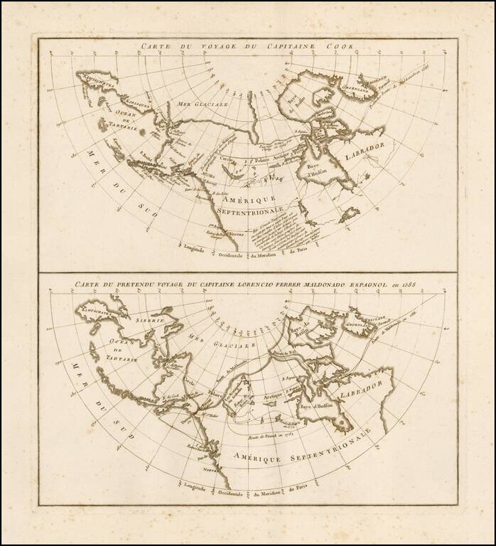
Rare pair of maps on a single sheet, showing the results of various real and apocryphal explorations in the Arctic Regions and the Northwest Coast of America, which appeared in the atlas volume of Jean Benjamin de LaBorde's Histoire Abrégée de la Mer...
![[Eastern Siberia and Alaska]. ‘Vostochnaya Chast Irtkutskoi Gubernii s prilezhashhimi ostrovami i zapadnom beregom Ameriki’ (‘The Eastern Part of the Irkutsk Province with the adjacent islands and the West Coast of America’).](/map/small/38895.jpg)
Fine example of this rare Russian map of the northwest coast of America and northeastern parts of Russia, published by Wilbrecht in his rare 1792 atlas entitled Ross'iiskoi Atlas iz soroka chetyrekh kart sostaiashch'ii I na sorok na dva...

First edition of Carey's map of Cook's Discoveries in the Pacific and Hearne's discoveries west of the Hudson, in search of the Arctic Sea. This is one of the earliest appearances of a Cook map to be published in America. Excellent conjectural NW...
Detailed chart of the coastal regions explored by Captain James Cook, one of the seminal voyages to the Northwest Coast. The map pre-dates the discovery of Vancouver Island and shows Cook's Tracks through Asia and along the Northwest Coast of America,...