
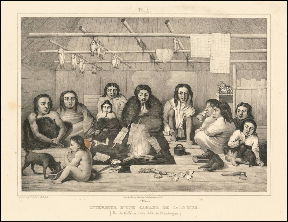
Beautiful antique lithograph of the interior of a Tlingit cabin, from an image drawn by Alexander Filippovich Postels near Sitka, which was then part of Russian America. The scene depicts 11 individuals sitting around a central fire, with fish cooking...
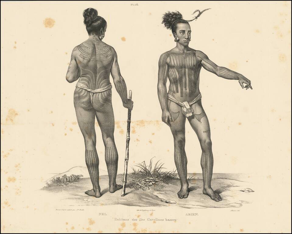
Beautiful antique lithograph of a tattooed Caroline Islander, from an image drawn by Alexander Filippovich Postels, during Fréderic Lütke's circumnavigation in the 1820s. The Caroline Islands are in the South Pacific, north of New Guinea, and were...
![[Map of Russian Possessions in North America] Карта Российскаго Владѣнія въ Сѣверной Америкѣ](/map/small/66569.jpg)
Extremely Rare Russian-Language Map of Russian America (Alaska). Detailed engraved map of Alaska, labeled "Russian Possessions", published in Saint Petersburg in 1836. This is one of very few contemporary Russian maps to focus specifically on Russian...
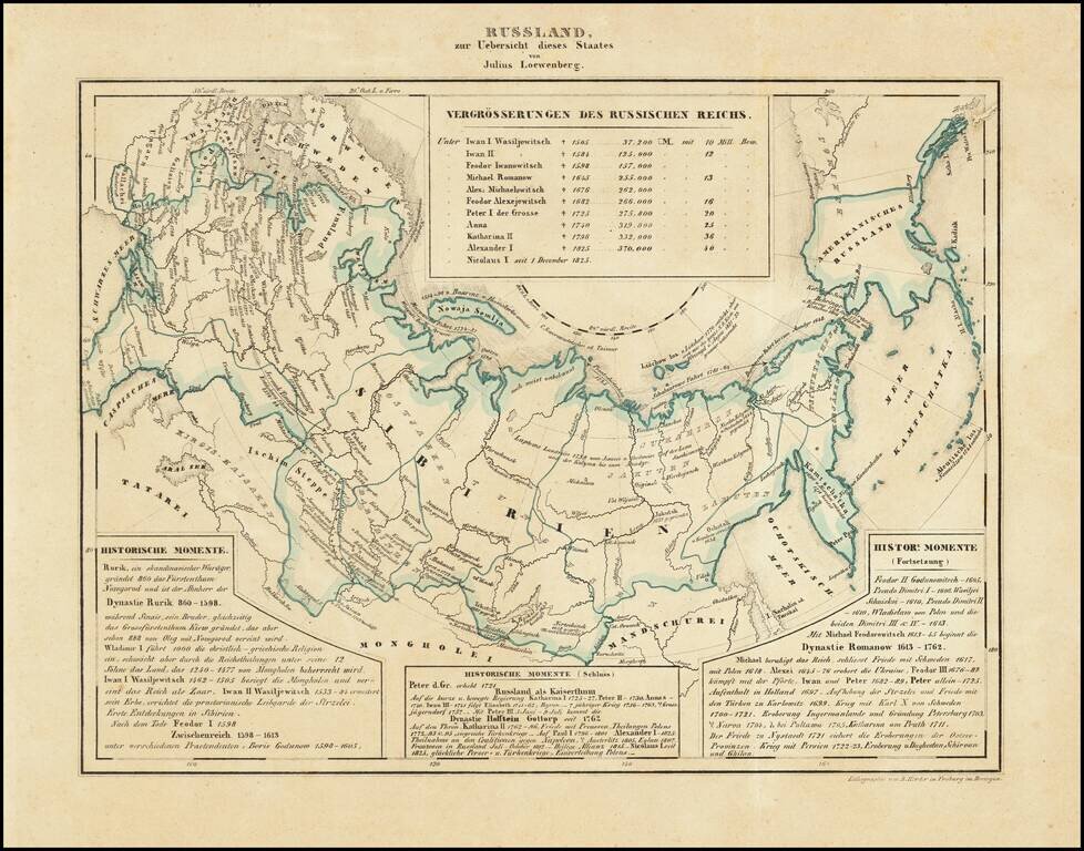
Interesting map of Russia, including Russian America, published in Freiburg in 1839. Includes historical text below the map, covering the history of Russia.
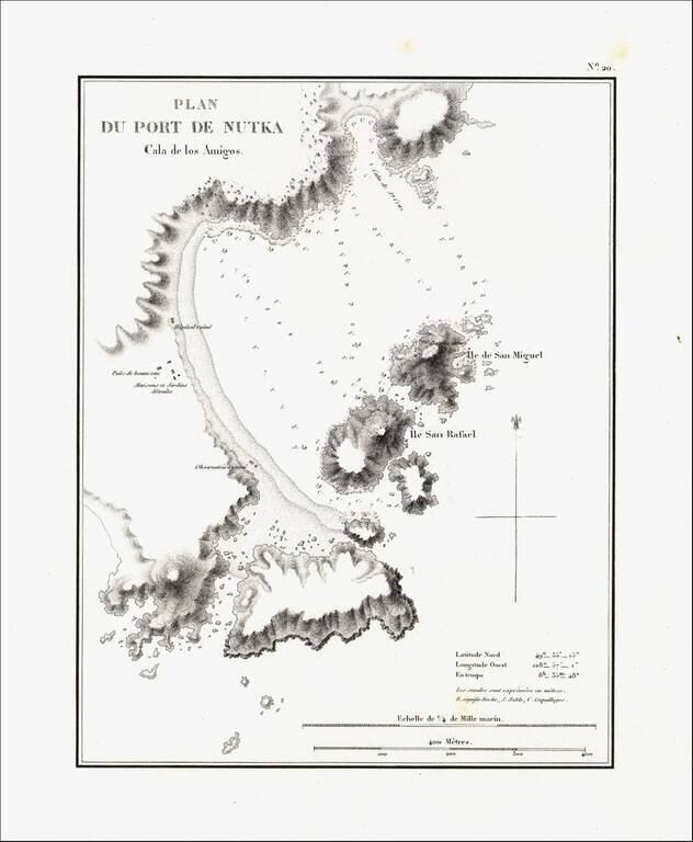
Detailed map of Nootka Bay, from Duflot de Mofras' momumental work. In 1839, Eugene Duflot de Mofras, was assigned to the embassy in Mexico City and instructed to visit the northwestern provinces of Mexico, report on potential commerce, observe U. S.,...
![Меркаторская Генеральная Карта, части Российскихъ Владеній въ Америкѣ (Mercator's [or Mercatorial] General Map, parts of Russian Possessions in America)](/map/small/55959.jpg)
"The First Printed Map of the Interior of Alaska Along the Lower Courses of the Yukon" (Streeter) Rare separately published example of Zagoskin's map of Alaska. According to the Streeter catalogue, “the map must be one of the first, if not the...
![[St. Lawrence Island, Alaska] Карта Острова св: Лаврентия исправленная колониальными мореходами [Map of the Island of St. Lawrence corrected by the colonial sailors.]](/map/small/59917.jpg)
The George Davidson Copy of Tebenkov's Map of St. Lawrence Island, Alaska Rare and remarkable map of St. Lawrence Island Alaska, compiled by Mikhail Dmitrievich Tebenkov, who in 1849 was serving as the Governor of American Russia. Mikhail Dmitrievich...

Rare map showing the Northwest Passage, via the Bering Straits, with a fantastic early depiction of Alaska (then Russian America) and contiguous parts of Canada. Philip's map highlights the discoveries of Franklin and Richardson in the Arctic Sea...
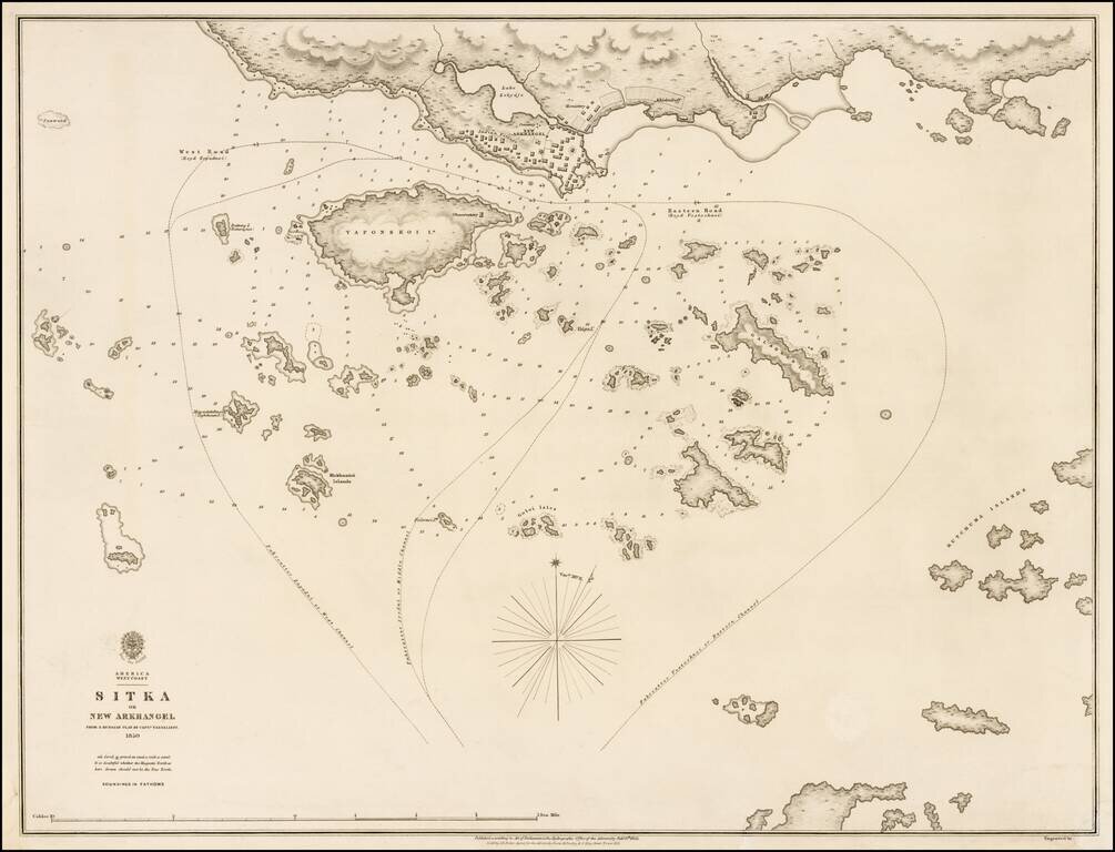
Exceedingly rare and highly detailed British Admiralty Chart of Sitka, Alaska and environs, based upon an earlier chart by the Russian Sea Captain Ivan Vasilyev. This exceptional chart shows one of the earliest obtainable scientifically drawn surveys...

Rare map of the Northwest Passage, Northern Canada, part of Alaska (America Russa) and Greenland. The map is quite unusual, being one of the few maps to focus on the known islands of the Northwest Passage, including several partially known...
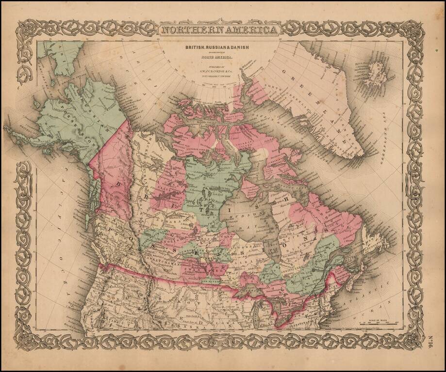
Marvelous map of Canada and Alaska, featuring a host of unusual borders. New Columbia stretches from the US Border to Russian America (Alaska). Lesser Slave Lake, Peace River, Mackenzie's River, Great Slave Lake, Churchill, Athabasca, Nelson, English...

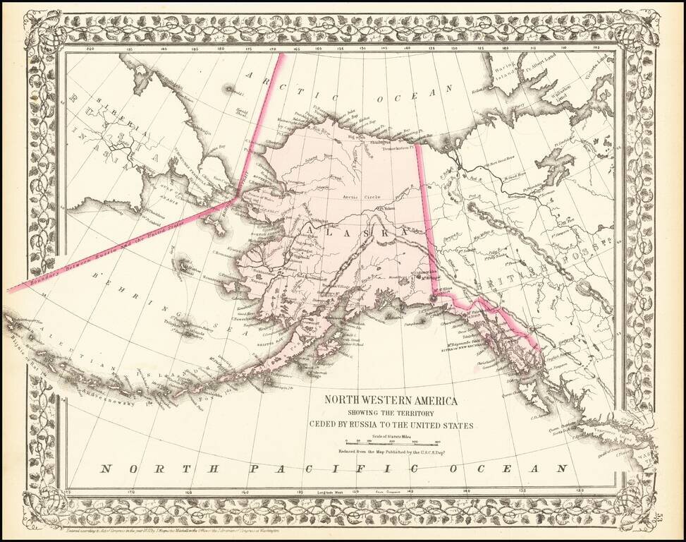
Fine separately issued example of Adolph Lindenkohl's important early map of Alaska, the earliest printed map of lands recently acquired from Russia and the first appearance of the name Alaska on a printed map. Alaska was purchased from Russia for...
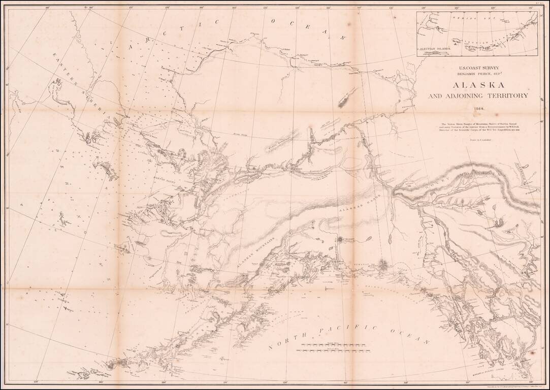
An Important Early Map of Alaska, Shortly After The US-Russia Sale of 1867 The map shows the results of the American explorations in the Yukon region in 1867 and 1868. The map notes: The Yukon River, ranges of mountains, shores of Norton Sound and...
A detailed map of Alaska, showing the territory shortly after it was sold by Russia to America for $7.2 Million in 1867. The map locates towns, mountains (with elevations), rivers, bays, and other details. Cities named include Sitka and Sheshalik. The...
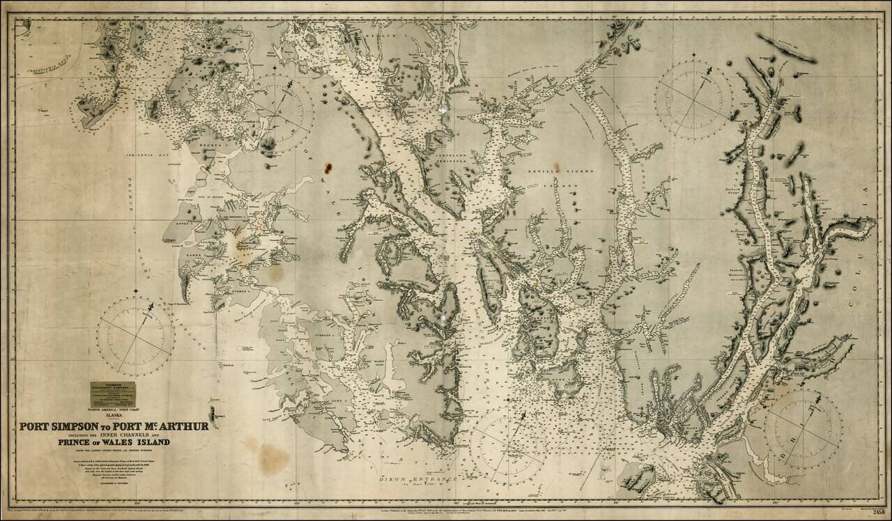
Detailed map of the southernmost part of Alaska, centered on Ketchikan and extending to the Alaska-Canada Border, north to Thorne Island and east to Mt. Gladstone (BC). As noted in George Davidson's The Alaska Boundary (1903) discussing an earlier...

Rare separately issued map of Alaska and British Columbia, showing the route to Gold Regions of Alaska, among the earliest printed maps to illustrate the route to the newly discovered Gold Regions in Alaska. Lowman & Hanford of Seattle produced...