
![La Parte Orientale della Russia Asiatica Delineata…1796 [Includes Alaska]](/map/small/23720.jpg)
Decorative map of Siberia and Alaska from this scarce and highly decorative 18th Century atlas.
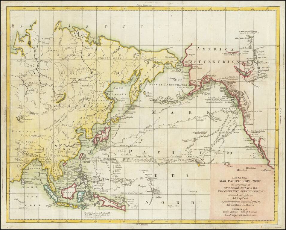
Scarce Italian published map of Alaska and the Northwest Coast of America and Northeast Coast of Asia, engraved to illustrate the Italian edition of the account John Meares Voyages to the Region. The map tracks both the journeys of Captain James...
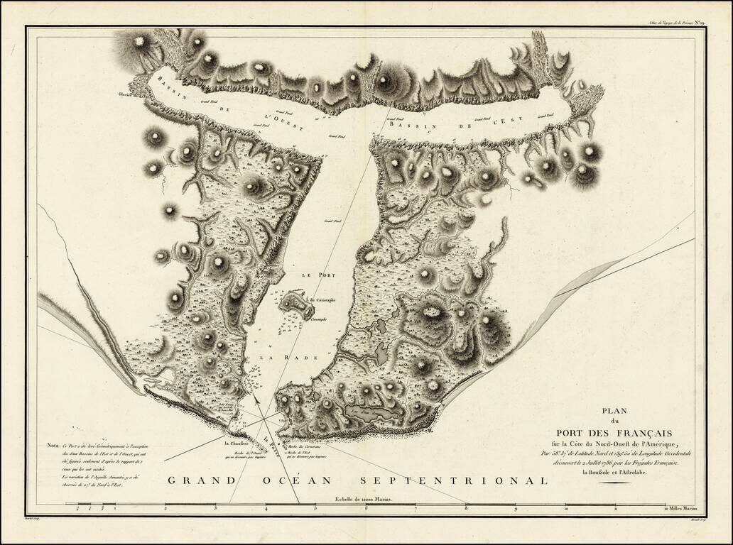
Detailed plan of Port des Francais, from the Atlas Du Voyage De La Pérouse. From the voyages of La Pérouse who set sail from France in 1785 to continue the discoveries of Captain Cook. He was shipwrecked in 1788 and died during the voyage, but his...
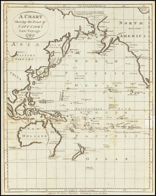
Early American printed map showing the Tract of Cook's final voyage. Cover Alaska, the Northwest Coast of America, Australia, New Zealand, the Coast of Russia, China, Japan, the Philippines, etc. Centered on Hawaii (Sandwich Islands)
![[Anchorage, Valdez and Prince William Sound] Cote Nord-Ouest De L'Amerique Reconnue par le Cape. Vancouver VI. Partie . . .](/map/small/61940.jpg)
Vancouver's Charting of the Region Anchorage, Valdez & Prince William Sound, etc. Highly detailed regional map of Alaska showing the area around Anchorage, Valdez & Prince William Sound, south to Mt. St. Elias. The chart is one of the...
![[Prince Frederick Sound, Ketchickan, Queen Charlotte's Island & Stitka] Cote Nord-Ouest De L'Amerique Reconnue par Cape. Vancouver IVe. Partie . . .](/map/small/62075.jpg)
Highly detailed regional map of Alaska showing the region from Prince Frederick Sound in the North to Queen Charlotte's Island and the contiguous Pacific Coast of Canada in the south, and including Juneau, Sitka, Ketchikan, etc. The chart is one of...
Eastern sheet Wilbrecht's a rare 3-sheet map of the Russian Empire, depicting Alaska, the Northwest Coast of America and the West Coast of Canada, prior to the discovery of Vancouver Island, along with Kamchatka, Northeast Russia and Iezo. The map is...
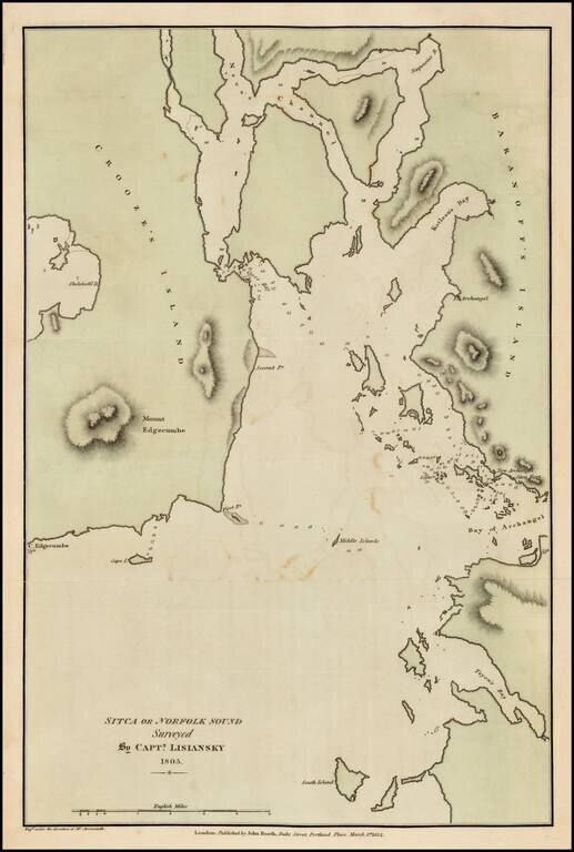
Fine example of the English edition of Lisiansky's map of the area around Sitka and Sitka Sound in Alaska, based upon the surveys of Captain Yuri Federovich Lisiansky in the region at the beginning of the 19th Century. The map is one of the earliest...
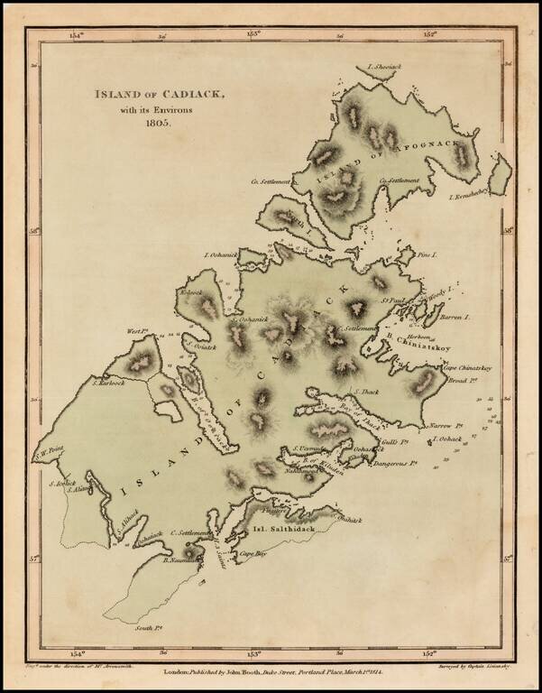
Fine example of the English edition of Lisiansky's map of Kodiak Island, in Alaska, based upon the surveys of Captain Yuri Federovich Lisiansky in the region at the beginning of the 19th Century. The map is one of the earliest obtainable maps of the...
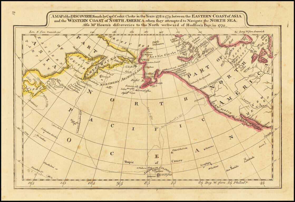
Outline color example of Carey's map of Cook's Discoveries in the Pacific and Hearn's discoveries west of the Hudson, in search of the Arctic Sea. This is one of the earliest appearances of a Cook map to be published in America. Excellent conjectural...
Scarce map of the NW Passage, the NW Coast of America and NE Coast of Asia. The map extensively tracks the voyages of Captain James Cook beyond the Bering Straits on a nearly daily basis in 1778 and 1779. In the Arctic Sea, a note regarding McKenzie's...
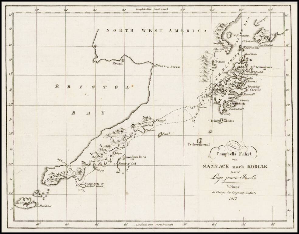
Rare map showing the tracks of Archibald Campbell's long boat trip from Sannack to Kodiak (then Russian America) in 1807. This map, showing the southwestern tip of Alaska and several Aleutian Islands, is from a German Serial containing numerous...
![Charte von Nord-America Prag 1818 [Rare Alaska Inset Map]](/map/small/62300.jpg)
Rare Czech map of North America, published in Neueste Lander und Boltersunde, in Prague. The map provides a fascinating depiction of the Transmississippi West, with unusual mountain ranges and a wishful but elusive search for a simple watercourse from...
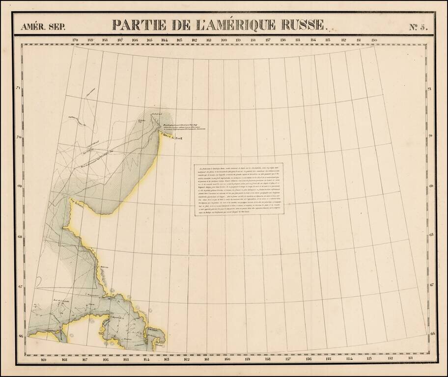
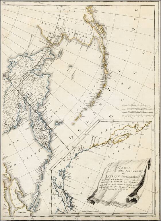
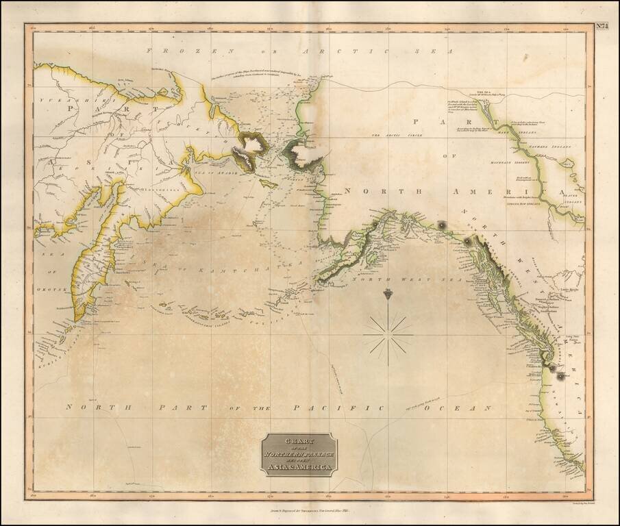
Large format map of the region, showing the Northern most known limits of Alaska. The northernmost named place is C. Glace de Cook. Cap Laburn is also shown, as is C. Mulgraves, and B. de Bonne Esperance. The primary feature on the map are the tracks...
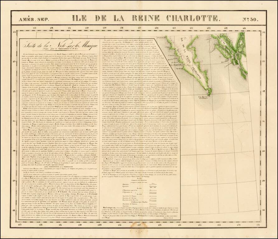
Highly detailed map of the southern portion of Queen Charlotte's Island and the continguous coastline of British Columbia, in the area of Canal de Grenville and Hawkesbury. Detailed and interesting map. From Vandermaelen's remarkable 6 volume atlas,...
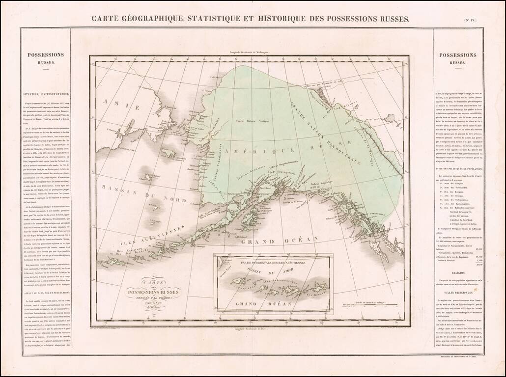
One of the Earliest Antique Maps of Alaska / Russian America -- 42 Years Prior to Its Acquisition by the US Scarce map of Russian America, being perhaps the first separate map of the region which would become Alaska. The region extends south to Queen...