Map size in jpg-format: 11.7657MiB
Click to open in high resolution (open in new tab).
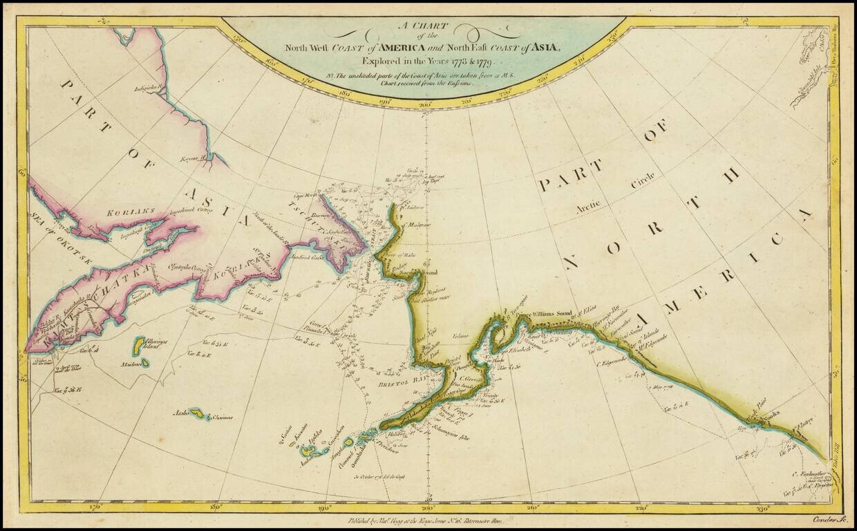
Detailed chart of the coastal regions explored by Captain James Cook, one of the seminal voyages to the Northwest Coast.
The map pre-dates the discovery of Vancouver Island and shows Cook's Tracks through Asia and along the Northwest Coast of America, with various notes, dates, etc.
Extends south to Cape Fairweather.
If you are a student, write to us in telegram: @antiquemaps and indicate what material you need and for what work you need a map in high detail. We are ready to provide material on special terms. For students only!
![America [Manuscript Map Showing the Sea of the West!]](/map/small/41297dm.jpg)

![[Atlantis?] Ristretto Delle Carte presentate all' Academia delle Scienze di Parigi negli anni 1737 e 1752 dal Sig di Buache](/map/small/58667.jpg)