Map size in jpg-format: 2.47603MiB
Click to open in high resolution (open in new tab).
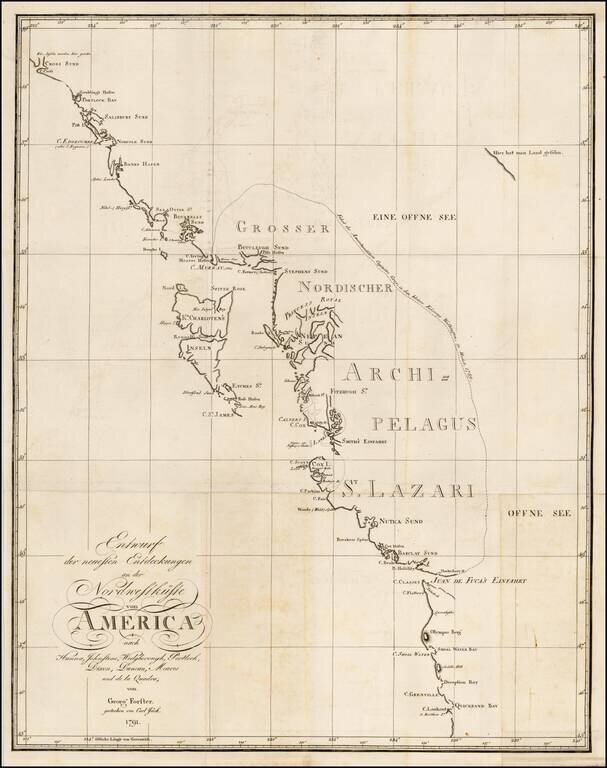
Rare chart of the Northwest coast of America, centered on Queen Charlotte's Island, from Georg Foster's Geschichte der Reisen, die seit Cook an der Nordwest…Amerika.
Rare chart of the Northwest Coast of America, illustrating the experiences of Georg Foster aboard Cook's second voyage. Forster was a German naturalist, ethnologist, travel writer, journalist and revolutionary. The chart shows the most recent discoveries at the Northwest coast of America according to Hanna, Johnstone, Wedgeborough, Portlock, Dixon, Duncan, Meares and de la Quandra. It extends northward from Cape Lookout, past the Juan de Fuca Strait, the Queen Charlotte Islands up to beyond Cape Cross. No interior detail is included.
A dotted line delineates Captain Gray's voyage through the inner passage in 1789.
If you are a student, write to us in telegram: @antiquemaps and indicate what material you need and for what work you need a map in high detail. We are ready to provide material on special terms. For students only!
![America [Manuscript Map Showing the Sea of the West!]](/map/small/41297dm.jpg)

![[Atlantis?] Ristretto Delle Carte presentate all' Academia delle Scienze di Parigi negli anni 1737 e 1752 dal Sig di Buache](/map/small/58667.jpg)