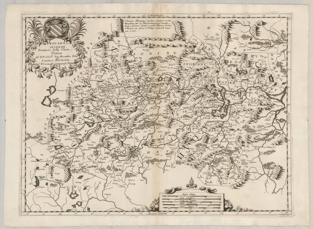
Decorative and highly detailed regional map of China, including parts of the Szechwan and Hunan Provinces. Shows the city of Chungking along the Yangtze River. Many decorative embellishments, including title cartouche and elaborate coat of arms....
![[Includes the Isle of Luzon or Manila!] Quantung, e Fokien, Provincie della China . . .](/map/small/62758.jpg)
Fine Map of Coastal China with the Island of Luzon or Manila Fine example of Coronelli's map of the provinces of Guandong, Guangxi Fujian and Jiangxi, including Hainan, Hong Kong, Guangzhou, and Taiwan from Coronelli's rare Corso Geografico...
![Parte Occidentale della China . . . [with] Parte Orientale della China . . .](/map/small/64242.jpg)
Coronelli’s Map of China—Rare Original Color Example Fine example of Coronelli's striking two-sheet map of China. The work is in original color, a rarity for a map that is one of the most sought after of large-format maps of China. The map covers...
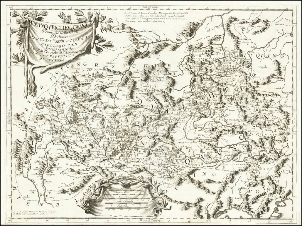
Striking early map of the Chinese provinces of Iunan (Yunan), Queicheu (Guizhou), e Quangsi (Guangxi), from Coronelli's Corso Geografico Universalle. The map includes a number of place names and topographical details, highly decorative title and...
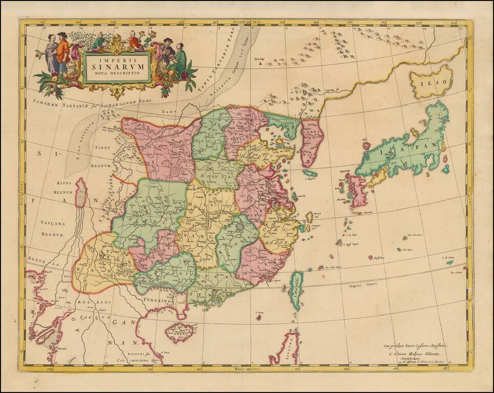
Rare Covens & Mortier's edition of Blaeu's map of China. An important general map of China, Korea and Japan, published by Joan Blaeu in the Jesuit Martino Martini's Atlas Sinensis , the first western atlas of China. The map incorporates the...
Detailed map of China from Cluver's Introductionis in Universam Geographicam. Shows the Great Wall, Macao, Formosa, etc.

Decorative map of Southeast Asia, China, Philippines and India, which was included in Cluverius' Introductionis in Universam Geographiam, tam Veterem quam Novam. Shows an oddly positioned New Guinea ("Pars Nova Guinea") and also China, India, Malacca,...
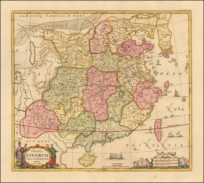
Scarce map of China and Korea, based upon Jansson's map of 1658. China is colored by provinces. Excellent detail throughout the map, which includes the Islands of Formosa and Hainan. The Great Wall of China is shown.
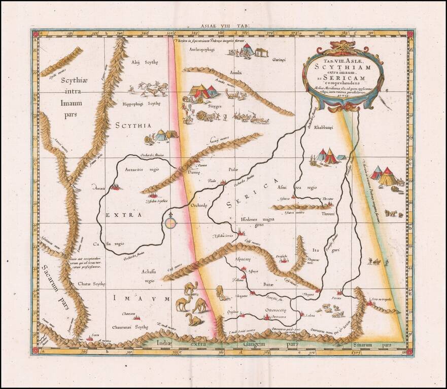
Fine Ptolemaic Map of Central Asia from Mercator’s Geographia Finely engraved map of Central Asia east of the Caspian Sea, encompassing parts of present-day Pakistan, Tajikistan, Kyrgyzstan, and western China. The map is from Mercator’s highly...
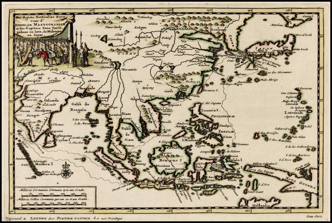
Decorative map of the region from India to Southeast Asia and north to Japan and Korea, including an illustration of the Great Wall of China, illustrating the Dutch translation of the account of the voyage of John Saris, Captain of the first English...
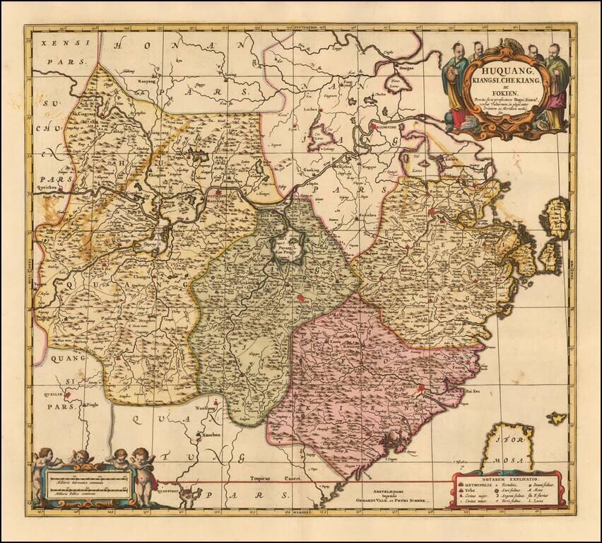
Fine example of the Valk & Schenk edition of Jansson's map of Hunan (Huquang), Jiangxi (Kiangsi), Zhejiang (Che Kiang), and Fujian (Fokien) in eastern China. The map is drawn largely from Blaeu's maps compiled by Jesuit Father Martino Martini who...
![[ Hong Kong / Macao / Canton ] Iunnan, Queicheu, Quangsi et Quantun, Provinciae Regni Sinensi Praefecturae dictae](/map/small/55800.jpg)
Fine example of the Valk and Schenk edition of Jansson's regional map of China, including the Hong Kong - Macao Region . A beautifully engraved map of Southern China covering Hainan and the Pearl River Delta with Macao and the islands around...
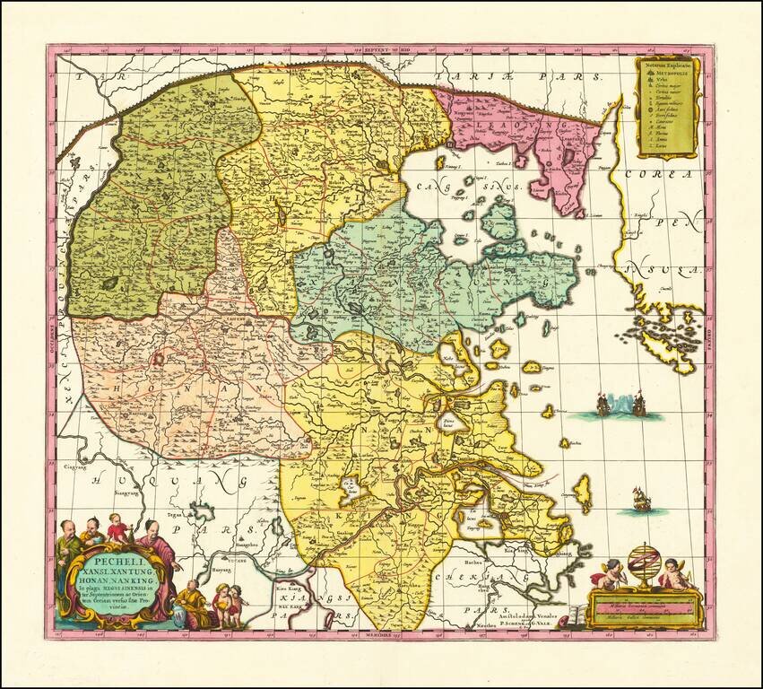
Scarce Valk & Schenk edition of Jan Jansson's highly decorative map of northeastern China and Korea. The present map is very geographically advanced for its time and depicts the provinces of Hebei (Pecheli), Shanxi (Xansi), Shandong (Xantung),...
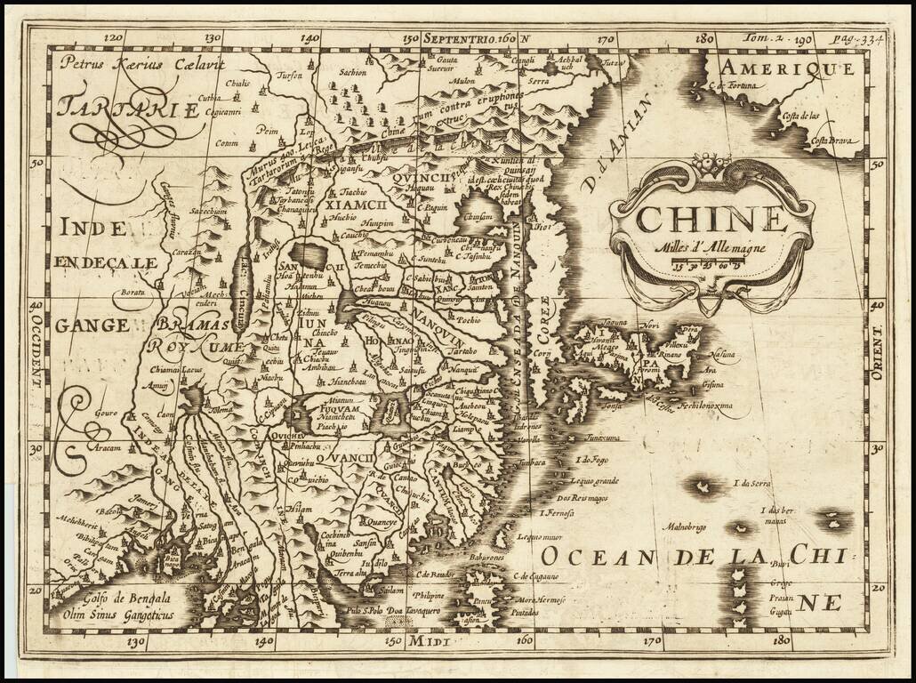
A Rare Variant! Rare early map of China, published by Martineau du Plessis in Paris. The map is printed from a copper plate originally engraved by Petrus Kaerius (Peter Vander Keere) Johannes Cloppenburg's Atlas Sive Cosmographie in 1730. This state...
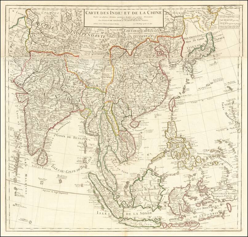
De L’Isle’s Detailed Map of Eastern Asia Updated example this noteworthy map of East Asia and the Indian subcontinent published by France’s foremost eighteenth-century cartographer, Guillaume De L’Isle. The map was foundational; it was...
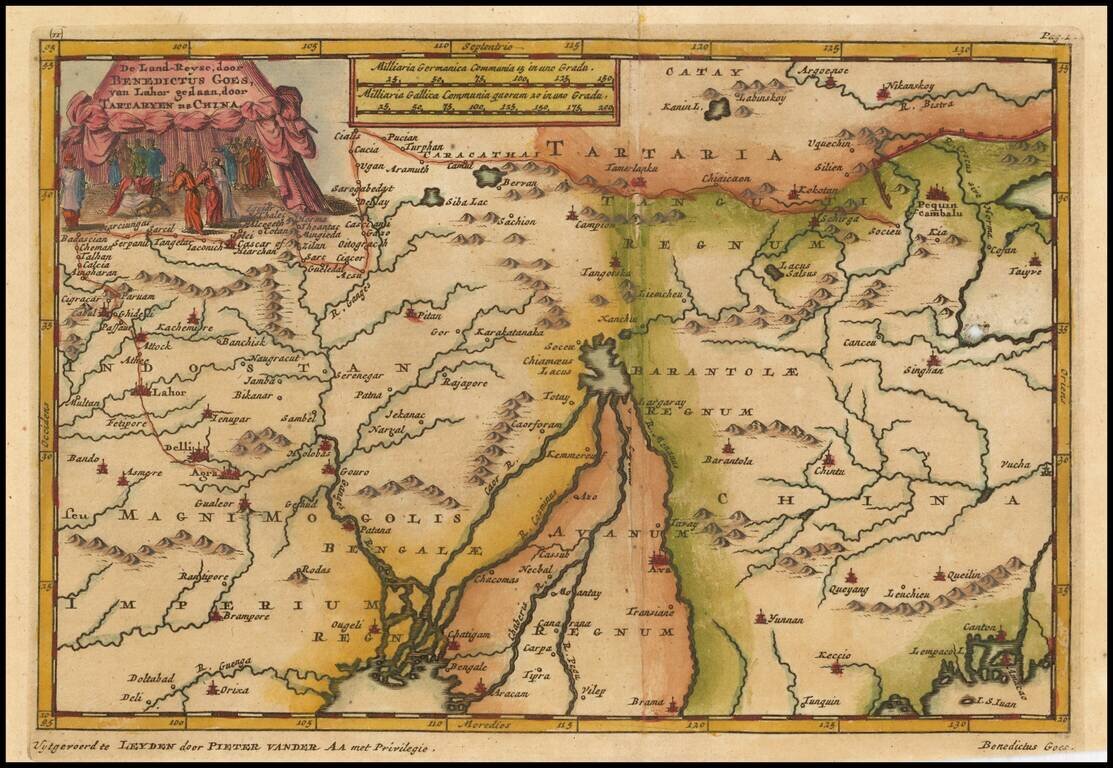
Interesting map showing the region of northeastern India, Nepal, Bhutan, Assam and Bangladesh. At center is the imaginary Chiamaeus Lacus with four huge rivers flowing south into Bangladesh and Burma. Decorated with a pictorial title cartouche of a...