Map size in jpg-format: 39.7592MiB
Click to open in high resolution (open in new tab).
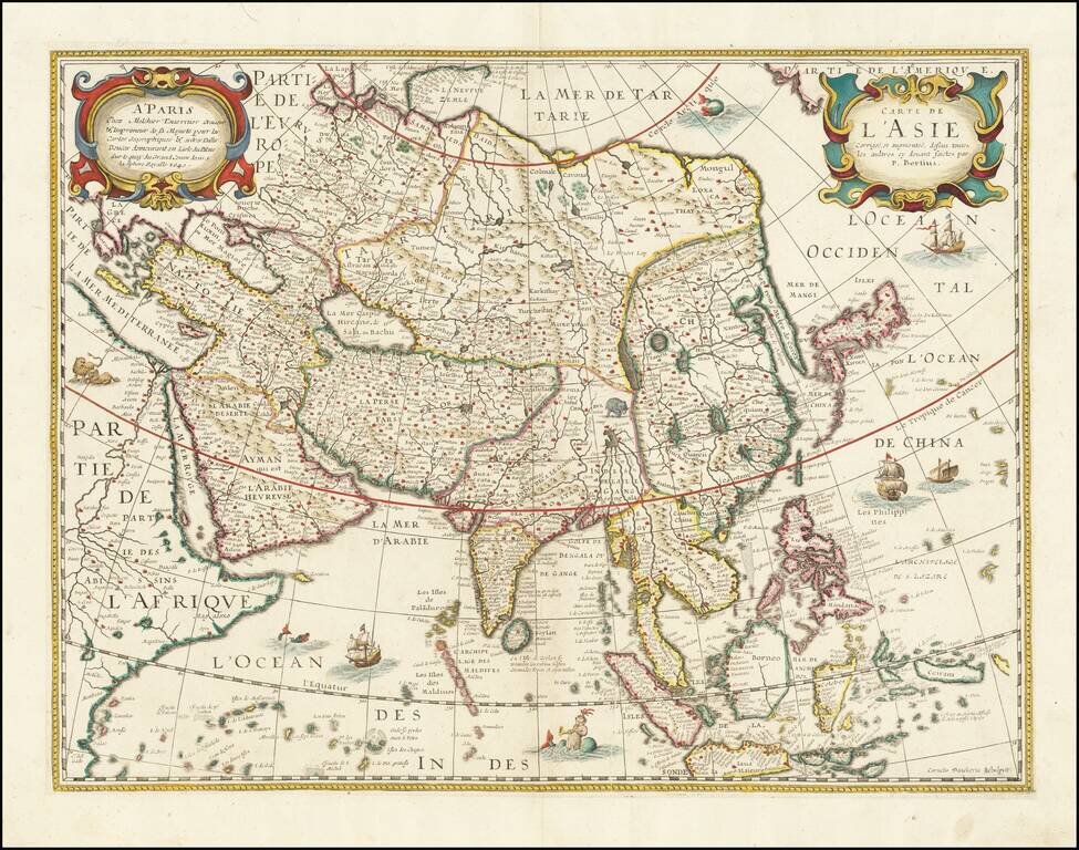
Rare map of Asia, likely drawn from an earlier map by Melchior Tavernier.
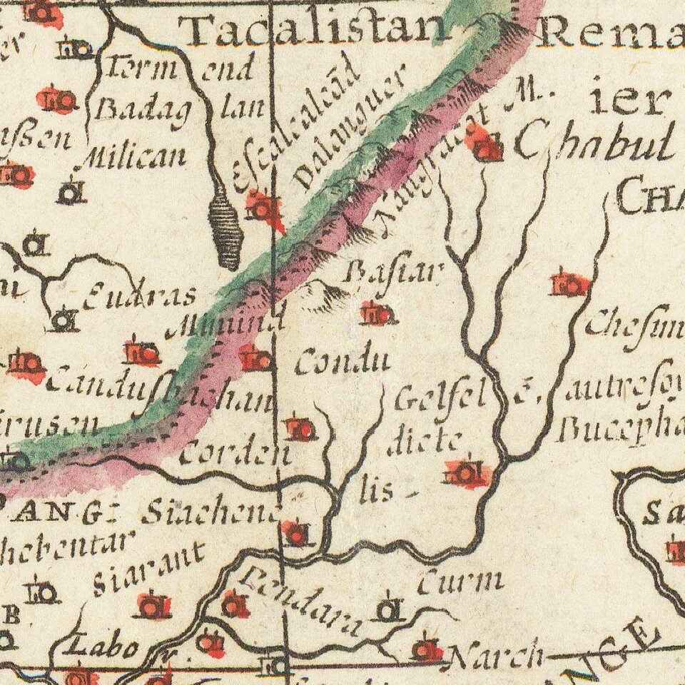
Extremely detailed throughout. Shows the Great wall, oddly projected Korea, Japan and China and elephant just about the source of the Ganges. Writing about the America map from the same source, Philip Burden notes that this was a rare separately issued map, which was apparently also bound into a few contemporary French books, including D'Avity's Nouveau Theatre du Monde.
A fine example.
Melchior Tavernier was a member of a large family involved in the publishing trade in Paris in the early years of the seventeenth century. Early in his career, he apparently collaborated with Henricus Hondius, as at least one of his early maps references Tavernier as the seller of a map engraved in Amsterdam, by Hondius. He is probably best known for his publication of a map of the Post Roads of France, which was copied many times until the end of the century. He also issued an atlas under the same title as J. le Clerc's Theatre Geographique, using many of Le Clerc's maps, but incorporating others from different sources. He published composite atlases and also published works for other cartographers, including N. Sanson, N. Tassin, and P. Bertius. He is not to be confused with his nephew of the same name (1594-1665), who also engraved maps for Nicolas Sanson.
If you are a student, write to us in telegram: @antiquemaps and indicate what material you need and for what work you need a map in high detail. We are ready to provide material on special terms. For students only!

![[Eastern Hemisphere Globe Gores] (Nova et integra universi Orbis descriptio)](/map/small/54480.jpg)