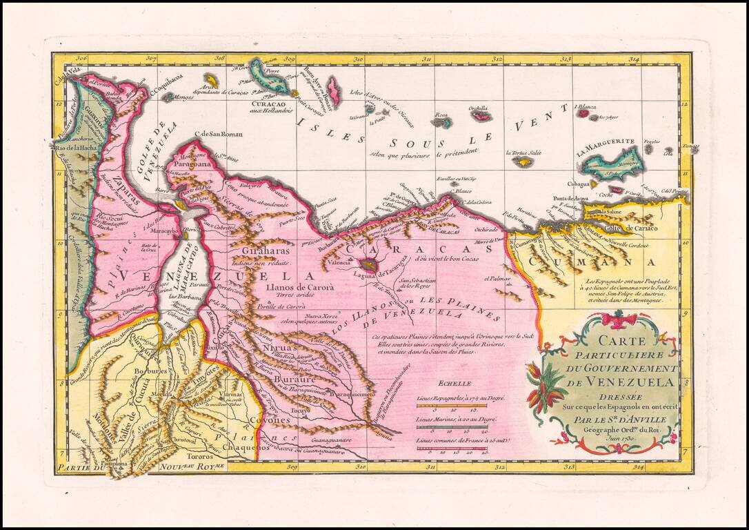
Striking D’Anville Map of Venezuela Fine example of D’Anville’s map of Venezuela, which features much of the northern part of what is today the country of Venezuela and the Leeward Antilles. The map shows the mountainous terrain in detail, with...
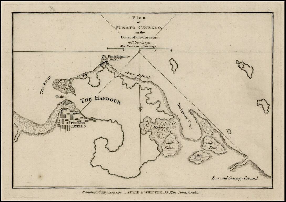
Rare plan of Puerto Cavello, Venezuela, first published by Sayer & Bennett. Includes a town plan, detailed charting of the harbor, with soundings and anchorages, forts, islands and other details. One of the earliest obtainable English language...

Rare Spanish Sea Chart of the Coast of Venezuela and Trinidad Rare first state of the edition of this rare Spanish sea chart of the coastline of Venezuela and neighboring islands, including Trinidad and Margarita. The present chart represents the...
![[Europe as a Queen | Europa regina]](/map/small/68327.jpg)
This is a nice full-color example of Munster's map of Europe in the shape of a queen. The regent's head and crown constitute the Iberian Peninsula, her arms Italy and Denmark, and her dress the countries from France to Bulgaria. In what might be...
De Jode's First Map of Europe Striking full color example of De Jode's rare map of Europe, which appeared in De Jode's Speculum Orbis Terrarum. The British Isles are shown in an early blockish configuration, with an equally curious shape for...
Nice example of Ortelius' first map of Europe. The first edition includes the incorrectly named "Cap de S Tincente" in southwestern Spain, which briefly appeared beginning in 1573, until it was revised to "Cap. de S. Vicente" with the issuance of...
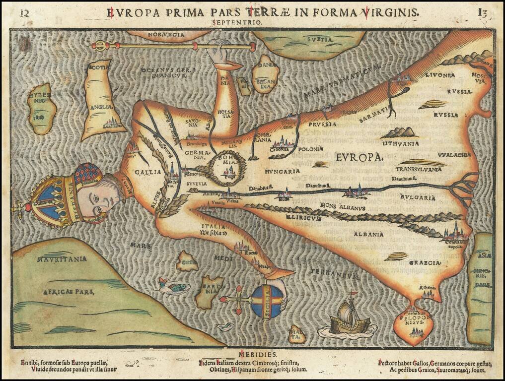
Europe in the Form of a Queen Fine example of Bunting's map showing Europe in the form of a queen. Protestant theologian Heinrich Bunting's map showing Europe as a queen is one of the most sought after anthropomorphic maps of the 16th Century. The...
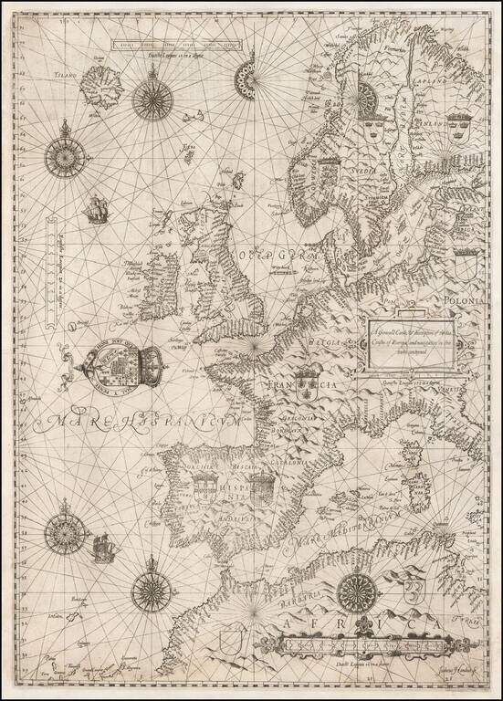
The Rare English Copy of Waghenaer's General Sea Chart of Europe -- The Earliest Sea Chart Engraved in England Important early sea chart of Europe, engraved by Jodocus Hondius for the The Mariner's Mirrour, an English translation of Waghenaer's...
Striking full color example of Gerard De Jode's rare map of Europe, which was issued only in the second edition of the Speculum Orbis Terarrum in 1593. The map includes a massive Terra Nova Zembla, several Northeast Passages and a number of the great...
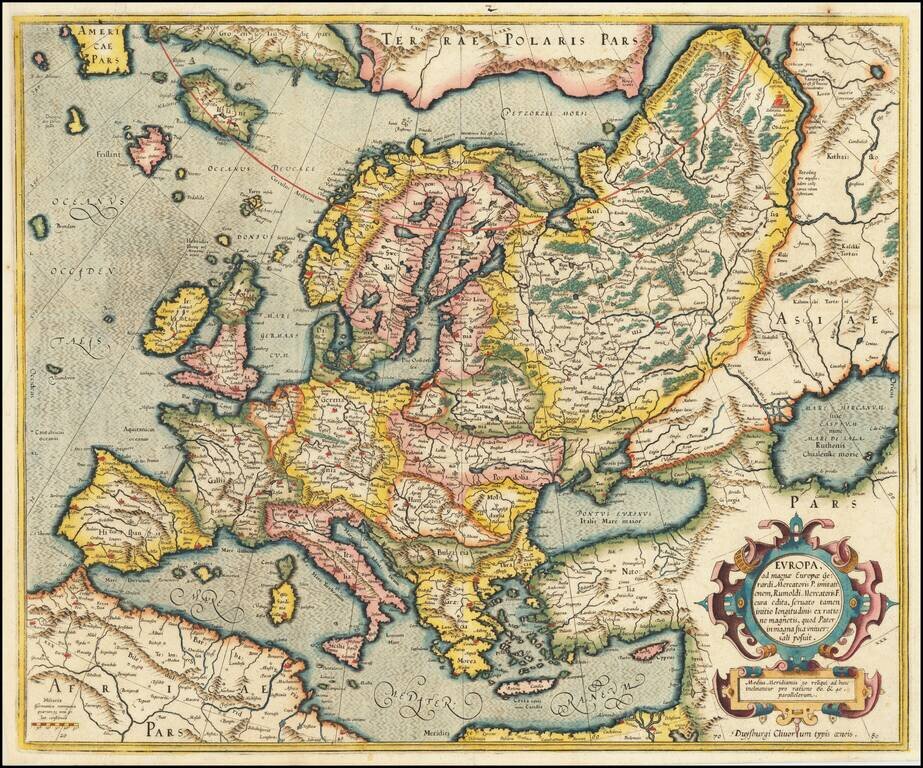
Gorgeous early example of Mercator's map of Europe from his Atlas Sive Cosmographia, first published in 1595. Includes an ornate cartouche. The map was updated and the cartouche etc. changed in 1606.

Old color map of the Roman Empire from Abraham Ortelius' Theatrum Orbis Terrarum, the first modern atlas of the world. Several decorative cartouches, 2 portraits, sailing ship and a historical tree showing details.
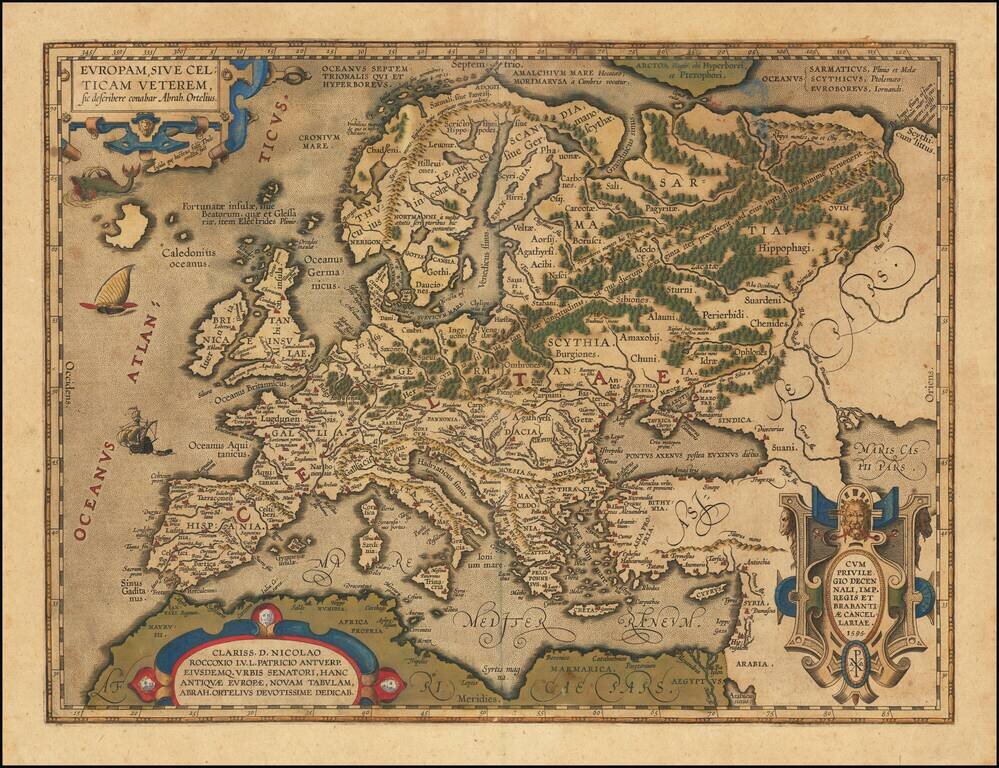
Celtic Europe Striking example of Ortelius' map of the Celtic Empire, from Ortelius' Theatrum Orbis Terraum, first published in 1570. This map first appeared in the 1595 edition of the atlas, and is believed to be derived from Ortelius' 2 sheet map...
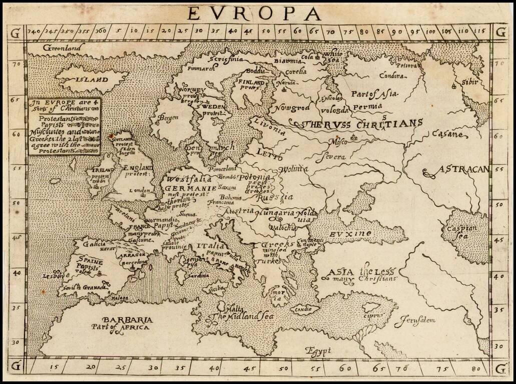
Rare map of Europe, from Ephraim Pagitt's Christianographie, or the Description . . . of the Christian World, not subject to the Pope, first published in London in 1635. The map shows the 4 groups of Christians in Europe: Protestants Papists...

Rare edition of Cloppenburg's map of the Holy Roman Empire.

Decorative map of Europe, published by Marian. The map is based upon an earlier map by Willem Blaeu. Includes sailings ships and a sea monster.
Rare map of Europe, published by in the Atlas of the Capuchin provinces, published by Montecalerio. The atlas of the Capuchin provinces was initiated in manuscript form by the minister general of the order, Father Silvestro from Panicale in 1632 and...