Map size in jpg-format: 25.2821MiB
Click to open in high resolution (open in new tab).
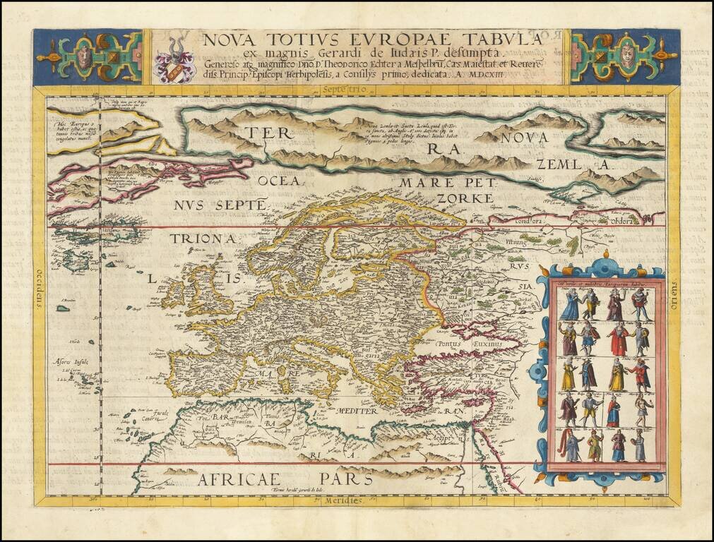
Striking full color example of Gerard De Jode's rare map of Europe, which was issued only in the second edition of the Speculum Orbis Terarrum in 1593.
The map includes a massive Terra Nova Zembla, several Northeast Passages and a number of the great mythical islands of the Atlantic, including S. Brandain, Bresil and Frislandt.
A large inset includes 20 costumed figures, representing the dress of various European inhabitants.
Gerard De Jode (1509-1591) was a pre-eminent mapmaker in the late seventeenth century, a time when the Dutch dominated the map trade. He was known for his many maps, some of which featured in Speculum Orbis Terrae (first edition Antwerp: 1578). Although never as successful as Ortelius’ Theatrum, the Speculum did get republished in a second edition in 1593, two years after De Jode’s death, by Arnold Coninx, and included this map. After his death, Gerard’s son, Cornelis (1568-1600), and his wife, Paschina, ran the shop. Unfortunately, Cornelis died young in 1600, aged only 32, and the stock and plates were sold to the publisher Joan Baptista Vrients.
If you are a student, write to us in telegram: @antiquemaps and indicate what material you need and for what work you need a map in high detail. We are ready to provide material on special terms. For students only!

![[Eastern Hemisphere Globe Gores] (Nova et integra universi Orbis descriptio)](/map/small/54480.jpg)
![[Signed Political Satire Artwork] Vietnam ... Vietnam ... Vietnam ...](/map/small/68726.jpg)