Map size in jpg-format: 34.215MiB
Click to open in high resolution (open in new tab).
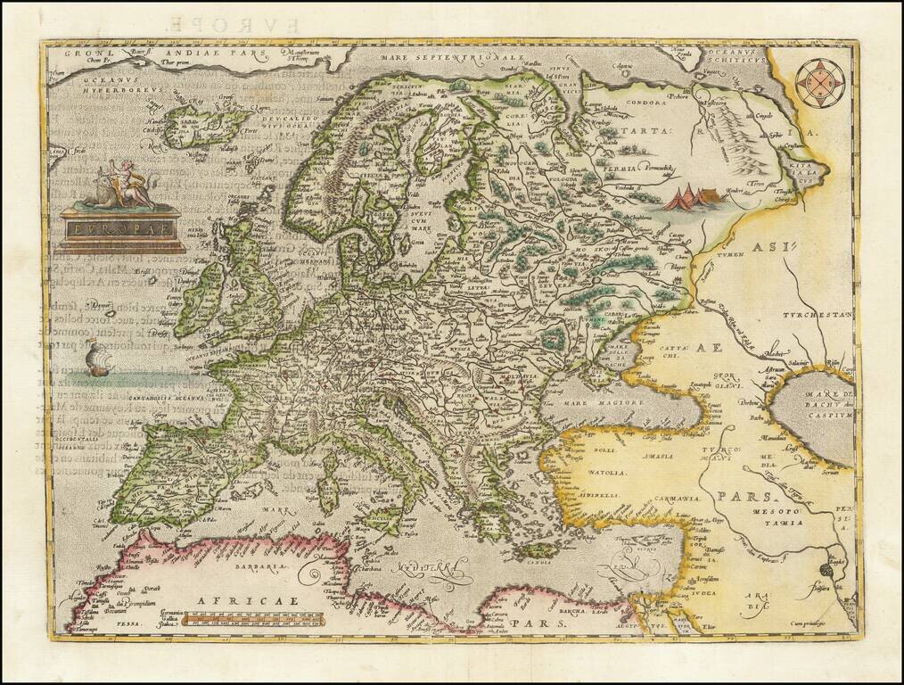
Nice example of Ortelius' first map of Europe.
The first edition includes the incorrectly named "Cap de S Tincente" in southwestern Spain, which briefly appeared beginning in 1573, until it was revised to "Cap. de S. Vicente" with the issuance of Ortelius' second map of Europe. The second map was first issued in 1584 and can be distinguished from the earlier editions by the inclusion of cursive lettering in the words "Africae Pars."
The map is based upon several important maps of Europe, including Gerard Mercator's 1554 map of Europe; the mapping of Greenland and Iceland from Mercator's 1569 world map. The treatment of Great Britain is based upon Mercator's 1564 Great Britain map. Scandinavia is drawn from Olaus Magnus' 1539 Scandinavia map. Russia is based on Jenkinson's 1562 Russia map. The Southeastern part of this map is based upon Gastaldi's first map of Asia of 1559. Parts of the North African coast are based upon Gastaldi's Africa map of 1564.
Ortelius himself mentions in his Catalogus Auctorum the maps of Apianus, Cornelius Antonii of Frankfurt, Ioannes Bucius Aenicola of Paris, Jacob Homem Lusitanus printed in Venice, Ioannes Dominicus Methoneus of Venice, Nicolaus Nicolay printed in Antwerp by Ioannes Stelsium, Vopelius, Waldseemüller, and Christoph Zell of Nurnberg.
If you are a student, write to us in telegram: @antiquemaps and indicate what material you need and for what work you need a map in high detail. We are ready to provide material on special terms. For students only!

![[Eastern Hemisphere Globe Gores] (Nova et integra universi Orbis descriptio)](/map/small/54480.jpg)
![[Signed Political Satire Artwork] Vietnam ... Vietnam ... Vietnam ...](/map/small/68726.jpg)