Map size in jpg-format: 50.1962MiB
Click to open in high resolution (open in new tab).
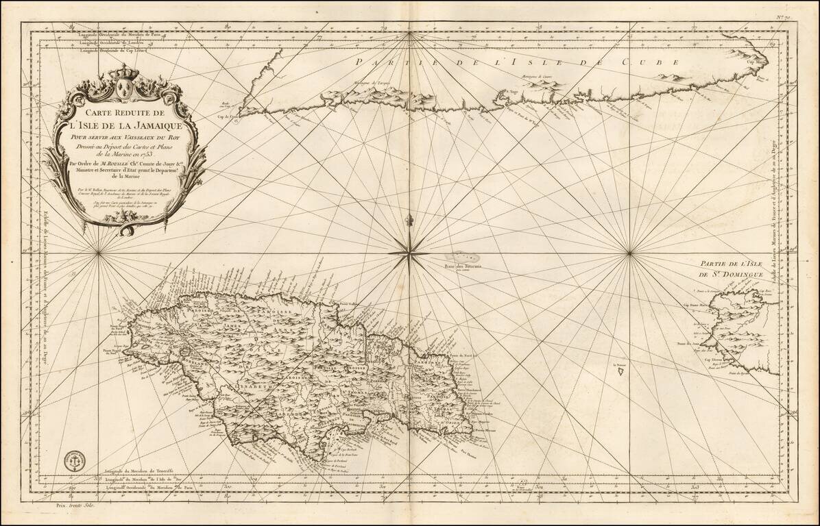
Detailed Depot De La Marine's sea chart of the region centered on Jamaica, with the southern part of Cuba and western end of Hispaniola.
This detailed map of Jamaica, shown divided into parishes, includes strong topographical details with many coastal toponyms, as well as the coastlines of southern Cuba and western Haiti.
If you are a student, write to us in telegram: @antiquemaps and indicate what material you need and for what work you need a map in high detail. We are ready to provide material on special terms. For students only!
![[British Colonies in North America] Carte Qui Contient Une Description Des Iles & Terres Que Les Anglois . . .[Chesapeake, Carolinas, New England, Bermuda, Gulf Coast, Jamaica, Barbadoes & Canada]](/map/small/46200.jpg)
![Cuba Insula [with] Hispaniola Insula [with] Insula Jamaica [with] Ins. S. Ioannis [with] I.S. Margareta Cum Confiniis](/map/small/70194.jpg)