Map size in jpg-format: 56.6798MiB
Click to open in high resolution (open in new tab).
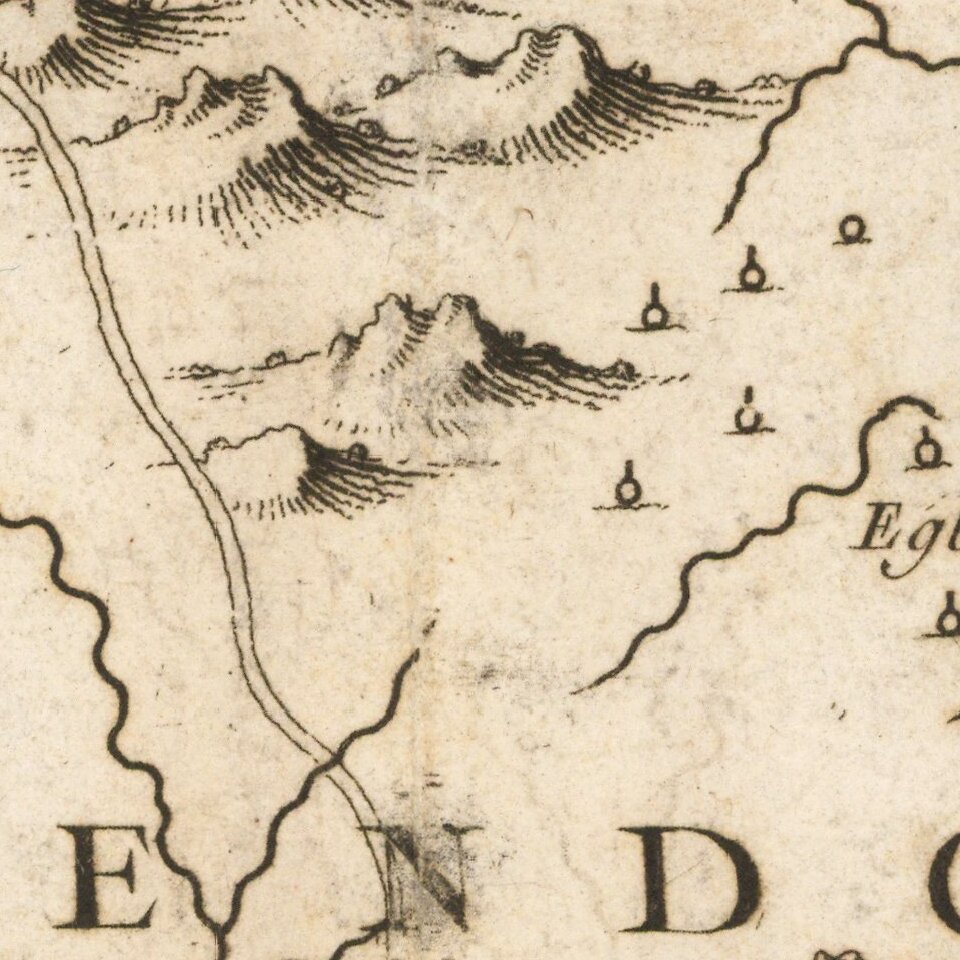
Locates Caberets and Taverns!
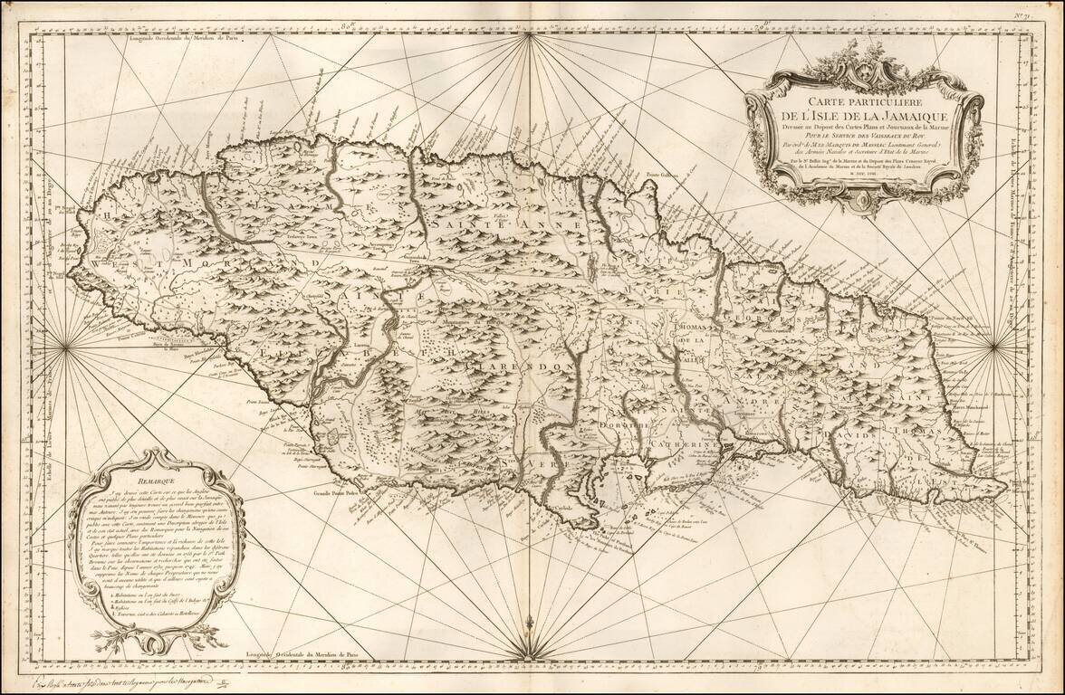
Detailed Depot De La Marine's sea chart of Jamaica, first published in 1758.
This detailed sea chart of Jamaica, shown divided into parishes, includes strong topographical details with many coastal toponyms.
Sugar Plantations, Coffee, Plantations, Indigo Plantations and Churches are noted with specific symbols, as are Taverns, Caberets and Hotels.
An exceptionally detailed chart of the island, which would have been utilized by the French during the Seven Years War (French & Indian War).
If you are a student, write to us in telegram: @antiquemaps and indicate what material you need and for what work you need a map in high detail. We are ready to provide material on special terms. For students only!
![[British Colonies in North America] Carte Qui Contient Une Description Des Iles & Terres Que Les Anglois . . .[Chesapeake, Carolinas, New England, Bermuda, Gulf Coast, Jamaica, Barbadoes & Canada]](/map/small/46200.jpg)
![Cuba Insula [with] Hispaniola Insula [with] Insula Jamaica [with] Ins. S. Ioannis [with] I.S. Margareta Cum Confiniis](/map/small/70194.jpg)