Map size in jpg-format: 114.62MiB
Click to open in high resolution (open in new tab).
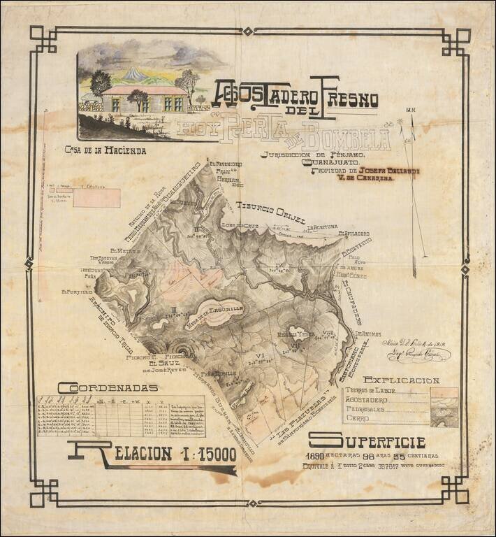
Large and handsome manuscript map of hacienda outside Penjamo, Guanajuato, Mexico, executed in pen and ink with watercolor by engineer Ricardo Gárate.
The map is a beautiful example of its kind; being an early-20th century Mexican land survey. It continues some of the traditions of 19th century Mexican manuscript surveys, while incorporating early 20th century design elements.
The vignette of the hacienda is particularly charming.
Information about land ownership, plot size, etc. are all included in the map.
Gárate was clearly a skilled professional mapmaker, though this is the only map by him that we have located.
If you are a student, write to us in telegram: @antiquemaps and indicate what material you need and for what work you need a map in high detail. We are ready to provide material on special terms. For students only!


![Map of Mexico, Central America, and the West Indies [Insets of Bermuda, Sandwich Islands, Jamaica and Panama Railroad]](/map/small/69133.jpg)