Map size in jpg-format: 8.38499MiB
Click to open in high resolution (open in new tab).
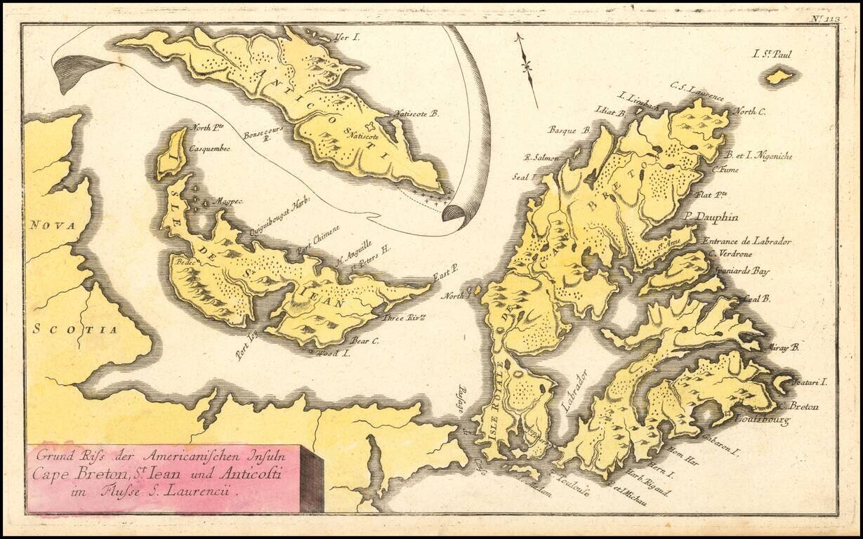
French & Indian War Map of NE Canada
Detailed map of Northeastern Canada, including the eastern part of Nova Scotia, namely Cape Breton and Prince Edward Islands, published by Raspe in Nuremberg.
The map includes an inset map of Anticosti Island on top.
The map was published to accompany Raspe's 10 volume Scahuplats des gegenwaertigen kriegs, durch accurate plans von den wichtegfen bataillen, belaugerungen und feldlaegern, published in Nuremberg between 1757 and 1764, which provided European audiences with accurate maps and plans depicting the primary theatres of the Seven Years War, a total of 160 maps, including 11 maps of American interest.
If you are a student, write to us in telegram: @antiquemaps and indicate what material you need and for what work you need a map in high detail. We are ready to provide material on special terms. For students only!
![[The First Maps in a la poupée Printed Color] Cartes en Couleur des Lieux Sujets aux tremblements de Terre Dans toutes les parties du Monde Selon le Sisteme de l’impulsion Solaire](/map/small/52293op.jpg)

